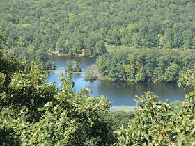
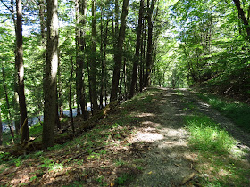
ABOUT THE PARK:
Sterling Forest State Park - NY State Office of Parks, Recreation and Historic Preservation
DIRECTIONS:
GPS Coordinates for Hall Drive Parking: 41.253777, -74.183419
View Larger Map
.jpg) |
| Gravel parking for about 4-5 cars on Hall Drive. |
TRAIL MAP:
Sterling Forest Trails Map 100 - NY/NJ Trail Conference
Sterling Forest State Park Trail Map - NY State Office of Parks, Recreation and Historic Preservation
Stering Forest State Park, NY - Wildcat Mountain at EveryTrail
HIKE DISTANCE: 7.5 miles
THE HIKE:
.jpg) |
| The green-line-on-orange trail starts to the right of the parking sign as the white-blazed trail that started at Southfields Furnace across the street joins in. |
.jpg) |
| Ruins on the right. |
.jpg) |
| Where green-line-on-orange and white split apart, a small pond a short distance to the right. |
.jpg) |
| Continuing left on the white-blazed Wildcat Mountain Trail. |
.jpg) |
| Early fall foliage. |
.jpg) |
| Fall flowers. |
.jpg) |
| Views begin to the right but keep going a short distance for more open views. |
.jpg) |
| Then open views of 17A, I-87 and Harriman State Park to the left. |
.jpg) |
| A great grassy spot for a break. |
.jpg) |
| More early fall foliage. |
.jpg) |
| Retracing back to the orange trail. |
.jpg) |
| Back at the pond at the junction of the orange and white trails. |
.jpg) |
| Continuing on the green-line-on-orange trail. |
.jpg) |
| American Robin |
.jpg) |
| Where the orange trail makes a right turn, continue straight a short distance to ... |
.jpg) |
| ... views of Harriman State Park to the left. |
.jpg) |
| Two very busy ants hauling provisions over the rock face. |
.jpg) |
| Continue on the orange trail to another view of 17A and Sterling Forest. |
.jpg) |
| Indian Kill Reservoir close up. |
.jpg) |
| The orange trail turns left on a gravel road (right on the gravel road leads to a communications tower). |
.jpg) |
| The orange trail ends at the green trail which is also for cross country skiing and mountain biking. |
.jpg) |
| The green trail nears Orange Turnpike. |
.jpg) |
| Continuing along Hall Drive back to the parking lot straight ahead. |
HIKE SUMMARY:
[ 0.00] Take the green-stripe-on-orange/white trail to the right of the hiker parking sign
[ 0.40] Turn left on white when orange goes straight
[ 2.25] Views; retrace (map shows another view before this one but must be overgrown)
[ 3.95] Left on green-stripe-on-orange when orange/white goes right (small pond short distance ahead)
[ 4.25] Rock hop creek
[ 4.90] Keep left on orange at cairn when unmarked trail goes right; rock hop creek
[ 5.05] Keep straight to overlook when orange makes a sharp right turn; retrace from overlook and continue on orange
[ 5.35] Turn left to view on open rock slab with cairn; retrace and continue on orange
[ 5.55] Orange turns left on gravel road
[ 6.00] Turn right at T-intersection and proceed past barrier on green
[ 6.80] Pass another barrier
[ 7.40] Pass barrier at end of green trail and keep right on Hall Drive
[ 7.50] Back at parking
.jpg)
.jpg)
.jpg)
.jpg)
.jpg)
.jpg)
.jpg)
.jpg)
.jpg)
.jpg)
.jpg)
.jpg)
.jpg)
.jpg)
.jpg)
.jpg)
.jpg)
.jpg)
.jpg)
.jpg)
.jpg)
.jpg)
.jpg)
.jpg)
.jpg)
.jpg)
.jpg)
.jpg)

.jpg)
.jpg)
.jpg)
.jpg)
.jpg)
.jpg)
.jpg)
.jpg)
.jpg)
.jpg)
.jpg)
.jpg)
.jpg)
Wow, these were wonderful photos and I especially loved the bird pictures. My camera can't come even close to such photos. This looked like a nice hike all around.
ReplyDelete