ABOUT THE PARK:
Mount Hope Historical Park - Morris County Parks
DIRECTIONS:
GPS Coordinates 40.921502, -74.553033
View Larger Map
TRAIL MAPS:
Jersey Highlands Central North Region Map 126 - NY/NJ Trail Conference
Mount Hope Historical Park - Morris County Parks
Mount Hope County Park, NJ at EveryTrail
HIKE DISTANCE: 5 miles
THE HIKE:
.jpg) |
| The trail starts between the kiosk and the Richard Mine sign. Turns out this is a yellow-blazed trail but it is not shown as such on the map and there are no blazes (that I could see) until the trail splits at the red and white trails. |
.jpg) |
| The trail goes through a power cut towards signs for the red trail to the left and the white trail to the right. |
.jpg) |
| White blazes don't actually start until ... |
.jpg) |
| ... the trail leaves the power cut and reenters the woods. |
.jpg) |
| Here it is, the start of the white trail. |
.jpg) |
| The blue trail splits off of the white trail. |
.jpg) |
| The blue trail reenters the power cut. |
.jpg) |
| Along the way, numbered posts indicate historical mine areas. There were no brochures at the kiosk explaining the sites so I took pictures of the brochure in the kiosk and put them at the end of this post. It would be nice to know what you are looking at as you go along! |
.jpg) |
| Looking back towards the west in the power cut. |
.jpg) |
| Heading east in the power cut. It becomes overgrown but still passable. |
.jpg) |
| Blue blazes are painted on rocks but are often obscured by foliage. |
.jpg) |
| There is nothing to indicate that the blue trail ends at the park boundary but it does continue on in the power cut into the Mount Hope Pond Municipal Park and the trail continues to be defined enough to follow. |
.jpg) |
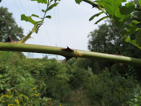
| Just watch out for these ... |
.jpg) |
| ... that result in this. |
.jpg) |
| The power cut trail comes out to... |
.jpg) |
| ... a woods rood on the right, which leads to the access road to ... |
.jpg) |
| ... Mount Hope Pond. |
.jpg) |
| This can probably be done only during off season since a badge is required to enter between Memorial Day and Labor Day. To circle the pond, enter the beach area - dogs aren't allowed but it was off season and the one couple on the beach did not mind - head to the right near the picnic table and ... |
.jpg) |
| Cross over the concrete wall and rock hop over. |
.jpg) |
| Or not. |
.jpg) |
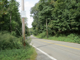
| Then turn left and road walk a bit on Mount Hope Road. |
.jpg) |
| There are several fishing access spots along the way ... |
.jpg) |
| ... with trails to ... |
.jpg) |
| ... the Mount Hope Pond. |
.jpg) |
| Even though it sometimes appears as through a trail goes around the pond ... |
.jpg) |
| ... they abruptly end with overgrowth. |
.jpg) |
| Continue on Mount Hope Road just past the pond to this gravel road with a yellow gate and turn left. The sign on the gate says "No Parking" so I figured it was OK to walk through. |
.jpg) |
| A little farther in there was one "No Trespassing" sign off to the side so not quite sure what was off limits since there was nothing at the gate, but with nobody being around, we continued on. |
.jpg) |
| Mount Hope Scout Cabin |
.jpg) |
| Continue straight into the woods ... |
.jpg) |
| ... and continue along the pond through a very pretty area, if you can overlook all of the beer cans from those who have trespassed and left a mess. |
.jpg) |
| Yikes. That looks more like a noose than a swing rope. |
.jpg) |
| Mount Hope Pond Beach |
.jpg) |
| Mount Hope Pond |
.jpg) |
| Almost at the beach (on the left) at this raised trail, turn right on a woods road. |
.jpg) |
| Unmarked woods road leads to ... |
.jpg) |
| ... a huge mine ... |
.jpg) |
| ... and the beginning of the white trail entering Mount Hope Historical Park. |
.jpg) |
| Looking back the way we came. |
.jpg) |
| The white trail. |
.jpg) |
| Back at the junction with the red trail and that yellow trail back to the parking lot that really isn't blazed. |
.jpg) |
| Mines along the red trail. |
.jpg) |
| Trees grow around old fence wires. |
.jpg) |
| The orange trail. |
.jpg) |
| A well-marked intersection where the orange trail leaves the gravel path as a foot path. |
.jpg) |
| Back on the red trail ... |
.jpg) |
| ... and back to the car. |
Pictures of the brochure in the kiosk describing the numbered historical sites.
 HIKE SUMMARY:
[ 0.00] Start at the far end of the parking lot between the kiosk and Richard Mine sign
[ 0.10] Keep right towards the white trail when the red trail starts to the left
[ 0.15] Turn right on the blue trail when white goes left
[ 0.40] Approximate end of blue trail at top at views, continue downhill on unmarked
[ 0.65] Right on woods road into woods at T-intersection
[ 0.70] Left at T-intersection; keep straight towards barrier and paved road when a woods road also goes left (dead ends); turn left on paved road towards Mount Hope Pond
[ 0.85] Veer to the right side of the beach, cross creek on rocks and proceed towards Mount Hope Road
[ 0.95] Left on Mount Hope Road
[ 1.30] Left on gravel road at yellow gate
[ 1.40] Straight past cabin on right into woods when veer right around pond on unmarked, but mostly identifiable path through woods
[ 1.65] Turn right on woods road just before elevated path ahead almost even with beach; turn right at T-intersection where left goes to a chain link fence
[ 1.70] Turn right at next T-intersection (left will lead back to power cut), then keep left at the fork
[ 1.90] Proceed uphill and keep straight on dirt road with other trails branch off
[ 2.00] Triple white blazes at start of white trail
[ 2.15] Straight on white when unmarked goes right
[ 2.25] Straight on white when blue goes left
[ 2.35] Come out into power cut briefly then turn right on red
[ 2.65] Red forks, keep right
[ 3.10] Turn right on orange when red goes left
[ 3.65] Turn left at unmarked T-intersection to stay on orange
[ 3.95] Orange leaves gravel road to the left
[ 4.05] Turn left and cross power cut at unmarked T-intersection (still on orange)
[ 4.25] Keep right on red at "To Parking" sign when orange goes left
[ 4.50] Keep straight on red at second "To Parking" sign when red also goes left
[ 4.85] End of red trail, turn right in power cut (a yellow blaze on a rock)
[ 5.00] Back at parking lot
.jpg)
.jpg)
.jpg)
.jpg)
.jpg)
.jpg)
.jpg)
.jpg)
.jpg)
.jpg)
.jpg)
.jpg)
.jpg)
.jpg)
.jpg)
.jpg)
.jpg)
.jpg)
.jpg)
.jpg)
.jpg)
.jpg)
.jpg)
.jpg)
.jpg)
.jpg)
.jpg)
.jpg)
.jpg)
.jpg)
.jpg)
.jpg)
.jpg)
.jpg)
.jpg)
.jpg)
.jpg)
.jpg)
.jpg)
.jpg)
.jpg)
.jpg)
.jpg)


.jpg)
+(1280x960).jpg)
.jpg)
.jpg)
.jpg)
.jpg)
.jpg)
.jpg)
.jpg)
Looks like a nice adventure!
ReplyDeletethanks. grew up in Rockaway. Now pretty far away, but I would do this hike. Looks nice.
ReplyDelete