ABOUT THE PARK:
DIRECTIONS:
GPS Coordinates 41.22046, -74.87152
 |
| Parking on either side of the entrance road to Dingmans Falls at Route 209 before the road closure gate. Suggestion: Park where I did, by 8 AM, to have the place to yourself when the road is gated. Later in the day cars are parked everywhere and the section opposite where I parked is a double parked mess. |
TRAIL MAP:
HIKE DISTANCE: 11.1 miles with lots of exploring
THE HIKE:
Dingmans Falls is a highly popular place where I had never been because crowds just aren't my thing. With the 1-mile access road closed in the winter, I figured there would be fewer people and with lots of road walking I could make it a bona fide hike. By starting at 8 AM I had the place to myself. By 9 AM as I was heading back out on the access road, people were coming up from the parking lot so my timing was perfect. At 2 PM it was bedlam in the parking lot with cars hovering for my spot. One car actually blocked me in to get my spot and then could not move to let me out. It was insane!
 |
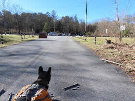
| Starting at the gate on the Dingmans Falls access road. |
 |
| It's quite pleasant following Dingman's Creek along the way. |
 |
| After the falls we would be coming back and taking the gated road on the left. |
 |
| Some small falls on the left. |
 |
| How disgusting. A loaded baby diaper. |
 |
| I used one of Brodie's poop bags to pack it out ... |
 |
| ... to the trash cans at the visitor's center about a two minute walk away. |
 |
| Oh no! I should have checked and I did not. What to do? Well, there was nobody around and I did clean up that nasty diaper. It seemed silly to turn back but had other people been around I would have. So I made the decision to proceed and get in and out before anyone else arrived. Shhhh. |
 |
| Silverthread Falls |
 |
| Dingmans Creek |
 |
| Another baby diaper?!?!?! |
 |
| We could not get much closer because at 24 degrees the spray had frozen on the boardwalk and it was slippery. So on to ... |
 |
| Dingmans Falls |
 |
| ... the steps which were not slippery at all. |
 |
| Ugh. Graffiti. |
 |
| Lots and lots and steps. It is quite the workout. |
 |
| The lower level at the top ... |
 |
| ... the top of Dingmans Falls. |
 |
| Up to an upper level at the end ... |
 |
| ... an upper upper level of the falls. |
 |
| Looking down from the top of Dingmans Falls. |
 |
| Heading back down. |
 |
| Instead of retracing on the boardwalk, we took the trail straight ahead which leads to the visitor center. |
 |
| And we are out with no harm done and nobody the wiser. Brodie neither peed nor pooped on the boardwalk and he left no graffiti or loaded diapers. |
 |
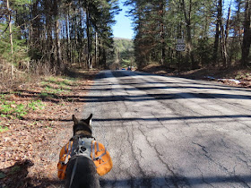
| Turning on to the gated road, a continuation of Johnny Bee Road. |
 |
| Brodie hearing people coming up the access road which we had just turned off of. |
 |
| This road is permanently gated and it's a steep climb up. |
 |
| Where it is gated at the other end, we continued straight. |
 |
| This road leads to a couple of pull out parking spots but it goes nowhere so there was no traffic at all. |
 |
| Checking out a woods road on the right. |
 |
| It leads back to the falls and I could see the visitor center roof through the trees ahead so we turned back. |
 |
| Continuing on Johnny Bee Road. |
 |
| At the intersection ... |
 |
| ... a gated road on the right to check out. |
 |
| This is a very old road that is a very pleasant straight and flat path. |
 |
| It ends above Dingmans Creek and turns left downhill. |
 |
| There is a bridge at the bottom that leads over to the end of Doodle Hollow Road. There were two people fishing, the only two other people we ran into the entire hike. |
 |
| We went straight on a path along the creek. I assumed it was a fisherman's path that would end soon but I was wrong. |
 |
| Turns out this is an old hiking trail that used to connect Dingmans Falls and Childs Park. It is mentioned in old hiking books but presumably no longer exists. Not true - it still exists and it is very lovely! |
 |
| I can't say how far this trail continues and if it does in fact still come out at Childs Park because we encountered this downed tree that is actually much larger than it looks. Brodie could not have cleared it in one jump and in trying he probably would have impaled himself on one of those broken off branches so it wasn't worth the risk and we turned back. |
 |
| Back at the bridge ... |
 |
| ... we continued straight retracing the way we had come. There is a path on the left that most likely leads to the top of Dingmans Falls. I don't know if the falls can be accessed from that point but maybe? I did notice some herd paths at the top of the falls when I was there so that might be the connection. |
 |
| Heading back on that pleasant old road/path. |
 |
| The old stop sign is still there at the end. |
 |
| We turned left on Mary Stuart Road. This follows along the property line of the park on the left and private property on the right. It is not a gated road but with only a handful of homes on the right, there was no traffic. |
 |
| At the end of Mary Stuart Road we turned right briefly ... |
 |
| ... to Loch Lomond ... |
 |
| ... to grab that picnic table for a break. |
 |
Now continuing on Wilson Hill Road. There is traffic on this road. Around a dozen cars passed over the course of two miles. The speed limit is 30 but most of those dozen think that is only a suggestion. With lots of curves and turns you do have to be very careful when you hear a car coming.
|
 |
| At Route 209 crossing over and heading right towards the park service maintenance building. |
 |
| Left at the far end of the building ... |
 |
| ... then straight ahead on the path ... |
 |
| ... to the McDade Trail where we turned left. |
 |
| When the McDade Trail turns right on gated Johnny Bee Road, we turned left ... |
 |
| ... a short distance back to Route 209 with the now overflowing parking lot on the opposite side. |
 |
| Looking up Route 209, cars parked everywhere for Dingmans Falls. |


Very helpful! I was planning to hike at Childs Park and wondered if the old trail along the outflow, which led to the top of Dingman's Falls was passable. Your photos confirmed it was. Thank you!
ReplyDeleteWell, at least partially from Dingman's Falls but I don't know if it goes all the way through to Child's because I did not go that far. If you do it, let me know!
Delete