Harriman State Park - New York State Parks
DIRECTIONS:
GPS Coordinates 41.22972, -74.18443
 |
| Tuxedo Park and Ride Parking Lot |
TRAIL MAP:
Southern Harriman Bear Mountain Trails Maps 118 and 119 - New York New Jersey Trail Conference
Southern Harriman Bear Mountain Trails Maps 118 and 119 - New York New Jersey Trail Conference
HIKE DISTANCE: 8.6 miles
THE HIKE:
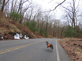
I like to incorporate seasonally closed roads to make loops that otherwise would not be possible (or pleasant) due to traffic. Also, that allows for solitude in an otherwise highly busy park. This hike incorporates Route 106 which is closed from Route 17 to the Kanawauke Circle from December 1 to April 1. Because the barriers are spaced far apart, a select few feel the closure does not apply to them and they speed through so you still have to watch for a handful of cars.
 |
| From the park and ride crossing over to Route 106 over Route 17 where the closure begins. |
 |
| Over the Ramapo River |
 |
| Under the New York Thruway |
 |
| In half a mile, right on the orange-blazed Parker Cabin Hollow Trail. |
 |
| The trail turns left but a woods road continues straight ahead beyond the pile of branches so I wanted to check that out. |
 |
| Coming up on a creek below on the left ... |
 |
| ... with a waterfall. |
 |
| The woods road eventually becomes more narrow and harder to follow. |
 |
| It completely fizzles out in an overgrown swamp so we headed back. |
 |
| Packed out a soda can that had been there for quite some time. |
 |
| Back at the branches blocking the unmarked woods road, continuing right on orange. |
 |
| This was a very tricky water crossing after snow melt and heavy rain in the previous days. |
 |
| Orange ends at the White Bar Trail where we turned left. |
 |
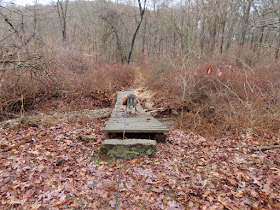
| After several rock hop water crossings I thought, "Yay, a bridge!" but ... |
 |
| ... seeing Brodie slip and slide across I tested the surface to find it too slippery with slime to stand on so I had to inchworm across on my behind. |
 |
| Ascending Car Pond Mountain |
 |
| Views at the top. |
 |
| The White Bar Trail passes through a parking lot ... |
 |
| ... then crosses Route 106 ... |
 |
| ... following along Route 106 before it veers to the right. |
 |
| Left on yellow. |
 |
| The entrance to ... |
 |
| Boston Mine |
 |
| Yellow turns left on Island Pond Road then leaves to the right. We stayed on unmarked Island Pond Road. |
 |
| At the end of Island Pond Road at Route 106, changed into sneakers for the 2.25 mile (95% downhill) road walk back to the car. |
 |
| One of the few cars that passed. |
 |
| Lake Stahahe |
 |
| To the left is the Parker Hollow Cabin Trail where we started. |
 |
| Back at the park and ride. |


