ABOUT THE PARK:
DIRECTIONS:
GPS Coordinates 40.81836, -74.60317

|
|
Parking at Coombs Hollow and Doby Roads.
|
|
TRAIL MAP:
HIKE DISTANCE: 12.9 miles
THE HIKE:
 |
| From the parking lot crossing Combs Hollow Road to the sidewalk along Doby Road. |
 |
| When the sidewalk ends, it's just a little bit along the fence to ... |
 |
| ... a left into Heisteins Park. |
 |
| Straight ahead to Heistein's Pond then left staying with the Patriots Path. |
 |
| Just a little bit of road walking on South Road then ... |
 |
| ... left into the woods on to a footpath. |
 |
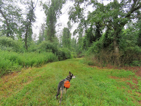
| It was about at this point that the blue sky from the first picture had turned into rain clouds that opened up on us. That was not in the forecast. |
 |
| What little managed to stay dry did not stay that way once the foliage I was brushing up against became soaked. |
 |
| I don't think soliciting would be an issue out here. Squirrels are not known to be big spenders. |
 |
| After a bit more road walking on Ironia-Mendham Road... |
 |
| ... the trail crosses North Road on to the dead end Huggs Road. |
 |
| Taking the trail at the sign into the woods only led us to ... |
 |
| ... a huge blow down and overgrowth. It looked like I could pick up the trail at a different spot from Huggs Road so I backtracked. |
 |
| Indeed, at the DEAD END sign, a trail to the left is clear all the way to the clear part of the Patriots Path beyond the blow down. So don't turn at the Patriots' Path sign, turn at the DEAD END sign. |
 |
| We were now in the Black River Wildlife Management Area. |
 |
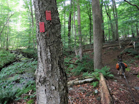
| Blazing and markers are almost non-existent here and with the many mowed paths it took some trial and error to stay with the trail but we finally found it again just as the rain was ending. |
 |
| Getting soaking wet from the vegetation encroaching on the trail. Plus it did still feel like it was raining with water draining from up high in the trees. |
 |
| Through a power cut ... |
 |
| ... in overgrowth. |
 |
| The trail is nice and clear beyond the power cut. |
 |
| At a fork the Patriots Path turns left; I turned right to see where that went. |
 |
| The right fork comes out on the West Morris Greenway Trail a bit west of where the Patriot's Path comes out. We turned left here. |
 |
| Where the Patriots' Path meets up with the West Morris Greenway. |
There were so many birds singing along this trail but I could not see any of them. My son had just told me about the Sound ID feature in the Merlin Bird ID app and since there was cell coverage here, I gave it a shot. It is really amazing. As soon as you hit the record button the app picks out bird songs and identifies them. These are the ones the app identified that I could hear but not see:
- Red-eyed Vireo
- Song Sparrow
- Veery
- Swamp Sparrow
- Red-winged Blackbird
- Common Yellowthroat
- Yellow Warbler
- Indigo Bunting
- American Goldfinch
- Chipping Sparrow
- Eastern Towhee
- American Crow
- Gray Catbird
- House Finch
 |
| The sun finally came out! |
 |
| I did manage to see a gray catbird. |
 |
| After about 2.5 miles on the West Morris Greenway, the Patriots' Path turns left up a steep hill. |
 |
| It's steeper than it looks. |
 |
| Back through that power cut. |
 |
| Just a short distance through overgrowth to mowed fields. |
 |
| We headed over to the picnic tables ... |
 |
| ... for a break. |
 |
| And to contemplate how to proceed. I had intended for this to be an out-and-back hike but having just changed into dry socks, I was not relishing the idea of slogging through dripping wet overgrowth again and Brodie had been severely attacked by deer flies throughout the WMA. The spray I use that always works well to keep them away was not effective with his fur soaking wet from rain so the deer flies were having a feast on his head and ears. So nope, not going back. We'll just make it a loop with some road walking. |
 |
| Heading over to the parking lot ... |
 |
| ... and continuing right on the Patriots' Path. |
 |
| The trail crosses over North Road ... |
 |
| ... then turns left ... |
 |
| ... then right in Highlands Park. |
 |
| At some point the Patriots Path turns right and Highland Park becomes the Evans Preserve. We turned left leaving the Patriots' Path and taking trails through the Evans Preserve. |
 |
| Silver-spotted Skipper |
 |
| On the yellow trail in the Evans Preserve. |
 |
| We would need to road walk on South Road so that is where we were headed. |
 |
| Left on red after the bridge. |
 |
| Through the South Road parking lot and right on South Road. |
 |
| Traffic zooms by at more than 40 miles per hour but there wasn't much of it and we were able to mostly stay in the shade when the sun came out. |
 |
| Another South Road road walker. |
 |
| I had the motor vehicle awareness talk with her as we went by. Yes, she thought I was nuts. |
 |
| You have to be careful where to pick up residential streets because some will just send you in dead-end circles on cul-de-sacs. I had to pay close attention to my app at every turn to be sure I would be able to weave through to where I needed to be. Here we turned left on Dogwood Drive. |
 |
| The residential road walking was definitely better than South Road. We had road walked 1.25 miles on South Road and 2.7 miles weaving through residential streets. |
 |
| We came out at North Road where we crossed directly over at the Black River WMA sign then veered right across the field towards a gated woods road. |
 |
| This would meet up with where we had trouble finding the Patriots Path earlier due to lack of turn markings. (The red line is where the PP actually is, the purple line is my track.) |
 |
| Back on the Patriots Path and retracing back without rain. |
 |
| Balloon #16 of the year. Missed that on the way out with the rain. |
 |
| An Eastern Bluebird fledgling starting to turn blue at the tip of the wings. |
 |
| Back at Heisteins Pond ... |
 |
| ... a Great Egret flying in ... |
 |
| ... to pose with a Great Blue Heron. |
 |
| At last back at the car to turn on the A/C. It was hot and humid out! |
Wildflowers seen on the hike:


No comments:
Post a Comment