ABOUT THE PARK: Appalachian Trail Pennsylvania - The Appalachian Trail Conservancy
DIRECTIONS:GPS Coordinates 40.52529, -76.21669
 |
| State Game Lands 110 Parking Lot |
HIKE DISTANCE: 12.5 miles total out and back with side trips
THE HIKE:
 |
| A short trail leads from the parking lot to the gravel game lands road. |
 |
| Right on the gravel road up the hill then left on the Appalachian Trail. |
 |
| Just before crossing Route 183, a blue-blazed trail on the right to ... |
 |
| Back at the Route 183 crossing, it was quite messy with stinky standing water and branches everywhere. |
 |
| Through the yellow barrier the other side of Route 183. |
 |
| A rerouted section of the AT due to environmental issues. |
 |
| That would be the Berks County high point, 1.6 miles away. |
 |
| It is reached via the yellow-blazed trail on the left. |
 |
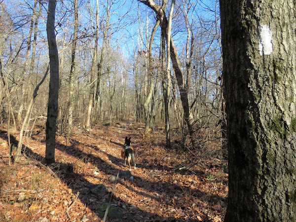
| Continuing back on the AT, fortunately there aren't many sections that are this rocky but even when the trails look smooth, pointy rocks facing upward lurk beneath the leaves. |
 |
| Passing by the other end of the relocated section. |
 |
| A sliver of a view at the gas pipeline cut. |
 |
| Where the trail had been relatively flat up to this point, we would start descending into Shubert Gap. |
 |
| At the Hertlein Campsite there is a trail to the left that has one or two old blue blazes that leads to ... |
 |
| ... more campsites and a pond with ... |
 |
| ... a very old stone dam. |
 |
| Back on the AT, a long rock hop over a wet area. |
 |
| Heading up out of Shubert Gap on long switchbacks. |
 |
| A short trail on the right leads to ... |
 |
| ... the boulder field. |
 |
| Coming up out of the gap ... |
 |
| ... to a rock outcrop on the left, Shikellamy Lookout. |
 |
| From this point we continued on a bit to add some mileage and find a good turn around spot to link up to when we hike the next section. |
 |
| And this would be the turn around point at a camp site right off the trail. |
 |
| Heading back to Shubert Gap. |
 |
| Back at the gas pipeline cut. |
 |
| Just before the Route 183 crossing we explored a couple of side trails on the left that were very clear and smooth with NO ROCKS! All of the rocks must have been moved to the AT. The first trail led back to the Fort Snyder monument. |
 |
| The second trail led to a bit of an overlook to the west over Route 183. |
 |
| Back at the yellow gate at the Route 183 crossing, I decided not to go through the muck on the other side rather to road walk back. I did not like the crossing here anyway as the visibility is very limited and there was now much more traffic going 55 mph than at 8 in the morning. |
 |
| We road walked on the right side to around the bend where visibility was much better then crossed over to the left. |
 |
| Then left on the game lands road ... |
 |
| ... back to the parking lot. |


Beautiful hike! Done part of this with the Scouts before, but wasn't sure til I saw the shot of the fort marker!
ReplyDelete