ABOUT THE PARK: There is a $7 in-state, $9 out-of-state entrance fee.
DIRECTIONS:
GPS Coordinates 38.74459, -85.41983
 |
| Clifty Falls State Park Nature Center Parking Lot |
TRAIL MAP:
HIKE DISTANCE: 9 miles
THE HIKE:
This was hike 1 of 2 on my return trip from Missouri to New Jersey. It took me about 75 miles out of my way but it was worth it and was my favorite hike of the entire trip.
The Four Falls Challenge is only 4 miles long and involves driving from one end of the park to the other. But if you know me, why drive when one can hike it? Start by stopping in the nature center for a copy of the challenge map.
 |
| Heading to the right facing the nature center towards the overlook tower. |
 |
| Views of the Ohio River from the overlook tower. |
 |
| Most of this hike follows along the canyon rim with excellent views now that the leaves are mostly down. |
 |
| Challenge Photo #1 - Hoffman Falls |
 |
| The biggest trail roots I have ever seen. |
 |
| Challenge Photo #2 - Lilly Memorial Stairs |
 |
| Challenge Photo #3 - Tunnel Entrance |
 |
| Challenge Photo #4 - Tunnel Falls |
 |
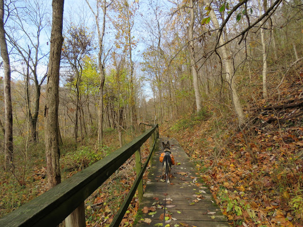
| Continuing beyond Tunnel Falls I was surprised to find a trail that is not on the map. (It is drawn in on the challenge map pictured above.) I had planned on road walking since I was not aware this trail existed. But ... |
 |
| ... it involves a water crossing, not rock hoppable, and it was about 43 degrees and windy. I had worn waterproof hiking shoes because of wet leaves since it rained overnight and those shoes would fill up with water and retain the water instead of it draining out as would be the case with non-waterproof shoes. So back to the road walk. |
 |
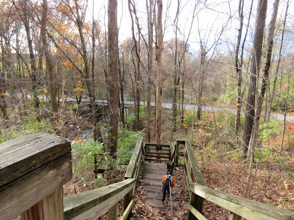
| Up the steps to ... |
 |
| ... the Tunnel Falls parking lot then left on the road. |
 |
| We would be walking from Tunnel Falls to Hickory Grove. |
 |
| It's not a bad road walk at all. |
 |
| There is a picnic table along the way for a break. |
 |
| Left into Hickory Grove to ... |
 |
| ... Trail 6. |
 |
| Had we been able to cross the creek, we would have been coming up the steps on the left. |
 |
| Clifty Falls from the parking lot overlook. We'd be getting much closer in a bit. |
 |
| Options! We chose rugged. |
 |
| Challenge Photo #5 - Little Clifty Falls |
 |
| Challenge Photo #6 - Cake Rock |
 |
| This stone walkway leads to an out and back to ... |
 |
| Challenge Photo #7 - Big Clifty Falls |
 |
| Another view from the observation area above. |
 |
| Continuing on a paved path around the main parking lot to ... |
 |
| ... Trail 8. |
 |
| Trail 8 involves a water crossing that we would also not be able to do without getting wet but the road bridge just to the right solved that problem. |
 |
| Trail 8 is a wide, mostly smooth trail, much easier than the trails we had hiked on the other side of the canyon so it had been a good choice to loop around counter clockwise. |
 |
| Zooming in to where we had been for the Big Clifty Falls view on the other side. |
 |
Trail 2 goes through the creek along/in the creek. Should we go down and give it a shot? Maybe the water wouldn't be so high down there? Can't know until you try so down we went.
|
 |
| The trail was alongside the creek so there was hope ... |
 |
| ... until we got the the vertical canyon wall and the trail crossed the creek. |
 |
| Back up to Trail 8 it is. |
 |
| Climbing back up out of the canyon. |
 |
| At the end, Trail 8 descends all the way down into the canyon to ... |
 |
| ... uh oh. The only way was to cross the creek. |
 |
| We had less than a mile left to go so I rolled up my pants and in we went. The water was about mid-shin deep. |
 |
| The water really wasn't cold at all but OMG once out of the water in 40 degrees with waterlogged shoes, toes were FROZEN! |
 |
| Back at the car just in time before the sun went down where I changed into dry socks and shoes and blasted the heat to thaw out my toes. Thank goodness I chose wisely early on in the hike and avoided the creek crossings. |
 |
| Completion sticker received in the mail after submitting challenge photos. |


You deserve it!
ReplyDeleteFor that last creek crossing most definitely, LOL! Now I know why they have it as driving from one end to the other to complete the challenge - it avoids all creek crossings.
Delete