ABOUT THE PARK
Delaware Water Gap National Recreation Area - National Park Service
DIRECTIONS:
GPS Coordinates 40.979776, -75.141934
 |
| Parking Lot at Lake Lenape for the Appalachian Trail and Mount Minsi |
TRAIL MAP:
NY/NJ Trail Conference -
Kittatinny Trails Map #120
HIKE DISTANCE: 7.5 miles
THE HIKE:
 |
| Starting on the Appalachian Trail for a very short distance ... |
 |
| ... to right on an unmarked trail. |
 |
| This trail leads to Lake Lenape in a short distance but watch for a turn to the right before the lake. |
 |
| Heading around the back side of Lake Lenape. |
 |
| An old trail marker. |
 |
| Lake Lenape |
 |
| Just after this picnic table the trail meets up with the Appalachian Trail which is not where I wanted to be. We had missed the trail we wanted ... |
 |
| ... so heading back a short distance. |
 |
| Near this picnic table, which really doesn't need to be chained and padlocked ... |
 |
| ... a trail that goes up steeply, the one we wanted. |
 |
| This trail follows along at a higher elevation than the one we were on before. |
 |
| Mount Tammany and Mount Minsi up ahead. |
 |
| Table Rock |
 |
| Heading towards the Mt. Minsi Fire Road but just for a sec because as soon as we reached it, we immediately turned right. |
 |
| On this trail watch for a trail to the left to... |
 |
| ... waterfalls in Caledonia Creek. |
 |
| The trail follows closely along the bank of Caledonia Creek with more cascades and waterfalls along the way. |
 |
| There is one washed out section that was a little challenging to cross but we made it over. |
 |
| Looking back at the trail and waterfall. |
 |
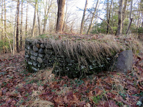
| We'd be on the other side of this dam later. |
 |
| Keeping left ... |
 |
| ... over the bridge then immediately left ... |
 |
| ... entering back into the Delaware Water Gap. There are two gated woods roads; the one on the right is Mountain Road. |
 |
| Mountain Road is shown as a road on the map and apparently it was at one time but now it has reverted to a woods road. |
 |
| It's January 12, the second day of 65 degree temperatures and yes, that is what you think it is. Fortunately the only one I saw this hike. |
 |
| There are still chunks of pavement along the way. |
 |
| We took a different woods road to the right that went uphill ... |
 |
| ... all the way to the top ... |
 |
| ... with great winter views all around. It felt like being on top of the world. |
 |
| The woods road fizzled out and we followed what looked to be a path but that fizzled out, too. |
 |
| An attempt to bushwhack back to Mountain Road brought us right back to the woods road we had just come up on. That is because that is the direction Brodie insisted on going and I gave up trying to divert him in a different direction. He knows how we got there. |
 |
| Back on Mountain Road. |
 |
| There are quite a few downed trees. Some we could get under or over, the massive blow downs have distinct paths around them. |
 |
| Mountain Road almost touches back on Caledonia Creek from above but there's an open spot to easily get down to creek level. |
 |
| After nearing Caledonia Creek, Mountain Road becomes a series of huge puddles, all of which we were able to get around. |
 |
| Once in the vicinity of the pipeline and power line blow downs have been cleared. |
 |
| Ohhhh, a break spot. But we were almost to the end so we'd hit this on the way back. |
 |
| The end of Mountain Road at Tott's Gap Road, our turn around point. |
 |
| Heading back ... |
 |
| ... to our break spot where someone patiently awaits ... |
 |
| ... his hiking snack. |
 |
| Heading back. |
 |
| At the end of Mountain Road, the car belonging to the only other people we ran into the entire hike. |
 |
| We took that other gated woods road which only goes a short distance to the dam where we had been on the other side earlier. |
 |
| Heading back across that bridge ... |
 |
| ... then right back the way we had come ... |
 |
| ... but turning left at the water tower where we had previously come in from the right. |
 |
| A few old green trail markers. |
 |
| An old bridge with some missing boards. |
 |
| This trail comes out on a gravel road along a secondary parking area ... |
 |
| ... back to where we parked. What a difference from 8 AM. Cars were also parked along both sides of the entrance drive making it tricky to get out with droves of people walking up heading towards Mt. Minsi. |


No comments:
Post a Comment