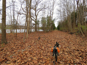
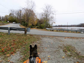
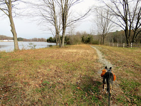
ABOUT THE PARK:
Kittatinny Valley State Park - NJ Division of Parks and Forestry
New Trail Cleared in Andover Township - New Jersey Herald
Thanks to Andrew who left a comment mentioning this new trail. He indicated that the park staff would draw a map at the park office and indeed, they did. The trail is not yet officially open at this date as it isn't 100% complete (I found it to be about 95% blazed, not counting the existing Sussex Branch portion which doesn't need blazing). Hiking this trail prior to the official opening is allowed. Just be aware that part of it does pass through the hunting zone where there are many tree stands along the trail so during hunting season, Sunday hiking is best.
DIRECTIONS:
Although there are several places to park along the route, I parked at 40.999876, -74.747080.
 |
| Sussex Branch Trail parking off Route 206. |
TRAIL MAP:
HIKE DISTANCE:
Andover Loop - 7.2 miles
Lake Iliff Trail - 1.4 miles each way
My total hike - 10 miles
THE HIKE:
 |
| Starting on the Sussex Branch Trail ... |
 |
| ... turn right a short distance in on an unmarked trail. If you miss it, no big deal. A little farther ahead is an arrow with an Andover Loop marker directing you to turn right on the red trail. |
 |
| The unmarked trail runs into the red trail which is also the Andover Loop Trail. A right turn here goes around the loop counter clockwise. Red will leave and rejoin then leave again. |
 |
| The Andover Loop turns left on a gravel road ... |
 |
| ... then turns right at an obvious marker ... |
 |
| ... to circle around the southern end of Gardners Pond. |
 |
| At the far end of Gardners Pond the Andover Loop turns left on an abandoned rail bed, shown as "proposed rail trail" on the map. This has all been cleared but the surface is chunky gravel which can be a little hard to walk on so I was happy I chose the counterclockwise loop to get this part out of the way first and return on the much smoother Sussex Branch Trail. |
 |
| At the barrier, the trail crosses the access road to ... |
 |
| ... Lake Aeroflex Boat Launch which is also an alternate parking spot for this hike. |
 |
| Continuing on, the trail follows along the eastern side of Lake Aeroflex. |
 |
| Lake Aeroflex |
 |
| This was the only tricky part of the Andover Loop, probably the unfinished part that was mentioned at the park office.. The trail suddenly ends at a private drive with no markers. It's here that you need to veer right then left on Limecrest Road for about a 1,000 foot road walk. |
 |
| Road walk on Limecrest Road. |
 |
| Shortly before the mailbox with the number 515, an Andover Loop blaze and the continuation of the rail trail to the left. |
 |
| The opening is obvious but if you miss it, there is another opportunity just before that 515 mailbox. |
 |
| Now it's smooth sailing the rest of the way. |
 |
| Just before Lake Iliff Road, the Andover Loop Trail turns left leaving the railbed. But I wanted to see how far the Lake Iliff Trail, a continuation of the same rail bed, could be hked so I left the Andover Loop Trail for a bit to go investigate. We'd pick up from this point in a bit. |
 |
| Crossing Lake Iliff Road. |
 |
| Lake Iliff |
 |
| The trail is now the smoother crushed gravel. |
 |
| Going under Newton Sparta Road. |
 |
| 1.4 miles out, the end at Mulford Road. |
 |
| Heading back. |
 |
| Since the sun had come out, a prettier view of Lake Iliff. |
 |
| We crossed back over Lake Iliff Road and picked up the Andover Loop Trail where we had left off. |
 |
| Had we not gone on to the Lake Iliff Trail, we would have made a sharp left where there are a couple sets of double turn blazes so it is easy to see. |
 |
| The trail veers left and follows a park road. |
 |
| At the fork, watch for the post with a marker on the right indicating to veer right. |
 |
| The Andover Loop Trail now follows the Goodale Trail in Hillside Town Park.along the back of athletic fields. |
 |
| Balloon #55 of the year. |
 |
| At the end of the field, left into the woods. |
 |
| The trail winds through a power cut for a bit ... |
 |
| ... then back into the woods. |
 |
| A right along the edge of ball fields at the end of the gravel path. |
 |
| Straight along the field... |
 |
| ... then straight across Goodale Road... |
 |
| ... for a short road walk on Luchetti Way. |
 |
| Where Luchetti Way curves to the right, the trail leaves into the woods to the left. |
 |
| The trail squiggles around and there aren't any turn blazes so you just have to keep an eye out for turns. |
 |
| This turn was very well marked. |
 |
| Coming up on the Sussex Branch Trail ... |
 |
| ... and turning left staying on the Sussex Branch Trail all the way back. There are no Andover Loop blazes along the Sussex Branch Trail. |
 |
| Crossing Goodale Road ... |
 |
| ... at the main park entrance where there is also parking for this loop. |
 |
| Whites Pond |
 |
| At this point staying on the Sussex Branch Trail would lead to the parking lot but for the sake of completing the loop, we turned left where the Andover Loop markers picked up again. |
 |
| A short distance in when the trail turns left, we turned right on that unmarked path ... |
 |
| ... to a left on the Sussex Branch Trail ... |
 |
| ... back to the parking lot. |


Great photos! Shortly after you enter the woods from Luchetti Way you will notice a metal tree stand to your right on private property. As the trail turns to the left there is an old wooden tree stand high in a tree on park property. An owl lives in one of the trees holding up the stand. -Andrew
ReplyDelete-Andrew
Thanks! I only saw an owl once on a hike and that was a few years ago in Massachusetts. Have always been looking for another though. I remember those tree stands.
DeleteLove the photos! Especially the fall leaves that are still orange on the ground in many of them :)
ReplyDeleteThanks! I was surprised to find any color left.
Delete