ABOUT THE PARK:
Al Foster Trails - St. Louis County Parks
Bluff View Trail - Wildwood Parks and Recreation
Bluff View - Gateway Off-Road Cyclists
DIRECTIONS:
GPS Coordinates 38.54229, -90.62430
 |
| Meramec Greenway parking at the end of Grand Avenue. |
TRAIL MAP:
Packwood Area Trail System - St. Louis County Parks
HIKE DISTANCE: 4.6 miles (2.3 miles each way)
THE HIKE:
 |
| From parking at the end of Grand Avenue, left on the Al Foster Trail. |
 |
| A short distance in, another left. |
 |
| The Al Foster Trail follows along the Meramec River. |
 |
| Passing the bluffs - we'll be on top of those bluffs via the Bluff View Trail. |
 |
| The Bluff View Trail on the left. |
 |
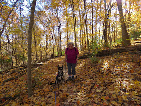
| My 82-year-old mother came along on this hike! |
 |
| Coming up on ... |
 |
| ... the overlook at the top of the bluffs. |
 |
| The Meramec River down below. |
 |
| I didn't realize weeds were in the way when I set the camera down. |
 |
| Heading back down. |
 |
| Downy Woodpecker |
 |
| With all of the foliage colors, there were still some random green spots. |
 |
| Back to the Al Foster Trail. |
 |
| Back to the parking lot on the right. |


Looks like another great place to hike. God Bless your Mom still hiking at 82. She's an inspiration! Glad Brodie is doing well. Thanks for sharing! Joanne from NJ
ReplyDeletewell done your Mom!! That is awesome that she can go hiking with you. I hope I can do that at 82. Nice color - looks like stillmpeas leaves there
ReplyDeleteBut those leaves were coming down fast. Driving out the weekend before there was nice color most of the way. Driving home one week later, all gone. I mean ALL gone, completely naked trees :(
DeleteMeant to say still peak
ReplyDelete