ABOUT THE PARK:
Bass River State Forest - NJ Department of Environmental Protection
Batona Trail - NJ Department of Environmental Protection
DIRECTIONS:
GPS Coordinates 39.62434, -74.44306
 |
| Parking along Dan Bridge Road at the southern Batona Trail trail head. |
TRAIL MAP:
Bass River State Forest Trails - NJ Parks and Forests (shows complete reroute and original trail)
Bass River State Forest Trail Map - NJ Department of Environmental Protection
Powered by Wikiloc
HIKE DISTANCE: 7.65 miles
From the trail head to Ives Branch Pond it was 4.5 miles but to shorten the return route, we took sand roads.
THE HIKE:
 |
| The beginning of the Batona Trail. |
 |
| The trail follows Dan Bridge Road for about half a mile. |
 |
| Turns are always very clearly marked. |
 |
| From the sand road on to a pine needle covered path. |
 |
| Bypass around a huge puddle. |
 |
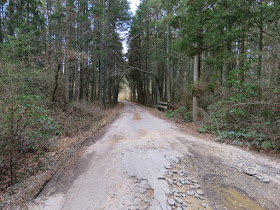
| The trail alternates between sand roads and paths. |
 |
| West Branch Bass River |
 |
| Looks like old cranberry bogs converting back to forest. |
 |
| Coming up on a small pond which is shown as a cranberry bog on the map. |
 |
| He considers it a pond. |
 |
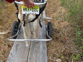
| These can be problematic for us. |
 |
| The wheels don't fit and she keeps wanting to step off into the swamp. It was a battle to get her across. |
 |
| I saw my first ever palm warbler last weekend in PA and now a second in southern NJ passing through on it's way to breeding grounds in Canada. |
 |
| Turning on to Allens Coal Road. |
 |
| Crossing Bartletts Bridge over ... |
 |
| ... Bartletts Branch. |
 |
| Eastern Towhee |
 |
| No takers? |
 |
| Just to the left of this intersection ... |
 |
| ... is the former route of the Batona Trail which looks like it is now becoming overgrown. It involved a substantial road walk which the reroute completely eliminated. |
 |
| This will be our last South Jersey hike for the season because the bugs are starting to wake up and you know it gets bad when bug spray is supplied at the trail register! |
 |
| We could have turned back here to make it a 7-mile hike but being pretty sure I could short cut the return route using sand roads, decided to continue on to Ives Branch Pond. |
 |
| Coming up on Ives Branch Pond at 4.5 miles. |
 |
| Ives Branch Pond |
 |
| This crossing might have been a little tricky for us but it was our turn around point anyway so no big deal. |
 |
| As short distance away I noticed a cross so we went to investigate. We paid our respects to Bella at her peaceful resting place overlooking Ives Branch Pond. |
 |
| Heading back to the Batona Trail. |
 |
| Where the Batona Trail left to the right, we continued straight. |
 |
| The Batona Trail joined back in from the right then when it turned left, we kept straight again. |
 |
| This was the only tricky spot we encountered... |
 |
| ... and trudging through was a bad, bad idea. This did not come off until shampoo and water at home. |
 |
| Balloon #27 of the year. |
 |
| The sand road widens as it gets closer to Stage Road. |
 |
| The Easter Bunny was here! |
 |
| And here come some Easter egg hunters. |
 |
| The sand road turns to pavement at Pilgrim Lake Campground. |
 |
| Left on Stage Road... |
 |
| ... then across this bridge which was the original Batona Trail ... |
 |
| ... a short distance to the parking area. |


Hi Daniela -- back in South Jersey again, I see! Always glad to have Shawnee in my neck of the woods -- and you picked an excellent section of the Batona Trail to hike! I did the 3-mile section (i.e. to the point where the original trail was) twice...once in 2012 and once in 2016 -- both in late October. The main difference is that the sections with blueberry bushes have gorgeous red leaves -- almost like the area is "on fire"...makes for excellent photo ops! Also, the section where you cross over Bartlett's Branch has beautiful trees with yellow leaves which line BB; another great photo op.
ReplyDeleteTell you what -- I never knew that bug spray was provided in the box where the trail register (at 3 miles) is...must be a new "feature"! Also, I never realized that Lake Oswego came in at 4.5 miles; I had hiked from the old Batona Trail (beginning off of Stage Rd.) to Martha Bridge in May 2012, and never realized the body of water I passed was actually part of Lake Oswego. (I have been to a section off Lake Oswego Road [off Route 563]; about 4 miles down that road.) Once again, it takes someone from "out of town" to teach this South Jersey guy some info on his own local trail! ;-) I managed to get a shot of a beautiful Rhododendron bush on one of the sections; I think it was a section that crossed a small paved road, and near another section which had a pond (or was it Lake Oswego?) that actually spilled over the trail; I had to cross on a series of concrete blocks. Hmm...perhaps I am due for another hike to Martha Bridge sometime!!
Anyway -- I'm glad to came back to South Jersey for this week's adventure; many happy returns to you & Shawnee!
-- Jim
Thanks, Jim. I have the section between Martha Bridge and Lake Oswego to do yet so I might have to try that in October. I tend to hike the South Jersey trails in the winter/early spring to avoid those horrendous biting bugs in the summer so I miss the other seasons.
DeleteJim & Daniela--That is not Oswego Lake, it is a pond on the Ives Branch. Oswego Lake is 5.5 miles north west as the crow fly's in the Penn State Forest. The Batona passes to the south of it at Martha, Martha's Bridge crosses the Oswego River that empties out of Oswego Lake to the north, and flows in to Harrisville Pond to the south.
Delete--Jeff
Thanks Jeff, you are correct. For lack of naming on the map, I was going by how pictures were labeled in Google Earth but now that I see exactly where Oswego Lake is, those pictures are named incorrectly.
DeleteDaniela