ABOUT THE PARK:
Fahnestock State Park - NY State Office of Parks, Recreation and Historic Preservation
DIRECTIONS:
GPS Coordinates 41.45252, -73.83826
 |
| Appalachian Trail parking on Route 301. |
TRAIL MAP:
East Hudson Trail Map #103 - New York New Jersey Trail Conference
HIKE DISTANCE: 5.2 miles
THE HIKE:
 |
| A kiosk where the Appalachian Trail enters the woods northbound at Route 301. |
 |
| I had intended for this hike to be an out-and-back but as it turned out, we did end up at the beach in an attempt to make a loop. |
 |
| On the Appalachian Trail. |
 |
| Lots of steps early on. |
 |
| The trail register. |
 |
| I photographed a few of the pages. Interesting to see where all of the thru-hikers are from. |
 |
| That last comment - "NY is tough" - yes it is. I had read this section of the AT was pretty easy and it was 10 degrees cooler here during this oppressive heat wave covering the northeast so that is why I chose to hike here. |
 |
| So deceptively smooth is the trail. |
 |
| Some more steps at the Fahnestock Trail junction. |
 |
| Was hoping for some water for Shawnee to get wet in at a creek crossing but it was bone dry. We started at 6 AM when it was only 63 degrees so it wasn't hot yet. |
 |
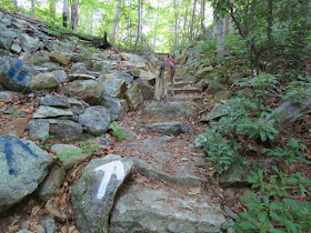
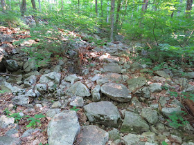
| Then the trail becomes very rugged and with a 15-year-old dog that needs assistance on the rugged sections, I made the decision we were not going back this same way. It was pretty treacherous moving her along so there aren't many pictures of that. |
 |
| The intersection with the trail down to the beach. But we had come this far so what's a little more ruggedness to get to the views? |
 |
| The view! Canopus Lake from up above. |
 |
| Heading back down to the blue trail to the beach. |
 |
| A much smoother trail with just a couple of rough spots. |
 |
| Canopus Lake from the blue trail. |
 |
| The beach all quiet at 9 AM. It opens at 10 and on a hot day like this, no doubt throngs of people would be arriving. |
 |
| But for now, birds hanging out while it's quiet. |
 |
| Coming around the beach on the park road. |
 |
| The map shows several unmaintained trails along the lake so that is what I was looking for... |
 |
| ... while walking along the park road with the throngs of beach goers arriving. |
 |
| Finally, one of those unmaintained trails on the right. |
 |
| At times pretty clear ... |
 |
| ... other times completely overgrown. |
 |
| But look .... |
 |
| ... a bridge! |
 |
| When you look back there is even a newer looking bridge sign. |
 |
| The trail even has a name. No doubt these trails are only used for snow shoeing or cross country skiing in the winter. |
 |
| Just beyond the Upper Hemlock sign ... |
 |
| ... access to Route 301. We road walked to the sign way down there on the left ... |
 |
| ... to Pelton Pond. |
 |
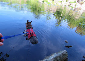
| Now it was getting hot and Shawnee had the opportunity to get wet. |
 |
| Or swampy rather. Not such a good spot. |
 |
| A little farther along some clean water to rinse off and really get wet. |
 |
| She did not want to get out of the water. |
 |
| It's a rugged trail around Pelton Pond with a nice bridge. |
 |
| Pelton Pond from the dam. |
 |
| We retraced back on the dam and took an unmarked trail just to the left of the pond outlet. |
 |
| This comes out on Route 301. |
 |
| It was a little bit of a road walk along 301 but thank goodness it was all in the shade. |
 |
| Just when we ran out of shade and would have been in full sun on the road, the blue-blazed Three Lakes Trail that you have to slide under the guardrail to get to. OK, that's for short people like me and Shawnee. Taller people should be able to go over. |
 |
| Watch closely on the Three Lakes Trail because it's only a short distance in to turn right on ... |
 |
| ... an unmarked trail that is very clear and runs parallel to Route 301. |
 |
| Just after the Appalachian Trail joins in from the left, back out on Route 301. |
 |
| From there it is a short road walk on the AT back to the parking area and the beginning of the hike. |


Wow I give you and Shawnee so much credit or hiking in this heatwave. Your pictures are beautiful as always. The sky looked so nice and clear, perfect white clouds. Thank God Shawnee found a cool place to get wet. Thanks for sharing. Joanne from NJ
ReplyDelete