ABOUT THE PARK:
Farny State Park -NJ Department of Environmental Protection
DIRECTIONS:
GPS Coordinates 40.956545, -74.476768
 |
| Parking at the red-blazed Beaver Pond trail head (trail starts beyond gate on left) |
If your GPS tells you to turn on Darlington Road, ignore those instructions as that road does not go through. You need to reach the trail head via Upper Hibernia Road.
TRAIL MAP:
Jersey Highlands Trail Map #125 - NY-NJ Trail Conference
HIKE DISTANCE: 9.15 miles
THE HIKE:
 |
| Walk beyond the gate to start on the red-blazed Beaver Pond Trail. |
 |
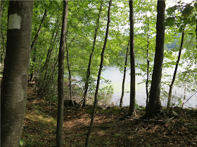
| The trail soon starts to follow along Beaver Pond. |
 |
| Beaver Pond |
 |
| Rugged white-blazed Four Birds Trail south of Split Rock Road. |
 |
| The white trail crosses over Split Rock Road at a kiosk. |
 |
| A short woods road leads to views of Splitrock Reservoir. |
 |
| More rugged terrain on the north side of Splitrock Road. |
 |
| Partial views from the top. |
 |
| The white-blazed trail descends and follows along the reservoir. |
 |
| Splitrock Reservoir |
 |
| But I can always count on my chipmunk friends to sit still for me. |
 |
| A metropolis of mushrooms. |
 |
| The lilac blazes (shown as pink on the map) of the Lilac Trail are sometimes hard to see but it's all woods road which is a welcome relief after the ruggedness of the Four Birds Trail. |
 |
| Some other blazes join in briefly from Camp Lewis trails. |
 |
| ... where the abandoned Oreland Branch crosses over; turn left here and the yellow blazes resume. |
 |
| It's a very pretty walk on the old rail bed to end the hike. |
 |
| The rail bed and yellow blazes end at Upper Hibernia Road and from there it is just a short road walk back to the car. |
HIKE SUMMARY:
[ 0.00] Walk beyond gate to start on the red-blazed Beaver Pond Trail
[ 0.20] Keep right at the fork at the far end of Beaver Pond
[ 0.35] Keep left at fork
[ 0.45] Red ends, turn left on the white-blazed Four Birds Trail
[ 0.80] Partial view at top of ascent[ 1.05] Keep left on white when blue starts to the right
[ 1.15] Yellow-blazed Wildcat Ridge Trail crosses over; keep straight on white
[ 1.40] Cross through power cut
[ 1.60] Pass kiosk then cross Split Rock Road continuing on white
[ 1.85] Woods road crosses over, turn right on woods road
[ 1.95] Right at fork
[ 2.00] Shore of reservoir with views; continue north along shore on unmarked footpath for more views
[ 2.10] In the cove, take trail to the left back to the woods road, right on woods road
[ 2.15] Right on white-blazed Four Birds Trail
[ 2.80] Keep straight on white when woods road crosses over
[ 3.15] Partial views on rock slab at top of ascent
[ 3.35] Straight on white when woods road crosses over
[ 4.35] Views along shore of reservoir
[ 4.45] Short side trail to the right to rock outcrop in reservoir
[ 4.50] Turn left on unmarked when white continues straight
[ 4.65] When woods road veers left, the Lilac Trail comes in from the right; swamp ahead on right
[ 5.10] Keep straight at fork
[ 5.15] At T-intersection with cairn, turn right
[ 5.60] Keep left with several trails split off to the right
[ 6.00] Cross plywood bridge; other blazes from Camp Lewis join in
[ 6.10] Camp Lewis trails leave the Lilac Trail
[ 6.15] Cross footbridge
[ 6.65] Cross creek either by rock hopping or side trail to the right over bridge
[ 7.00] Trail forks just before Split Rock Road and blazes end - proceed to Split Rock Road and turn left
[ 7.25] Turn right on the white-blazed Four Birds Trail at the kiosk
[ 7.40] Cross through power cut
[ 7.75] Turn right on yellow-blazed Wildcat Ridge Trail
[ 8.30] Enter power cut
[ 8.35] Turn left on paved Upper Hibernia Road
[ 8.45] Turn left on yellow-blazed Wildcat Ridge Trail (now following abandoned railbed)
[ 8.90] Yellow ends at Upper Hibernia Road, turn left and walk along road
[ 9.00] Keep right at fork
[ 9.10] At intersections, keep left on Brunache Road then straight to parking
[ 9.15] Back at parking


Great post! Just did a trail run here two weeks ago. Did you notice the huge amounts of garbage near
ReplyDeleteGreen Pond Road? -very distressing for such a beautiful expanse of forest.
Thanks! I didn't go out to Green Pond Road - you mean where the Oreland Branch comes out at Green Pond Road, right? I do want to check that out eventually. Depressing about the garbage. There was a lot of garbage and broken glass along the short woods road to views at Splitrock Reservoir. Never ceases to amaze me how people can haul stuff in full when it is heavy, yet they can't haul out the lighter empties. So many of the bottles are power drinks. Apparently they don't work since so many do not have the strength to carry out the empty bottles.
DeleteDaniela