ABOUT THE PARK:
Delaware Water Gap National Recreation Area - NJ Hikes/Coppermines
New Jersey Department of Environmental Protection - Worthington State Forest
TRAIL MAP: NY/NJ Trail Conference Southern Kittatinny Trails Map #120
DIRECTIONS:
I-80 to New Jersey exit 1, north on Old Mine Road for 7.5 miles to Coppermines parking on left. GPS coordinates to parking area: 41.03738, -75.02915
HIKE DISTANCE:
Coppermines to Kaiser Road Loop: 6.2 miles
Coppermines to Raccoon Ridge and back to Kaiser Road: 8.2 miles
Coppermines to Raccoon Ridge to Sunfish Pond and back: 11.3 miles
Coppermines to Raccoon Ridge around Sunfish Pond and back: 12.5 miles
HIKE DIRECTIONS:
This hike description and mileage is for the 11.3 mile hike. The hike starts out at the red-blazed Coppermines trail which begins directly across Mine Road from the parking lot. Keep right at the fork that you come to early on. (The left trail goes to a lower mine from which you will need to backtrack.) The red-blazed Copper Mines trail involves a steep uphill climb but it's so pretty you don't realize just how much climbing you are doing. I have found it to be the best in April when the waterfalls are really flowing. The water was just a little trickle this time of year in August. Click here for April pictures of the Coppermines Trail.
The Coppermines Trail terminates at the white-blazed Appalachian Trail. Turn right and follow the white-blazed Appalachian Trail. You will soon see some views to the east.


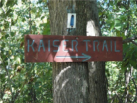
At 3.9 miles you will pass the Kaiser Road trail on your right. Turn right here if you want the 6.2 mile hike, otherwise continue straight ahead following the white-blazed trail.

At about 4.5 miles you will leave the Delaware Water Gap National Recreation Area and enter Worthington State Forest. Soon thereafter there will be views of the Delaware River to the west.

Views to the east and west will open up more as you approach Raccoon Ridge indicated by a huge rock cairn in the center of the ridge.


North view of the Kittatinny Mountains:

For the 8.2 mile hike, turn around here following the Kaiser Road directions below, otherwise continue south along the white-blazed trail to Sunfish Pond.
Arrive at Sunfish Pond at 6.4 miles. Take the turquoise trail to the left for a short distance to a rocky area overlooking the pond.


On this particular day, this was as far as we could go due trail closures resulting from a forest fire at the south end of Sunfish Pond. Click here for fire report.


The Appalachian Trail along with the Turquoise trail and a woods road form a loop around the lake for the 12.5 mile hike.
Head back passing over Raccoon Ridge into the Delaware Water Gap Recreation Area at 8.5 miles to the junction of the Kaiser Road trail at 9 miles.

At 10 miles you have the option of taking a short spur trail back over to the red-blazed Copper Mines Trail where you would turn left to return to the parking lot.

Or continue on the blue-on-white blazed Kaiser Road trail to the second spur trail at 10.6 miles. Turn right on the spur trail and arrive back at the Coppermines trail at 11.1 miles, turn left and arrive at the parking lot at 11.3 miles.


I usually do this hike starting on Old Mine Rd but today I started at Yards Creek Generating Station on the other side of the mountain. I followed Kaiser Rd up from YCGS to the AT. It's open for hiking now. It just re-opened to the public recently according to the guard who you must check in with.
ReplyDeleteI was looking for a long abandoned yellow-dot trail but I had no luck. Next time I'll take the Fire Rd off the blue trail and try to locate it from the top and follow it down to somewhere along rt 80 and Camp Weygadt.
I actually like the Coppermine Trail better but it did provide a little variety.