ABOUT THE PARK:
Goosepond Mountain State Park - New York State Parks
DIRECTIONS:
GPS Coordinates 41.309015, -74.257779
 |
| Room for about 2 cars off to the side without blocking the gate. |
TRAIL MAP:
Goosepond Mountain State Park Trail Map - New York State Parks (does not show all trails)
Goosepond State Park Mountain Bike Trails - Trailforks
Powered by Wikiloc
HIKE DISTANCE: 9.7 miles
THE HIKE:
 |
| Beyond the barrier, what used to be the Highlands Trail, now a Highlands Trail spur. |

 |
| Right off the bat, balloon #45 and my first ever Red Tag Clearance Event balloon. Who knew there was such a balloon? |
 |
| Catbird |
 |
| I was looking for the Goosepond Mountain Trail which is a mountain bike trail that goes over the summit of Goosepond Mountain and is not shown on maps. I had grabbed the track from Trailforks and put it in my Gaia app. When I looked I had just passed it so we had to backtrack a bit. |
 |
| Back at where we should have turned off on the trail to the left (coming from where we parked). |
 |
| Immediately cross a little creek ... |
 |
| ... then follow along the other side of the creek. |
 |
| Crossing a meadow. |
 |
| There are some old green blazes. |
 |
| I was surprised to find the trail in such nice shape. It was always clear and easy to follow even with sporadic blazing. Even though the trail runs behind homes for a while, you rarely see them and the woods are gorgeous. |
 |
| Except for this. |
 |
| Massive stone boundary walls throughout. |
 |
| White-throated Sparrow |
 |
| Now some white blazes. |
 |
| The higher we got, the foggier it became. This was not boding well for the overlook. |


 |
| And here we are at the overlook in a cloud with nothing to see. The Rambling Wanderer has some nice pictures of the views. I'll just have to go back again another time on a nicer day. |
 |
| Continuing on. |


 |
| After descending the trail comes to a woods road where we turned left. There is path to the left around this blow down. |
 |
| After a night of rain, this was the only part so far that was sloppy mud. Up to this point the trail had been amazingly dry. |
 |
| The woods road comes out on Route 17M where we turned right. There is a lot of traffic noise from Route 6 that runs parallel. |
 |
| It's a mile of road walk to make the loop but there is plenty of shoulder space, there isn't all that much traffic, and the road walk is broken up by trail about half way along. |
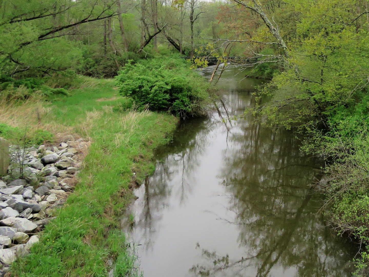 |
| Crossing the bridge over Seely Brook. |
 |
| Cross back over Route 17M to the 1/2 mile wetlands loop trail. |

 |
| Looping around counter clockwise. |
 |
| Song Sparrow |
 |
| A tree swallow standing guard over ... |
 |
| ... the other parent on the nest. |
 |
| American Goldfinch |
 |
| I saw something up ahead. Brodie had not noticed yet because he was busy eating grass so I was able to zoom in... |
 |
| A ring-necked pheasant! |
 |
| Then Brodie noticed and thought he might have himself some pheasant for lunch. Oh, he was soooo wrong about that. This is why Brodie will never see the open end of a leash while hiking. |
 |
| A boardwalk through the gorgeous wetlands. |
 |
| Red-winged Blackbird |


 |
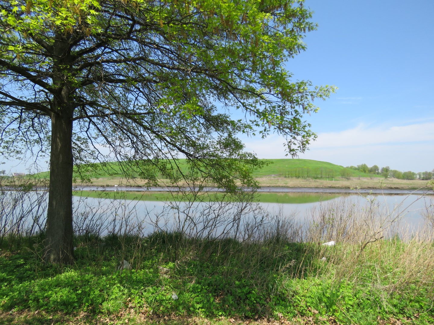
| Goosepond Mountain where we had hiked across the summit in the fog. |
 |
| Female Red-winged Blackbird |
 |
| Exiting the wetlands ... |
 |
| ... and continuing right on Route 17M. |
 |
| One of the advantages of road walking - you can actually read the historical signs that you can't read while driving by. |
 |
| At the large Goosepond Mountain State Park lot on the left ... |
 |
| ... cross over 17M to ... |
 |
| ... the Highlands Trail. |
 |
| Grey Catbird |
 |
| The Highlands Trail follows an old paved road, Lazy Hill Road. |

 |
| There are huge old trees along the way. |
 |
| We left the Highlands Trail on another mountain bike trail in search of old cemeteries. I had the track of the trail I needed saved to the Gaia app but although we were on it, it did not continue on to where the cemeteries were supposed to be based on coordinates in Find A Grave. |
 |
| Very nice trails nonetheless but you don't want to tackle them without tracks loaded to a GPS. It's very easy to get turned around in the maze of trails. |
 |
| Sporadic markers aren't of any help because they are sporadic and the same old marker no matter which trail it is. |

 |
| It's the purple track I intended to follow but we got off of it. Figured we'd hook back up with it later so we continued on. |


 |
| Some sort of wren, hard to tell which from this angle. |

 |
| We ended up back on that purple track but going the wrong way so we turned back ... |
 |
| ... to where purple should have continued and there was no trail so we continued retracing to other trails. |
 |
| Cardinal |
 |
| A precarious creek crossing on wobbly logs. |
 |
| It was at this point, 7 miles into the hike, when I realized we had not yet taken a break and was hoping to come across logs or boulders to sit on but there was nothing until ... |
 |
| ... just seconds after I had that though when a bench came into view. What a nice surprise! |


 |
| Brodie having his snack at Tully's Bench with Goosepond Mountain in the background. |
 |
| I can now see the summit where we had been for the invisible overlook. |
 |
| Thank you for letting us use Tully's Bench! Great view and comfortable break spot just when we needed it. |
 |
| We packed out this cigarette butt that some thoughtless person left behind. |

 |
| We ended up back on Lazy Hill Road/Highlands Trail and where the other end of that purple trail should have been it's completely overgrown and loaded with blow downs. If I have the correct locations for the cemeteries, which should be off of the defunct section of that trail, I suppose they are no longer accessible. |
 |
| A little farther along on Lazy Hill Road, the Highlands Trail leaves to the left on a newer reroute. We continued straight on the spur heading back to where I had parked. |


 |
| At that bridge over Seely Brook, what is looks like in May 2019 versus what it looked like in June 2016. |


 |
| Back at the car. |