

ABOUT THE PARK:
Whittingham WMA - New Jersey Department of Environmental Protection
DIRECTIONS:
GPS Coordinates 41.02196, -74.78779
 |
| Parking lot on Fredon - Springdale Road. |
TRAIL MAP:
No trail map, actually no trails rather unmarked woods roads and mowed paths that can be overgrown in the summer. I suspect that the paths are mowed in the fall for hunting season. This hike should definitely be done with a GPS since there is no map.

HIKE DISTANCE: 5.1 miles
THE HIKE:
 |
| We started out on a footpath right off the eastern side of the parking lot. |

 |
| That soon became more and more overgrown and ... |
 |
| ... simply fizzled out. |
 |
| So we retraced to the parking lot and ... |
 |
| to the next opening from the parking lot which let on to the mowed paths along overgrown fields. |


 |
| The trail alternates between mowed paths along the fields and woods roads in the forest. |


 |
| We got started at 6 AM and got to see the sun rise through the trees. Very pretty! |


 |
| Wildflowers everywhere. |

 |
| Little red efts everywhere, too, and I try very hard not to step on them. |

 |
| The mowed paths were very wet so it must have stormed overnight. My shoes were soaked in no time. |


 |
| That is a HUGE pile of bear poop up ahead. It had little plants growing out of it so it wasn't that fresh. |

 |
| Back in here some of the woods road sections that are not in the shade are pretty overgrown. |
 |
| But it is worth hacking through. Anyone with good sense would wear long pants but not me. I hate long pants in the summer. So my legs look like ground beef right now but nothing a little Bactine won't fix. |
 |
| This tire on the left ... |
 |
| ... must belong to this old farm equipment on the right. |


 |
| Not long after the old farm equipment ... |
 |
| ... a pond comes into view. |

 |
| A Great Blue Heron flying over the pond. |
 |
| A couple of ducks took off when they heard us approach but this one stayed behind. |
 |
| Continuing on from the pond, the woods road makes a loop back to the bear poop trail. |
 |
| Retracing on the bear poop trail. (See what descriptions I have to resort to when the trails are not marked?) |
 |
| Oh yes, there it is, up ahead on the trail. |
 |
| And back on mowed paths in search of Big Spring (which I did not know I was VERY close to while at that pond but I never did get to it - for another time!) |


 |
| I had just taken this picture of Shawnee by the daisies when I turned back around and saw ... |
 |
| ... three little coyote pup head pop up straight ahead! They were where I needed to go but did not want to disrupt their home or risk running into momma so we turned back. They were too stinking cute and so glad I got to see them. |
 |
| Biting flies started to attack Shawnee and there is a product I have been wanting to try for that but had not yet had the opportunity. |
 |
| I covered her eyes and spitzed her head with it and no more biting flies. I have never seen anything work so well before. I bought it because the place I order her arthritis injections from had a special where you got 10% off your order if you bought a bottle of Bug Soother so it was worth a $3 bottle to save $12 on the order. I spray it on my face and it has been doing a decent job of keeping the gnats from annoying me. |


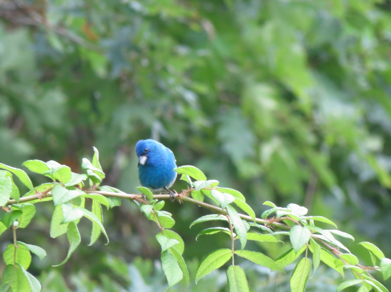 |
| Indigo Bunting |
 |
| I came out at the Springdale Road parking lot, walked to Springdale Road and turned around to see ... |
 |
| ... a sign for the Big Spring Trail! But don't get too excited because it is the ONLY sign and you are on your own from that point on. |
 |
| Apparently you are supposed to walk through the parking lot and beyond this gate then keep right but there are so many mowed paths it is impossible to tell which way to go and I ended up back where I had already been. |
 |
| So back on the woods road to retrace back to the parking lot. |
 |
| Shortly before the parking lot I had seen this footpath on the way out and wondered if it connected to the footpath from the parking lot that fizzled out so we gave it a try. |
 |
| It starts to get overgrown and ... |
 |
| ... dumps you right out on the mowed path from the beginning of the hike. |
 |
| Back at the car. |
 |
| I drove around the WMA and found this parking lot at a water dog training area so we stopped to check it out. |
 |
| Shawnee wasn't really wanting to get out of the car but she did and I think in the end she was glad she did. |
 |
| Looking back at the parking lot. |
 |
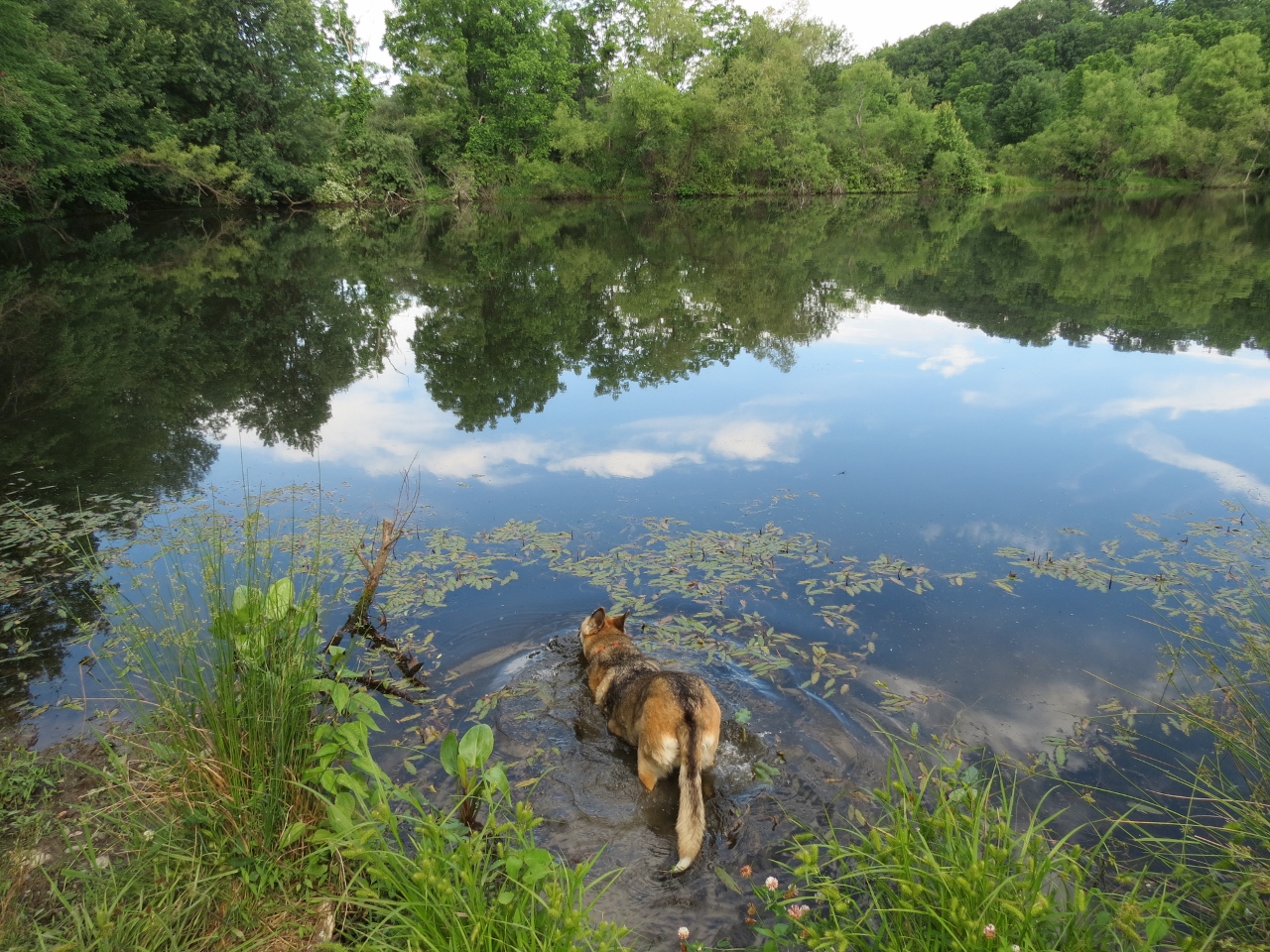
| There are mowed paths to a pond. The mowed paths do continue north towards where I had hiked so I'll need to come back and explore that another time but for now, I promised Shawnee only the pond, nothing more. |


 |
| It didn't take her long to trot on in. |
 |
| We walked around to the other side of the pond ... |
 |
| ... for another dip. |

 |
| Happy dog. |
 |
| .7 miles around the pond. At the upper right corner of the pond is were mowed paths continue on into the WMA. Parking is over on the left by Ridge Road. |


