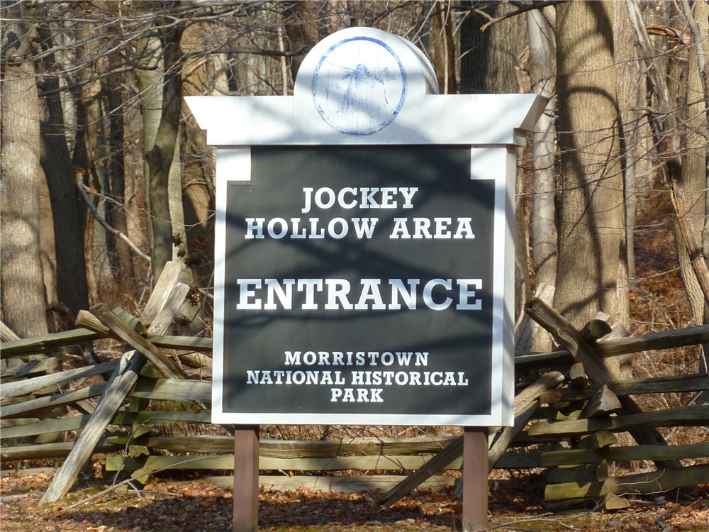
Monday, January 16, 2012

Morristown National Historical Park, NJ - Jockey Hollow Area


ABOUT THE PARK:
Morristown National Historical Park - National Park Service

DIRECTIONS:
GPS Coordinates 40.772242, -74.527680

View Larger Map
In the winter the restroom in this lot is closed but the one in the visitor center is open.  The trail starts to the left of the restroom building.

TRAIL MAPS:
Morristown National Historical Park/Jockey Hollow Area - National Park Service

HIKE DISTANCE:  9.1 miles

PEAK BAGGING:
Mount Kemble - Peakery.com

THE HIKE:
A pond and bench along the combined blue/white trail.
The white-blazed Grand Loop Trail.
The Patriots Path joins in from Lewis Morris Park.
Reconstructed Revolutionary War soldier huts.
Along the Aqueduct Trail
A cold day on the Aqueduct Trail.
Wick Farm
Wick Farm Garden
Hut behind Wick Farm where hiking trails are accessed.
Along the Primrose Brook Trail
Blue-blazed Old Camp Road/Patriots Path
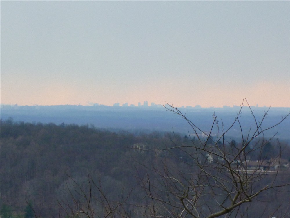
Views from the blue-blazed Mount Kemble Loop Trail

HIKE SUMMARY:
[  0.00]  Start on blue-blazed NY Brigade Trail at kiosk next to restroom building
[  0.30]  Turn left on blue/white when white comes in from the right; pond on right
[  0.40]  Turn left on the white-blazed Grand Loop Trail when blue goes right
[  0.85]  Cross over paved Jockey Hollow Road staying on white
[  0.95]  Keep right on white when unmarked trail goes left to soldiers huts
[  1.75]  Cross paved Sugarloaf Road
[  1.80]  Keep left on white/Patriots Path when Patriots Path comes in from left
[  2.00]  Turn left on Patriots Path towards soldiers huts when white goes straight
[  2.10]  Cross parking lot then turn left up path to soldiers huts
[  2.30]  At the single soldiers hut to the right up the hill, turn right on yellow; at sign post 41 keep right on yellow; keep right on yellow at next intersection when left goes to the Grand Loop Trail
[  2.45]  At T-intersection turn right on the yellow-blazed Grand Parade Trail
[  2.90]  At parking lot keep right on yellow towards the Aqueduct Trail; at the Aqueduct information board keep right across bridge when yellow goes left; keep right at fork when Aqueduct Stop B goes left; at fork at sign post #54 keep right and cross foot bridge straight ahead when green/Patriots Path comes in from larger bridge on the left
[  3.15]  At fork keep left when Patriots Path goes right up steps; Aqueduct Trail is unblazed but is well-defined and easy to follow
[  3.30]  At Aqueduct Stop N keep right on foot path when woods road is to the left
[  3.40]  After crossing foot bridge, trail makes sharp left turn and follows bank of creek; cross several more foot bridges and boardwalks
[  3.75]  At end of trail at stone well (?) turn left, cross bridge, proceed up to intersection at clearing and turn around to see three trails converge - the far right is the Aqueduct Trail you just came off of, take the far left trail that says "To Grand Loop Trail .1 mile"
[  3.80]  Cross over paved Sugarloaf Road
[  3.85]  Turn left on white-blazed Grand Loop Trail
[  4.25]  Turn left at sign towards park office when the white Grand Loop Trail continues straight towards the New Jersey Brigade
[  4.30]  Cross wide bridge, paved road, wide bridge and continue on unmarked horse trail
[  4.60]  Cross through Visitor Center parking lot, walk around Visitor Center and follow red paved path towards Wick Farm; continue through Wick Farm past barn towards old hut
[  5.05]  Turn right on yellow-blazed trail at old hut
[  5.20]  Keep right on yellow when unmarked goes left
[  5.30]  Keep left on yellow Grand Parade Trail when right goes to Jockey Hollow Road
[  5.70]  When the yellow trail comes up on paved Jockey Hollow Road at a trail intersection, turn right and cross over Jockey Hollow Road to the red-blazed Primrose Brook Trail slightly to the left before the bridge
[  5.90]  Turn right for "Long Loop" when "Short Loop" goes left
[  6.25]  Straight on red when white/Patriots Path cross over
[  6.50]  Straight on red when white crosses over; rock up over creek - a few steps later there is another rock hop back to the other side but the rocks were too far under the water - if you keep straight along the left bank, you can pick up the trail when crosses back over again a short distance ahead
[  6.85]  Turn right on paved Jockey Hollow Road a short distance then right on the blue-blazed Old Camp Road Trail/Patriots Path
[  7.15]   Keep straight on blue when the white-blazed Grand Loop Trail comes in from left; cross bridge, white-blazed trail leaves to the right
[  7.45]  Keep left on blue trail just before a yellow house (trail now called Mount Kemble Loop Trail)
[  7.55]  Keep right on blue as unmarked goes straight
[  7.80]  Keep left on blue when unmarked goes right
[  8.00]  View to right at open field at Stark's Brigade
[  8.20]  Straight at black metal gate when unmarked crosses over
[  8.35]  Turn left through black metal gate to stay on blue-blazed Mount Kimble Loop Trail as unmarked goes straight
[  8.50]  Stay right on blue when unmarked goes left
[  8.60]  Stay left on blue when unmarked comes in from right
[  8.70]  Left on blue/white when white goes right
[  8.75]  Pond and bench on left
[  8.80]  Right on blue towards NY Brigade Parking Lot when white goes left
[  9.10]  Back at parking lot

Saturday, January 14, 2012

Hook Mountain and Nyack Beach State Park, NY


ABOUT THE PARKS:
Hook Mountain/Nyack Beach Bikeway - Rails-to-Trails Conservancy
Nyack Beach State Park - Palisades Parks Conservancy
Hook Mountain State Park - Palisades Parks Conservancy
The Long Path, Nyack to Long Clove Section - NY/NJ Trail Conference
So there is no confusion regarding hunting, as of 1/13/2011 the Rockland County Parks Department confirmed that there is no hunting allowed in any parks in Rockland County.  In some of the pictures my dog has her blaze orange vest on because it is insulated and it was a very cold and windy day, not because we were hiking where hunting is allowed.

DIRECTIONS:
GPS Coordinates 41.120856, -73.910937

View Larger Map
Nyack Beach Parking - seasonal fee charged.  No fee in winter but per sign on gate, road to parking lot can be gated in the winter since road is not plowed.

TRAIL MAPS:
Hudson Palisades Trails Maps 110 and 111 - NY/NJ Trail Conference

HIKE DISTANCE:  12.55 miles
Click here for NY/NJ Trail Conference 6 miles option from Rockland Lake State Park. 

PEAK BAGGING:
Hook Mountain - Peakery.com

THE HIKE:
Start on the bike path at the far end of the parking lot.
The bike path follows along the Hudson River.
Looking back towards the Tappan Zee Bridge
Cliffs along the bike path.
Keep right when the trail splits 1.5 miles into the hike.  The trail will become more hilly and rockier.  This section was closed after Hurricane Irene but has reopened and is in good shape. (For the 6 mile version, veer left towards Rockland Lake.)
A memorial bench for Colleen Murphy and her dog Jemma who fell off the cliff to their deaths in February 2011.
Click here for the news coverage.

Watch for bald eagles flying over and scan the tops of the trees up on the cliffs to maybe spot one watching you.
At the old stone building, watch for the beginning of the white-blazed Treason Trail which leads up to the Long Path for the return trip along the tops of the cliffs.

The white-blazed trail switchbacks up steeply on loose rocks.
A train coming out of the tunnel under the mountain.
The Hudson and the bike path below come into view.
The aqua-blazed long path leads back along the top of the mountains.  Expect to ascend and descend several times over the rolling mountaintops.
The Long Path passes the Wells Family Burial Ground from the mid 1800's.
Several views along the way.
The Tappan Zee Bridge
Looking south down the Hudson River
Rockland Lake from up above.
New York City

HIKE SUMMARY:
[  0.00]  Begin on bike trail at end of parking lot
[  1.20]  Trail becomes paved and ascends
[  1.45]  Keep right on Haverstraw Trail when trail to Rockland Lake goes left
[  1.80]  Unmarked trail merges in from left
[  2.30]  Memorial bench on left
[  4.25]  Trail turns to pavement, old stone building on right, turn left on white at end of stone building
[  4.65]  At end of white trail, turn left on aqua-blazed Long Path
[  4.90]  Long Path follows along ridge
[  7.05]  At stone wall, Rockland Lake on right, cliff above memorial bench to left
[  8.00]  Wells Family Burial Grounds on left; trail descends to Rockland Lake State Park parking lot; keep straight through parking lot
[  8.30]  At fork, veer left on unmarked to view when aqua goes right
[  8.45]  View; retrace
[  8.60]  Back at intersection, left on aqua
[  8.90]  Unmarked trail not on map merges in from left
[  9.75]  Keep left on aqua as unmarked woods road forks to the right
[10.00]  Short unmarked side trail to left to overlook
[10.30]  Open, rocky summit of Hook Mountain
[10.80]  Keep left when unmarked goes right (yellow on map but did not see blazes)
[11.50]  Left on white when aqua continues straight
[11.85]  Cross small creek on boards
[11.95]  Left on paved road
[12.00]  Right on Larchdale Road
[12.20]  Left at stop sign when road ends; right at park tollbooth
[12.55]  Back at parking lot

Monday, January 9, 2012

Silas Condict Park, Morris County, NJ


ABOUT THE PARK:
Silas Condict Park - Morris County Park Commission

DIRECTIONS:
GPS Coordinates 41.003998, -74.384424

View Larger Map
Park in the second marking lot.  I made a U-turn before parking putting the trail head just beyond my car right before the gravel road.

TRAIL MAPS:
Silas Condict Park - Morris County Park Commission
Silas Condict County Park Trail Map - NY/NJ Trail Conference

HIKE DISTANCE:  3 miles

THE HIKE:
This hike is simply then entire white-blazed trail, which is very well marked, then connecting back to the beginning by walking around Canty's Lake and the Casino.  The hike in the opposite direction starting at the other trail head is written up here.
View of Canty's Lake and the Casino from bench at beginning of the white-blazed trail.
Trout Brook
Hike by several huge rock formations.
Kakeout Reservoir?
The trail passes through a rock tunnel.
View to the west.
An attractive pine grove at the top of a mountain.
Nice seasonal views all along the higher elevations.
View to the east.
End of the trail (or beginning if going in the opposite direction).  Go right for short paths to lake or left towards Casino to return to car.
Walking around Canty's Lake and the Casino back to the parking lot.

Sunday, January 8, 2012

Shohola Falls, PA in State Game Lands 180


ABOUT THE PARK:
Shohola Recreation Area - Discover Pike PA

DIRECTIONS:
GPS Coordinates 41.390598, -74.969041

View Larger Map
Although there are many parking lots, this one was open on a Sunday in winter when others were gated.  Trails for the falls are accessed directly from this parking lot.

TRAIL MAPS:
I found it helpful to have both of these maps as they differ slightly.  Trails are not marked or maintained. Expect to have to maneuver through some blow downs. Even though maps show trail names, no signs exist with these names.  The trails along the falls are not shown on the maps and several paths branch off.  It is pretty obvious where to go once there and hard to get lost since the lake is always nearby and makes a great reference point. 
State Game Lands 180 - Pike County, PA
State Game Lands 180 - Pennsylvania Game Commission

HIKE DISTANCE:
Shohola Falls - Overlook Tower - Chucks Trail and Horseshoe Trail: 8 miles
Shohola Falls - Overlook Tower:  about 4 miles
Shohola Falls only:  about 1.5 miles

THE HIKE:
For orientation purposes:
Heading west, turn left before the Route 6 bridge towards Shohola Falls Inn (A) to paved the parking lot; Come out from the falls/gorge trail in the small gravel lot (b); Cross to the other side of Shohola Creek via the Route 6 bridge (c)
From the parking lot, facing the dam, take the trail at the right corner of the lot where my dog is to get to the lower falls.
Descend on a series of wooden steps.
Shohola Falls after descending steps.
Retrace from this point back to the parking lot.  (From what I read, the icy section is slippery even when there is no ice but the trail does not continue on the other side so you have to go back to get to the upper level.
Back at the parking lot, walk a few steps along the left side (with your back to the dam) and look for paths going into the woods that will run parallel to Shohola Creek up above the gorge.
A view of the lower level steps from the upper level trail.
The trail will follow on a ledge with a steep drop down into the gorge through a beautiful hemlock forest.
Come out into a small gravel parking area, walk around the guardrail and turn left to cross over Shohola Creek on the Route 6 bridge.
A view of the gorge from the Route 6 bridge.
Keep walking along Route 6 a short distance to the end of the guardrail and turn left.  You might see faint paths in this area but if not, it's a short distance before coming out on a wide grassy clearing with an overlook to the left.  On your way to the overlook, note where to access the trail for the other side of the falls on your way:
The overlook is at the split rail fencing to the far left, my dog is sitting at the entrance of the trail which is about half way between the overlook and the utility pole.  It is obstructed by a blow down.  I broke away as many branches as I could to make it a little more obvious.
The trail will follow a fence along the other side of the gorge heading upstream back towards the falls and dam.
Another series of steps lead to a stone walled overlook at the other side of the falls.

Beyond the dam trails, the service road and woods roads lead to an observation deck.
View from the observation deck.
Entrance to Chucks Trail (not marked) from the gravel service road.
The named paths on the maps which are not signed by name in the game lands, are grassy woods road, sometimes very swampy.
A nice view of Shohola Lake and the countryside descending on the Horseshoe Trail.
Shohola Lake
Return to the parking lot by crossing the bridge on Route 6, turning right into the gravel parking lot, then accessing the trail at the left side of the fence.
Follow the trail along the upper rim of the gorge through the hemlock forest.
Shohola Falls from the upper trail.

HIKE SUMMARY:
[  0.00]  Take the trail from the right corner of the parking lot facing the dam; descend step to bottom of falls, at end of trail retrace back to parking lot.  Take path into woods from parking lot to left and follow upper trail along ridge above gorge through hemlock forest
[  0.35]  Trail ends at gravel parking lot, turn right to end of guardrail, turn left on Route 6 and cross over bridge continuing to end of guardrail
[  0.50]  Turn left at end of guardrail and continue briefly through woods to clearing then veer left to overlook at fence; retrace a few steps and turn left on path before utility pole
[  0.60]  Keep to the right along fence and down steps to falls overlook
[  0.75]  Falls overlook; retrace a few steps then go up steps to the left continuing towards dam; at dam veer right across open area on mowed path
[  1.00]  At paved parking lot, turn left and walk along pavement
[  1.10]  Turn left at picnic and trail sign opposite parking lot entrance on right; at clearing turn right on path into woods at "boating" sign
[  1.30]  Turn left at T-intersection (right goes back to paved road); at paved boat ramp, turn right, proceed a few steps then turn left on path into woods
[  1.50]  Left at fork
[  1.75]  Trail veers slightly away from lake, come out at clearing behind yellow game commission building, continue right on gravel road passing the yellow building, at the gravel service road, turn left
[  2.20]  Turn left at the woods road (Hill Trail on Game Commission map) - if you miss this, the next woods road has a "observation tower" sign and you can turn left there also
[  2.40]  Observation tower; descending tower steps, continue straight then turn left on the woods road; turn left at next woods road
[  2.65]  Continue through clearing to gravel service road; turn left on gravel road  (turn right if only hiking out to observation tower)
[  2.80]  Gravel parking lot on right and boat launch on left (shown on map); continue on gravel road through gates
[  3.20]  Gravel road crosses creek (shown on Pike County map, not game lands map)
[  3.45]  At top of hill as gravel road levels out, turn right on grassy woods road (Chucks Trail on both maps)
[  3.85]  Trail veers left and becomes somewhat more narrow
[  4.05]  Turn left at T-intersection (Horseshoe Trail) (shown as 4-way intersection on maps)
[  4.30]  At next T-intersection turn left; as trail descends view of Shohola Lake ahead
[  4.70]  Turn left on gravel service road
[  4.80]  Parking lot on right (shown on map)
[  4.85]  Pass Chucks Trail on left
[  5.10]  Gravel road crosses creek
[  5.70]  Continue through gates with gravel parking lot on left and boat launch on right
[  6.10]  Straight on gravel road at observation trail sign on right
[  6.70]  Continue as gravel road becomes paved at yellow building on right
[  6.95]  Turn right on paved road at Shohola Falls sign
[  7.00]  As pavement widens into parking lot watch on left for trail into woods; turn left and follow trail through picnic tables - trail branches off, keep along contour of lake
[  7.30]  Continue right around dam on mowed grass path towards falls trails
[  7.45]  Falls overlook; turn around and go up steps to right
[  7.60]  Go through clearing then through woods briefly towards guardrail and turn right on Route 6 and cross bridge; turn right at other end of guardrail then right again into gravel parking lot; take trail to left of wooden fence along hemlock gorge
[  8.00]  Back at parking lot