Sunday, June 19, 2011

Stokes State Forest, NJ - Stony Brook/Appalachian Trail Loop from Culver's Gap


ABOUT THE PARK:
Stokes State Forest - NJ Department of Environmental Protection
Stokes State Forest - Wikipedia

DIRECTIONS:
GPS Coordinates to Culver's Gap Parking Lot 41.180132, -74.788000

View Larger Map

The paved parking lot is huge.  I would guess it holds about 40 cars and it is not heavily used since the only reason to park there is to hike - nothing else is nearby.  While there is an entrance fee between Memorial Day and Labor Day to get into the park for the other parking lots, this is a free lot.

TRAIL MAP:
Northern Kittatinny Trails Map 122 - NY/NJ Trail Conference (this is the better map)
Stokes State Forest Trail Guide - NJDEP (map is not so good but the paper copy available at the park office has nice descriptions of the trails on the back)

HIKE DISTANCE:  10.5 miles

HIKE DESCRIPTION:
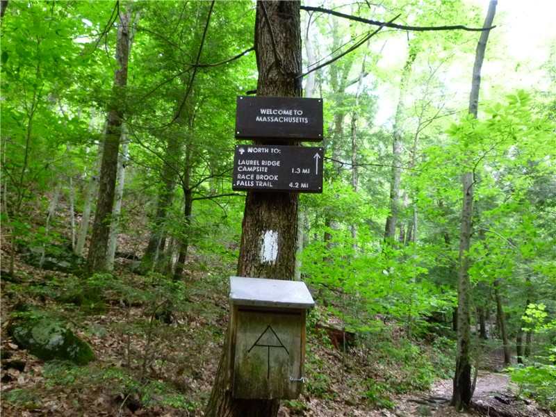
This hike does not include the highly popular and heavily visited Sunrise Mountain but covers many of the lesser used trails through beautiful forests.  The hike begins on the Appalachian Trail which skirts the parking lot.  Head towards Maine.
When the Appalachian Trail crosses over paved Sunrise Mountain Road, turn left and stay on the road for about a quarter of a mile.
Sunrise Mountain Road
Leave Sunrise Mountain Road to the left on the Coursen Trail.
Watch your step! Red Efts are abundant along a section of this trail.
The Stony Lake Trail circles around Stony Lake: (The NY/NJ Trail Conference map shows this as a blue/brown-blazed trail - the markers must be discolored as they appear to be green/tan as shown below.)
Stony Lake
From the far side of the lake note the fire tower up on the Appalachian Trail where this hike goes later.
After circling the lake, a short road walk comes out at the Stony Lake Day Use Area.  The next trail is a little tricky to find.  Turn left before the sign below and walk through the parking lot towards the basketball hoops.
As you near the hoops you should see the brown trail markers of the Stony Brook Trail on the tree.  The trail is to the left of the markers and goes through a grassy area.
The trail becomes very pretty and parallels Stony Brook.
Stony Brook Falls
Stony Brook Trail
The Stony Brook Trail ends at two old barns.  Straight ahead is a gravel parking lot.  Proceed to that lot and turn right on to the Blue Mountain Trail.
The brown/green-blazed Blue Mountain Trail ends at a camping area at Big Flat Brook.
Big Flat Brook
Another short walk along a quiet paved road brings you to the yellow-blazed Tinsley Trail which passes through pleasant woods.
Shortly after crossing the paved Sunrise Mountain Road, the Tinsley Trail ends at the Appalachian Trail.  Turn right on the white-blazed A.T. and a short distance ahead on the right is a nice pine needle covered clearing with a view to the west.
Appalachian Trail
From the base of the Normanook (Culver) Lookout Tower, a view of Stony Lake from the beginning of the hike.
Stony Lake in the bottom center.
Normanook (Culver) Lookout Tower (marked no trespassing - climbing up not allowed without permission).
Limited views of Culvers Lake to the east.
Just before the Appalachian Trail starts to switchback down to the parking lot, a couple more views.
Kittatinny Lake to the south.
View to the West - continuation of A.T. to the right beyond dead tree.
The white A.T. blazes are hard to follow across this area.  Keep to the right of the stone surfaces heading towards the dead tree shown above.  Turn right just past that tree and the blazes will pick up again.

HIKE SUMMARY:
[  0.00]  From the information board at the far end of the parking lot, turn left to the white-blazed Appalachian Trail then turn right on the Appalachian Trail
[  0.20]  Turn left on paved Sunset Mountain Road and keep straight when the white-blazed A.T. goes right
[  0.65]  Turn left on the blue circle-blazed Coursen Trail
[  1.55]  Turn left on the green/tan (should be blue/brown) trail before crossing creek
[  2.05]  Trail turn left away from pond and ends; right on black circle-blazed Lackner Trail
[  2.15]  Turn right on paved park road, cross bridge over creek
[  2.25]  Turn left before Stony Lake Day Use Area sigh, proceed through parking lot towards basketball hoops, take brown circle-blazed Stony Brook Trail to left of hoops
[  2.45]  Brown-blazed Stony Brook Trail turns right before foot bridge
[  2.50]  Cross wooden foot bridge, proceed to the right through picnic area
[  2.60]  Take orange/brown trail between picnic pavilion on left and restroom building on right
[  2.80]  Keep left on brown when orange Silver Mine Trail goes right
[  3.25]  Keep right at clearing then left between two old barns; head towards gravel parking area
[  3.30]  At gravel parking area, turn right on blue circle-blazed Blue Mountain Trail
[  3.40]  Keep right at fork when unmarked goes left
[  4.50]  Rock hop creek, veer left towards camping area, rock hop another creek, right on paved road running parallel to Big Flat Brook to right on paved park road
[  4.75]  At "dead end" sign leave paved park road and turn right on the yellow circle-blazed Tinsley Trail
[  5.20]  Keep right on yellow Tinsley Trail when Spring Cabin Trail goes left
[  5.70]  Keep straight on yellow Tinsley Trail when red Swenson Trail joins in from left
[  5.80]  Keep left on yellow Tinsley Trail when red leaves to right (no red blazes at intersection)
[  6.05]  Unmarked trail to left appears to go nowhere
[  6.50]  Pass kiosk, cross paved Sunshine Mountain Road, continue on Tinsley Trail
[  6.55]  Tinsley Trail ends, right on white-blazed Appalachian Trail
[  6.70]  Clearing with view on right (nice break spot)
[  7.85]  Keep straight on A.T. when the brown circle-blazed Stony Brook Trail and blue-blazed trail to the Gren Anderson shelter go right
[  8.80]  Keep straight on A.T. when green circle-blazed Tower Trail goes right; A.T. trail register; Normanook Lookout Tower
[  9.90]  Cross open rock clearing staying right to continue on A.T. to right beyond dead tree, A.T. descends
[10.35]  Left on paved Sunshine Mountain Road briefly then right as white-blazed A.T. continues into woods
[10.50]  Arrive at parking lot

Saturday, June 11, 2011

Mt. Everett State Reservation, MA (Race Brook Falls, Mt. Race to Sages Ravine via the Appalachian Trail)


ABOUT THE PARK:
Mt. Everett State Reservation - Massachusetts Department of Conservation and Recreation

DIRECTIONS:
GPS Coordinates 42.089478, -73.411248

View Larger Map
Off-road parking for about 5-6 cars.
TRAIL MAP:
South Taconic Trails Map (check for new edition Spring 2015) - NY/NJ Trail Conference
Mt. Washington State Forest Map - Massachusetts DCR
South Taconic Range Map - Berkshire Natural Resources Council, Inc.

HIKE DISTANCE:  13.75 miles out and back

HIKE DESCRIPTION:

Pick up the blue triangle-blazed Race Brook Falls Trail from the information board at about the mid point of the parking area.
Some things to note about the trail blazes:  For the most part they are blue triangles although there are some blue rectangles - all are part of the same trail.  Sometimes triangles are used point to the direction of a turn.  In other words, if the triangle is on it's side, that indicates a turn and it is sometimes hard to notice so you have to pay close attention.  Sometimes a "tail" is drawn in to make the turn more obvious.
I had read several accounts of how poorly the trail is blazed but it appears as through there has been recent reblazing and I had no trouble at all staying on the trail. If you aren't seeing blazes, you missed a turn.

The first fork gives  the option of seeing the lower falls via a .35 mile side trail to the right.
Race Brook Falls - Lower Falls
The only way to see the lower falls is to take the side trail and retrace back to the intersection then continue on the left branch of the trail.  At another fork about .35 mile ahead, there is another option to see the lower falls from the opposite side of the creek but the view is much better from the first fork.

The trail ascends and crosses the creek at the bottom of the upper falls.
Race Brook Falls - Upper Falls
Race Brook Falls Trail terminates at the Appalachian Trail
Appalachian Trail
The south bound Appalachian Trail ascends to the summit of Mt. Race.  Once at the top, the trail follows along the edge of the eastern side of the ridge for continuous panoramic views over a distance of over 1/2 mile.
Mt. Everett to the north as seen from Mt. Race
View of Massachusetts countryside to the east from Mt. Race
Twin Lakes in Connecticut from Mt. Race
Descend from Mt. Race, cross over Bear Rock Stream, descend into Sages Ravine:
Bear Rock Stream
Before crossing Sages Ravine Brook there is a "Welcome to MA" sign but you will still be in MA all along Sages Ravine.
Sages Ravine Brook
Sages Ravine

Where the Appalachian Trail starts to ascend to the left away from Sages Ravine Brook is a good turn around point.  The picture of the Sages Ravine sign is from up at the top of that hill but there is nothing else worth climbing up for unless you are doing a shuttle hike to parking areas in that direction.
Returning via Mt. Race

HIKE SUMMARY:
[  0.00]  From parking area take trail starting at kiosk (sign trail register)
[  0.30]  Right at fork towards lower falls
[  0.65]  Lower falls; retrace
[  1.00]  Back at intersection take left fork towards upper falls; trail parallels creek; watch for unmarked left turn to rock hop over creek short distance ahead
[  1.15]  Ascend two sets of log steps
[  1.35]  Keep left towards Race Brook Campsite (right trail to lower falls does not provide as good of a view as the first trail to the lower falls)
[  1.60]  Rock hop over creek at top of lower falls; trail turns left away from creek and ascends more steeply
[  1.75]  Trail levels out with views to the east through the trees
[  1.85]  Trail reaches creek, turns right and follows along right side of creek
[  1.95]  Cross creek to left over log bridge
[  2.10]  Rock hop over feeder stream
[  2.25]  Continue through Race Brook Campsite
[  2.50]  Trail switchbacks up short flight of stone steps
[  2.60]  Turn left on white-blazed Appalachian Trail at intersection
[  3.45]  360 degree views at top of rock scramble
[  4.10]  Trail leaves ridge into woods and descends
[  4.25]  Cross small stream
[  5.15]  Cross Bear Rock Stream
[  5.35]  Keep straight when trail to right goes to Laurel Ridge Campsite
[  6.05]  Keep straight when trail merges in from left (easy to miss veering left on the return route so be sure to turn around and make note of this area as a fork going in the opposite direction)
[  6.15]  Keep left when unmarked woods road goes right
[  6.25]  Rock hop across Sages Ravine Brook
[  6.35]  Ascend rock steps where trail parallels ravine from higher up
[  6.45]  Cross feeder stream on log bridge
[  6.75]  Keep left on white-blazed trail when log bridge crosses over on blue-blazed trail to Sages Ravine Campsite
[  7.00]  Turn around to head back when trail ascends uphill to the left
[  7.25]  Keep right on white-blazed trail when log bridge crosses over on blue-blazed trail to Sages Ravine Campsite
[  7.50]   Cross feeder stream on log bridge
[  7.70]   Rock hop across Sages Ravine Brook
[  7.85]  Keep straight on white-blazed trail when woods road comes in from left
[  7.95]  Left at unmarked fork when woods road goes right
[  8.70]  Straight on white-blazed trail when trail to Laurel Ridge Campsite goes left
[  8.85]  Cross Bear Rock Stream
[10.00]  Exit woods on to ridge with views
[10.40]  Summit of Mt. Race
[10.60]  360 degree views with Mt. Everett straight ahead before descending from Mt. Race
[ 11.55]  At intersection, right on blue triangle-blazed Race Brook Falls Trail
[ 11.80]  Follow trail through Race Brook Falls Campsite
[12.25]  Cross over log bridge
[12.35]  Watch for left turn over creek where trail appears to go straight
[12.70]  Cross creek at bottom of upper falls
[13.00]  Keep straight when side trail to lower falls goes left
[13.25]  Descend two sets of wooden steps
[13.35]  Trail turns left and rock hops over creek
[13.50]  Keep right at intersection where left goes to lower falls
[13.65]  Trail exits woods and skirts small field
[13.75]  Arrive at parking area

Saturday, June 4, 2011

Ricketts Glen State Park, PA - Falls Trail, Cherry Run Loop and Evergreen Loop


ABOUT THE PARK:
Ricketts Glen State Park - PA Dept. of Conservation and Natural Resources
Ricketts Glen State Park - Wikipedia

DIRECTIONS:
Lake Rose Trailhead Parking
GPS coordinates 41.329576, -76.291308
The GPS gets a little wonky entering the park from Route 487 so follow the signs for the Lake Rose parking lot.

View Larger Map


TRAIL MAP:
Ricketts Glen State Park Map - Pennsylvania DCNR
For the Cherry Run Loop portion see Midatlantichikes.com

HIKE DISTANCE:
Falls Trail - Cherry Run/Hall of the Hemlocks - Evergreen Trail - 15.1 miles
  Individual Hikes:
Falls Trail - 3.5  miles
Cherry Run/Hall of the Hemlocks Loop - 13.3 miles
Evergreen Loop - 1 mile

HIKE DESCRIPTION:
From the Rose Lake parking lot, pick up the trail at the information boards to begin with the Falls Loop.  The trail will descend along Ganoga Glen, cross Waters Meet, then ascend along Glen Leigh for a total of 18 waterfalls.
Ganoga Glen Falls from top to bottom (click on picture to enlarge)
Waters Meet with Ganoga Glen to the left, Glen Leigh on the right.
Glen Leigh Falls from bottom to top (click on picture to enlarge)
Steps going up Glen Leigh.
After ascending Glen Leigh, a left on the Highlands Trail brings you back to the parking lot.  Keep going towards the Cherry Run Trail which starts beyond the dam.
Cherry Run Trail
For the Cherry Run/Hall of the Hemlocks Circuit, please refer to the Midatlantichikes.com instructions.  (The day after I did this hike I received the new edition of Jeff Mitchell's "Hiking the Endless Mountains" where he has a very detailed description of the Cherry Run Circuit on page 103.)

You leave the Cherry Run trail to the right at a log and cairn to access unofficial trails.  This is very difficult to find.  I passed by it and found a trail to the right with initials carved into trees on either side of the trail.  I went farther in case that was not the right trail but found nothing else so I backtracked.  Just as I was getting ready to turn on the trail with the carved initials to see where that went, a trail maintainer with a local hiking club appeared so I asked him if that was the right trail.  It was not so he helped me find it.  Turns out the cairn was knocked over so it is basically a log with a few larger rock lined up along the log and you really have to be looking for it to see it.  The trail maintainer offered to escort me through that part of the hike since he is familiar with the maze of unofficial trails and he was kind enough to lead me through that entire part over to the Mountain Spring Lake Trail.  He not only shared lots of information with me about the surrounding area but also told stores of his Appalachian Trail thru-hike and Pacific Crest Trail hike.  What luck to have run into him and how nice of him to give me a tour of the unofficial trails!
Giant Conk
Cherry Run
A Cherry Run Waterfall
Mountain Spring Lake Trail
Intersection with Old Bulldozer Trail
Rocky Section of Old Bulldozer Trail
Midway Crevasse along the Highland Trail.
Leaving the park, turn left on Route 487 then left on Route 118 and watch for parking on the right at the pedestrian crossing sign for the Evergreen Trail.  This trail is only 1 mile long and definitely worth stopping for.
Follow the trail to the 36' Adams Falls.


Continue on the loop trail passing several very interesting interpretive signs such as:

HIKE SUMMARY:

[  0.00]  Take trail at trailhead information boards
[  0.10]  Right towards Ganoga Glen at intersection (left is return route)
[  0.30]  Cross bridge, turn left on Falls Trail when Old Beaver Dam Trail goes straight
[  0.65]  Straight on Fall Trail when Old Beaver Dam and Ganoga View Trails go right
[  1.40]  At Waters Meet turn left and cross bridge
[  2.10]  Keep right when shortcut trail to Highland Trail goes left
[  2.30]  Keep right when Highland Trail goes left (or for 3.5 mile hike turn left)
[  2.70]  Right on grassy road towards orange diamond and yellow rectangle-blazed Cherry Run Trail at info boards when gravel road goes left
[  2.80]  Follow along dam and keep straight on Cherry Run when Mountain Springs goes right (coming in from right is return route)
[  5.50]  Look for trail right  - missed turn if you reach trail with initials carved in trees; follow Midatlantichikes.com instructions for directions through this section.

To continue after exiting unofficial trails:
[ 10.75]  After crossing Bowman Creek, right on orange diamond-blazed Mountain Spring Trail
[ 12.00]  At intersection with multiple signs, right on red diamond-blazed Old Bulldozer Trail towards Lake Leigh
[ 12.60]  Turn left at dam when Cherry Run Trail goes right
[ 12.70]  Turn left at intersection towards Glen Leigh
[ 13.00]  At intersection right on Highland Trail when Falls Trail goes straight
[ 13.20]  Keep right on Highland Trail when shortcut trail goes left
[ 13.60]  Midway Crevasse
[ 14.00]  At intersection turn right towards Lake Rose parking lot when trail to Ganoga Glen goes left
[ 14.10]  Back at parking lot