Tuesday, October 26, 2010

Cacapon State Park, WV


ABOUT THE PARK:  Cacapon Resort State Park - West Virginia State Parks

DIRECTIONS:

View Larger Map

I did this hike on my way from New Jersey to Virginia.  In addition to breaking up the drive with a hike, it enabled me to bypass a section of traffic-heavy I-81 on pleasant country highways.

After entering the park, follow the signs to the lodge registration office and park in the lodge parking lot.

TRAIL MAP:  Cacapon Resort Trail Map

HIKE DISTANCE:  6.50 miles

HIKE DIRECTIONS:
Walk back the way you drove in from the parking lot to the 4-way stop intersection.  Walk across the intersection towards the cabins.  At the end turn right, then turn left between cabins 21 and 22 to the green-blazed Laurel Trail.
Keep left on green at the intersection with the red trail where the reservoir can be seen to the right.  At .60 miles where the green Laurel, red Central and orange Ziler trails intersect, turn left on the red-blazed Central Trail.
Cross Middle Fork Road with cabins on the right.  At 1.65 miles the blue Ziler Loop Trail joins the red Central Trail for a short distance.  Stay straight on the blue Ziler Loop Trail when the red Central Trail veers to the right.
There may be a few limited, seasonal views along the way.

You will be ascending until you arrive at the ridge where you will find a bench at the intersection with the orange Ziler trail.
If you were to turn left on the orange Ziler trail for a few steps you will come to a woods road that runs along the ridge.  I hiked out a short distance to the left and found no views.  If you continue in that direction it would take you to the Cacapon Mountain Overlook, probably about 3 miles away.  This overlook can also be reached by car via a bumpy gravel road (more on that later).  For this hike, continue from the bench on the blue Ziler Loop Trail which will switchback down to a view around 4 miles.
At 4.80 miles the red Central trail joins the blue Ziler Loop trail briefly.  Cross a gravel road, turn left and walk a short distance turning right on the red Central Trail.  A short distance ahead keep right at an unmarked intersection.  Although there is no blaze at the intersection, you will see a red blaze a short distance ahead.  You might run into this friendly little guy.
As you near the reservoir at 5.60 miles, watch for the trail to make a sharp right turn which is easily missed.  If you find yourself walking along the reservoir, you missed the turn.
At 5.90 miles turn left on the green-blazed Laurel trail.  A white trail joins in after a short distance.  At 6.25 miles turn left at the intersection to go between cabins 21 and 22 from behind.  At the road turn right then left at the first intersection, through the 4-way stop and back to the parking lot.

If you would rather drive to the Cacapon Mountain Overlook (alternative is to add about 6 miles to the hike by taking the woods road at the bench intersection described above), drive as though you are exiting the park but turn right at the sign for the Cacapon Mountain Overlook.  (I believe this road is closed in the winter.)
Signs will warn of the condition of the road although I did not find it to be all that bad in an SUV.  Expect that your car will be covered in gravel dust.
Arrive at the Mountain Overlook at the top of the mountain.
You can also hike on the woods road along the ridge from this point.  I hiked out about half a mile and it was a fairly level hike out and back with some gradual ups and downs.

Shenandoah River State Park, VA


ABOUT THE PARK:  Raymond R. "Andy" Guest Jr. Shenandoah River State Park

TRAIL MAP:  The online map is not up to date as the park is still a work in progress.  Updated maps can be obtained at the park office.  This map is current as of October 2010. (Click on the picture to enlarge.)

DIRECTIONS:

View Larger Map

ACCOMMODATIONS:
Stayed in a brand new (as of summer 2010) pet friendly cabin right next to the trailhead.

HIKE DISTANCES:


HIKE DIRECTIONS:
Trails are very well-marked, not only with the color of the trail but the name of the trail on each marker as well.  It's a very pretty hike through farmlands and forests and along the river on woods roads with some uphill and downhill sections, mostly on switchbacks.

At the information board next to cabin 6 on the cul-de-sac,  follow the trail downhill.
At the first intersection, turn left on the orange-blazed Cullers Trail.
At .45 miles turn left on the white-blazed Big Oak Loop Trail.
Turn left on the pink-blazed Tulip Poplar Trail at .65 miles.
At the intersection with the white-blazed Big Oak Loop Trail at 1.35 miles, turn right and follow that briefly then turn left on the red-blazed Redtail Ridge Trail.  This trail has nice views with a short side trail to an overlook.
At 2.50 miles turn left on the gray-blazed Shale Barrens Trail briefly then right on the white-blazed Big Oak Loop Trail for almost 1/2 of a mile.

At 2.95 miles, turn left on the teal-blazed Bear Bottom Loop Trail.  You will be returning to this point at the completion of the 3.5 mile loop.  This is a fun trail with roller coaster ups and downs, weaving around from one mountain over to another.
At 6.20 miles arrive back at the beginning of the Bear Bottom Loop and take the white-blazed Big Oak Loop back to the gray-blazed Shale Barrens Trail.  Turn left on the Shale Barrens Trail following the switchbacks down to the orange-blazed Culler's Trail.
Turn left on the orange-blazed Culler's Trail then right on the green-blazed River Trail a short distance ahead.  Cross over the bridge and follow the trail along the river.
The River Trail briefly joins the Culler's Trail at a brown cabin, then veers to the left.  Just before crossing a bridge where the campground can be seen straight ahead, turn right on the mowed path to get back over to the orange-blazed Culler's Trail.  Turn left on the Culler's Trail then immediately turn right on the trail that leads back to the cabins.

HIKE SUMMARY:
[0.00]  Start hike from trailhead at the end of the cul-de-sac next to cabin 6
[0.20]  Turn left on the orange-blazed Culler's Trail
[0.45]  Turn left on the white-blazed Big Oak Loop Trail
[0.65]  Turn left on the pink-blazed Tulip Poplar Trail
[1.35]  Turn right on the white-blazed Big Oak Loop Trail briefly then left on the red-blazed Redtail Ridge Trail
[1.60]  Turn right on short side trail to scenic observation point
[1.75]  Continue right on red-blazed Redtail Ridge Trail after backtracking from scenic view
[2.50]  Turn left on gray-blazed Shale Barrens Trail briefly then right on white-blazed Big Oak Loop Trail
[2.95]  Turn left on teal-blazed Bear Bottom Loop
[4.65]  Continue to the right on teal-blazed Bear Bottom Loop where left goes to horse trailer parking
[6.20]  Turn left on the white-blazed Big Oak Loop Trail
[6.60]  Turn left on the gray-blazed Shale Barrens Trail
[7.10]  Turn left on the orange-blazed Culler's Trail
[7.25]  Turn right on the green-blazed River Trail; cross over bridge
[7.65]  Keep left at the intersection
[8.20]  Keep left at split at brown cabin
[8.65]  Turn right before bridge and walk on mowed path; left on Culler's Trail; immediate right on path back to cabins.
[8.90]  Arrive back at the cabins

Sunday, October 17, 2010

Mount Tammany - Delaware Water Gap/Worthington State Forest, NJ

ABOUT THE PARK: 
Hiking Mount Tammany - National Park Service

TRAIL MAP:
Hikes at the Gap - National Park Service
NY/NJ Trail Conference Southern Kittatinny Trails Map 120

DIRECTIONS:
GPS Coordinates:   40.97237,-75.125159

View Larger Map
From NJ, I-80 West, exit for Dunnfield before Exit 1, pass the picnic area on the right, next right is Dunnfield parking at Dunnfield Creek Natural Area.  The parking lot will be PACKED if you don't get there early.  At 1 pm the lot was full and cars where hovering for my spot when they saw I was going to leave. This picture was taken at 8 am.  Also, starting early pretty much guarantees you will avoid the crowds and have the views all to yourself.

HIKE DISTANCE:
This hike was 8.1 miles but I will give options for a 4 mile and a 6 mile hike.

HIKE DIRECTIONS:
Start the hike by walking as though you are leaving the parking lot.  The red dot trail to Mount Tammany is on the left just before you leave the lot and will start out with steps built into the incline eventually becoming stones to step up on.

At .45 miles arrive at the first overlook.
The Delaware River and Mount Minsi, PA from 1/3 way up Mount Tammany.
The trail will become rockier the rest of the way.


At 1.30 miles, arrive at the summit of Mount Tammany (1,527' - New Jersey 1K Club Peak)
Mt. Minsi, PA as seen from Mt. Tammany, NJ
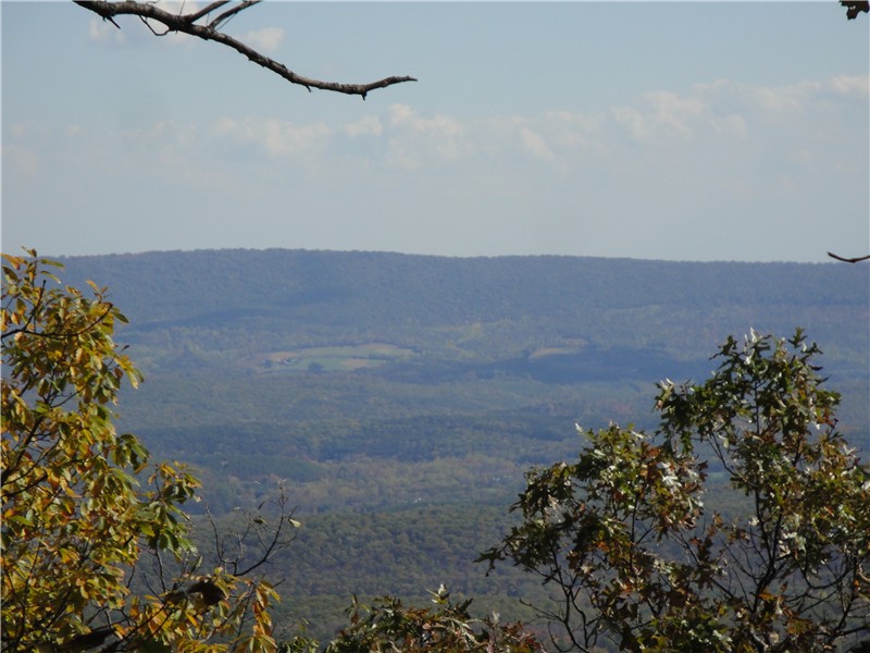
Looking west into Pennsylvania from Mount Tammany.
Where the red dot trail ends, continue on the blue trail.  You can catch a couple of views looking east into New Jersey.

At 1.60 miles stay left on the blue trail as the unmarked Mount Tammany fire road goes right.
At 3 miles turn right on the mint green-blazed Dunnfield Hollow Trail.
(For the 4 mile hike, turn left on the joint mint green/blue-blazed trail which will run into the white-blazed Appalachian Trail.  Turn left on the white-blazed trail back to the parking lot.)

Dunnfield Creek will be on the left.
Shortly after a rock hop over Dunnfield Creek, turn left on the red-blazed Holly Springs Trail at 4.0 miles.
At 4.50 miles arrive at the white-blazed Appalachian Trail where the red-blazed trail ends.  Cross straight over the Appalachian Trail to pick up the start of the yellow-blazed Beulahland Trail.  The yellow-blazed trail is an easy grassy woods road.
(For the 6 mile hike, turn left on the white-blazed Appalachian Trail which goes straight to the Dunnfield parking lot.)
At the end of the yellow trail at 5.85 miles, turn left on Mine Road and carefully walk along the road for a very short distance.
There will be two parking lots ahead, Fairview on the left and Karamac on the right.  Turn right into the Karamac parking lot.  Continue through the parking lot towards the information board, beyond which begins the unmarked Karamac Trail.
The Karamac Trail descends down to the Delaware River,
As the trail reaches the river, it turns left and follows closely along the river eventually becoming an old rail bed.
Nearing the I-80 bridge into Pennsylvania towards the end of the Karamac Trail.
The trail ends in a parking lot at the stop light at Mine Road and the I-80 bridge over the Delaware River.
Walk along the right shoulder of the road under I-80 (there is a wide shoulder to walk on).  At 7.25 miles the white-blazed Appalachian Trail joins in on the shoulder from the bridge ramp on the left.
You'll get great views of Mount Tammany and Mount Minsi along this stretch, a view you normally just get a flash of driving on I-80.

Pass the visitor center on the right then a boat docking area and picnic tables.  At 8.00 miles the AT turns left under the I-80 bridge.
Once on the other side of the bridge follow the road to the left and you will see the Dunnfield parking area on the right.

LITTER REPORT:
It's been a while since I featured litter, mainly because I haven't found any.  This litter could not be missed.  It was smack in the middle of the summit of Mount Tammany where people stand for views - a used baby diaper!  My dog never poops on hikes but I carry poop bags anyway just for cases like this.  I had to carry this with me for 4.5 miles until fortunately there was a trash can at the Karamac parking lot.  If you can haul a baby up Mount Tammany, you can haul out the dirty diaper.


HIKE SUMMARY:
[ 0.00]  Red dot trail at southeast end of parking lot.
[ 0.45]  Arrive at first overlook
[ 1.30]  Red dot trail ends at the summit of Mount Tammany; views; continue on blue trail
[ 1.60]  Turn left on blue trail; Mt. Tammany fire road goes right
[ 3.00]  Right on mint green-blazed Dunnfield Hollow Trail
            *** for 4 mile hike turn left on blue/green then left on white back to parking lot***
[ 4.00]  Left on red-blazed Holly Spring Trail
[ 4.50]  Cross white-blazed AT to continue on yellow-blazed Beulahland Trail.
            ***for 6 mile hike, turn left on the white-blazed Appalachian Trail back to parking lot***
[ 5.85]  Turn left on Mine Road; right into Karamac Parking Lot, through lot to Karamac Trail
[ 6.00]  Karamac Trail arrives at the Delaware River and turns left.
[ 7.00]  Karamac Trail ends at Mine Road; continue along shoulder of road under I-80
[ 7.25]  White-blazed AT joins road from bridge ramp on the left
[ 8.00]  White-blazed AT turns left under I-80 bridge then left after bridge.
[ 8.10]  White-blazed AT turns right into Dunnfield parking lot