ABOUT THE PARKS:
Otter Creek Nature Preserve - Lancaster Conservancy
Susquehannock State Park - Pennsylvania DCNR
Mason-Dixon Trail - The Mason-Dixon Trail System
Apollo County Park - York County, PA
The Otter Creek Flood of August 31, 2018 Articles from the York Daily Record:
Crunched cars, boat, other debris still choke Otter Creek months after flood: Help needed
York County still cleaning up from flash floods
DIRECTIONS:
GPS Coordinates 39.903074, -76.398526
 |
| Parking at Apollo County Park. |
TRAIL MAP:
Otter Creek/Urey Overlook Trails - Mason-Dixon Trail (map on page 3)
Apollo County Park Brochure - York County Department of Parks
HIKE DISTANCE: 10.3 miles
THE HIKE:
 |
| From the parking lot turn left just the other side of the barrier. |
 |
| Mason-Dixon Trail heading south through the woods. |
 |
| The trail comes out into a power cut ... |
 |
| ... then crosses Shenks Ferry Road. |
 |
| Crossing Furnace Road. |
 |
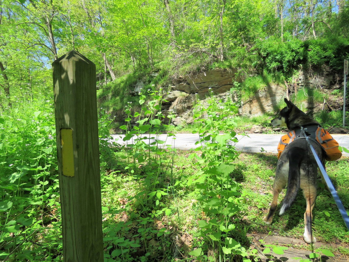
| Crossing Kline Road. |
 |
| This sign concerned me because I had thought the trails were clear. Plan B was to hike the Mason-Dixon Trail in the opposite direction but I continued on to see how far we would get. When I ran into another hiker coming from the opposite direction, he said everything was clear from Urey Overlook. |
 |
| A little bit of a rock scramble. |
 |
| Descending into the Otter Creek gorge, there was a loud CRASH as we watched an entire tree come down, fortunately on the other side of the creek It was an insanely windy day with over 20 mph winds. |
 |
| The Mason-Dixon Trail turns left along Otter Creek. Evidence of flood devastation was visible throughout and it was obvious what a massive cleanup effort had already taken place. |
 |
| You can see how high the water in the creek had been by the chunks of bark missing where debris knocked into trees. |
 |
| A boat in the creek deposited by the floods. |
 |
| Red joins in from the left; now on blue/red. |
 |
| Not litter rather somebody's belongings smashed and lost in the flood. |
 |
| I was amazed at how one dish was shattered, the other intact. |
 |
| Staging areas where volunteers have piled up flood debris. |
 |
| Red leaves blue to the right continuing along Otter Creek. I had intended to return on red but would have to see if it was closed at the other end. If so, there were other trails to take. |
 |
| For now, up on blue out of the gorge. |
 |
| Crossing Furnace Road to the Urey Overlook parking lot, part of Susquehannock State Park. |
 |
| Straight through the parking lot and on to the grassy woods road beyond the gate. |
 |
| Yellow joins in from the right. |
 |
| Coming up on ... |
 |
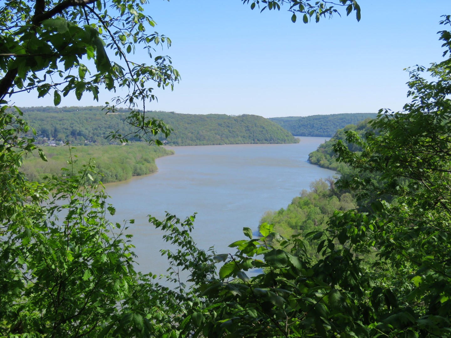
| Urey Overlook |
 |
| Susquehanna River |
 |
| Leaving the overlook on blue/yellow. |
 |
| We turned left on yellow when the blue Mason-Dixon Trail continued straight. |
 |
| Yellow isn't as well-maintained as blue and is already becoming overgrown in spots but was still easily passable this early in the season. |
 |
| Bluebells all along the way. This was the only trail where I saw them. |
 |
| Yellow comes out on Furnace Road where we turned left. |
 |
| The Maxon-Dixon Trail comes in from the right and crosses over the bridge. We would be picking it back up where it comes out just before the bridge but first ... |
 |
| ... over the bridge to Otter Creek Recreation Area. |
 |
| Lake Aldred |
 |
| To the right a rock outcrop. |
 |
| Heading back to the boat launch. |
 |
| From the boat launch, the rock we had just been standing on. |
 |
| Back on Furnace Road a right over the bridge then left over the guardrail on to the Mason-Dixon Trail. |
 |
| This part of the trail is actually red/blue. It follows along the top of the gorge for a bit ... |
 |
| ... then descends to Otter Creek. |
 |
| I could see where flooded out trail had been rerouted in this area. |
 |
| So many trees down in the flood and so much hard work by volunteers to clear. |
 |
| Making use of one of those downed trees for our break spot. |
 |
| Blue leaves to the right but there were no signs saying red was closed from this end as it continues along Otter Creek so I decided to see how far I could go on red. |
 |
| Although any trail along Otter Creek is very scenic, this was my favorite stretch with all of the rock formations. |
 |
| What is left of a sofa. |
 |
| The scenery constantly fluctuates from flood devastation to scenic beauty. |
 |
| Yes, that is an entire car over there. |
 |
| How do you even begin to get this out of the gorge? |
 |
| Where red meets back up with blue, looking back at the sign saying red is closed from earlier in the hike. We had made it all the way through so it is now clear but probably very recently as the hiker I ran into earlier said it was completely impassable when he tried a couple months prior. |
 |
| Now retracing on red/blue. |
 |
| This belted kingfisher had been flying back and forth chattering up a storm. |
 |
| Heading up out of the gorge. |
 |
| Dogwood Blossoms |
 |
| Back at the Apollo County Park parking lot I had only hiked 8 miles and 10 is my minimum for a 3-hour road trip so we stayed to the left on the Mason-Dixon Trail into Apollo County Park to hike those trails. |
 |
| The Apollo County Park Trails are called 2 and 2A only indicated on posts like this. |
 |
| The Mason-Dixon Trail leaves left (that's for another trip) and we stayed right on 2. |
 |
| An old Mason-Dixon Trail marker from when this used to be the route. |
 |
| Don't believe this sign that it is the end of the trail. Keep going on the footpath because the best is yet to come. |
 |
| At the end of the footpath down some rocks to a lovely break spot ... |
 |
| ... with great views of the Susquehanna River. |
 |
| Heading back up. |
 |
| Back at the parking lot. |