ABOUT THE PARK:
DIRECTIONS:
GPS Coordinates 37.78158, -83.63619
 |
| Backpacker Parking Lot, also the only lot for day hikers. |
 |
| This sign entering the backpacker parking lot indicates there is a fee and that is a bit confusing. |
 |
| Before turning into the backpacker parking lot is the self pay station for camping. |
 |
In the backpacker parking lot is this sign with different fee amounts for overnight parking for backpacking. I could not tell if there was a day use fee or not. A park truck came into the lot so I asked and was told there is no day use fee. Fee payment is checked on cars at night, not during the day.
|
TRAIL MAP:
 |
| I hiked this as two separate loops from the same parking lot. |
HIKE DISTANCES:
Silvermine Arch - 3.2
Hidden Arch and Koomer Ridge Loop - 8.4 miles
THE HIKE:
Hike 1 of 1 on the second day of the semi-annual trip from New Jersey to Missouri.
 |
| Walking back out the parking lot entrance drive ... |
 |
| ... then veering left and crossing the road to the trailhead. |
 |
| At the split, left will be the second hike, but first right to Silvermine Arch. |
 |
| Before arriving at Silvermine Arch the trail descends steeply on stairs. |
 |
| Coming up on Silvermine Arch. |
 |
| Even though this area is insanely popular on weekend, on this weekday the campground was almost empty but some campers were already at Silvermine Arch. We did have the rest of the day to ourselves. |
 |
| Heading back. |
 |
| Keeping left to the campground ... |
 |
| ... to access the Cliff Trail on the left. |
 |
| Dogwood is blooming in Kentucky. |
 |
| The Cliff Trail ends on a campground road where we road walked a bit before rejoining the Silvermine Arch Trail to retrace back. |
 |
| Since we were so close to the parking lot, we continued back to the car for lunch and to grab more water out of the cooler for the longer hiking loop. It was over 80 degrees on this day with virtually no shade under trees just starting to get leaves, making it much hotter than expected. |
 |
| Heading back the same way we started but now keeping left on the Koomer Ridge Trail. |
 |
| It continues between a split in the fence. |
 |
| A short distance in, left on the Hidden Arch Trail. |
 |
| This comes out at a clearing that appears to be an overlook but ... |
 |
| ... that Hidden Arch is well hidden because it was not to be seen. |
 |
| It was disappointing thinking it was now overgrown but continuing on ... |
 |
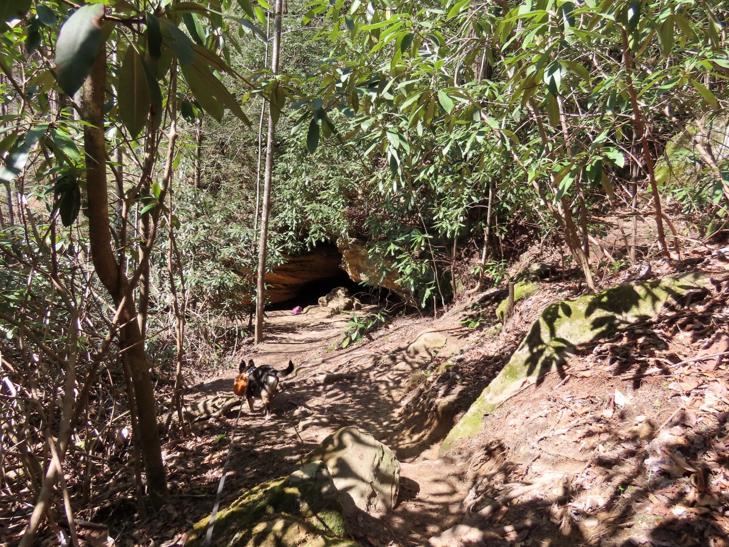
| ... there were steps descending steeply to ... |
 |
| ... Hidden Arch! |
 |
| Heading up. |
 |
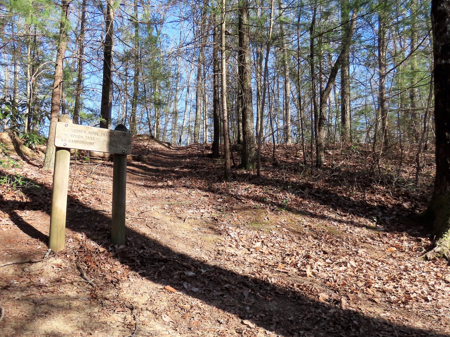
| Back out on the Koomer Ridge Trail we turned left. |
 |
| All trails are marked with white diamonds. |
 |
| The Koomer Ridge Trail descends to ... |
 |
| ... Chimney Top Creek. |
 |
| The Koomer Ridge Trail ends at the Rough Trail and a short distance ahead the Sheltowee Trace Trail joins in. |
 |
| The Sheltowee Trace Trail is marked with a white turtle in addition to the white diamond. |
 |
| The trail crossed the creek three times but the water was low so I was able to rock hop all of the crossings. |
 |
| On the third crossing a sudden gust of wind blew my hat off into the water but I was able to nap it with my trekking pole before it took off. I had to put a soaking wet hat on my head but it really did feel good. |
 |
| The trail ascends from the creek and there were several blow downs across the trail in this area but all were passable. |
 |
| The trail eventually clears. |
 |
| Leaving the Rough Trail/Sheltowee Trace Trail to the left on the Buck Trail. |
 |
| The Buck Trail descends to Right Fork Chimney Top Creek where we crossed another 3 times. |
 |
| Although the crossings looked mostly doable on rocks, it was hot so I opted for ... |
 |
| ... going in with water shoes. It was ice cold and so refreshing. |
 |
| At the end of the Buck Trail, right on the Koomer Ridge Trail to retrace. |
 |
| Passing by the Hidden Arch Trail from earlier. |
 |
| Road walking the last bit back to the parking lot. |
This area of Kentucky was in full swing spring mode. There were wildflowers everywhere and migrating birds returning north.

Birds identified with the Merlin Bird ID sound app:
- Carolina Chickadee
- Black-and-white Warbler
- Pine Warbler
- Black-throated Green Warbler
- Tufted Titmouse
- Golden-crowned Kinglet
- Carolina Wren


 Birds identified with the Merlin Bird ID sound app: