

ABOUT THE PARK:
Shades State Park - Indiana Department of Natural Resources
Pine Hills Nature Preserve - Indiana Department of Natural Resources
DIRECTIONS:
GPS Coordinates 39.936661, -87.075629
 |
| Hickory Parking Lot |
TRAIL MAPS:
Shades State Park - Indiana Department of Natural Resources
Pine Hills Nature Preserve - Indiana Department of Natural Resources
Powered by Wikiloc
HIKE DISTANCE: 9.9 miles
THE HIKE:
 |
| From the parking lot we headed towards trails 7 and 8. We needed to avoid 4 and 5 since those have ladders Brodie would not be able to climb. |


 |
| We'd be seeing many, many, many more steps during this hike. |
 |
| Not too rugged looking yet. |

 |
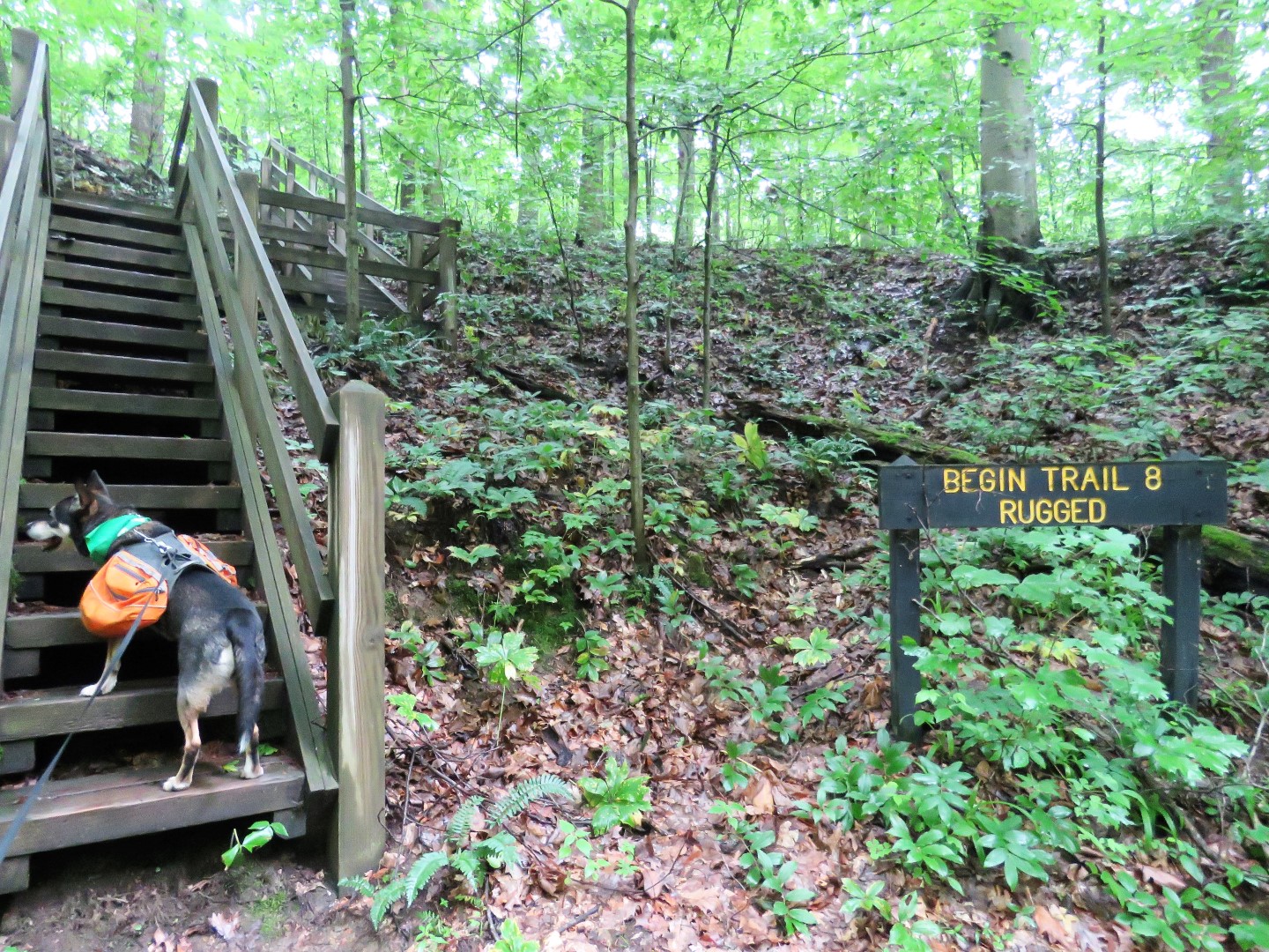
| Descending into the rugged part. |
 |
| Yes, the creek IS the trail and it was wet and slimy and slippery. Many times I had to sit on a slimy rock and slide down. I was quite a filthy mess when we got through the canyon but it was gorgeous and a lot of fun. |


 |
| Coming out of Shawnee Canyon. |

 |
| Trail 8 follows along Sugar Creek for a bit. |

 |
| Back on Trail 7. |

 |
| Trail 7 brought us back out to the parking lot where we turned left towards the Hickory Shelter. |

 |
| Trail 1 is flat and easy and also pretty busy since that is where most people go. |

 |
| Inspiration Point might only be inspiring in the winter. |
 |
| Since Prospect Point was being guarded by another dog, I hooked Brodie to the fence and went to take a peak by myself. |
 |
| Sugar Creek from Prospect Point. |
 |
| Down into the Devil's Punchbowl. |


 |
| Coming off Trail 1 we stayed left to Trail 2 but first a short out and back to Lover's Leap. |


 |
| A little bit of a view of Sugar Creek from Lover's Leap. |
 |
| We retraced then took Trail 2. |

 |
| This area was a huge muddy mess and some other hikers had mentioned this trail might not be doable for Brodie so we turned back. We did end up doing it from a different direction later in the hike and it was not near as challenging as Trail 8 so Brodie was fine with it. |
 |
| Coming off of Trail 2 and heading to Trail 10. |

 |
| Trail 10 connects to the Pine Hills Nature Preserve in about a mile. |

 |
| Here is another way to Trail 2 which is not on the map. We would take this coming back after the nature preserve. |


 |
| The trail is smooth and flat for quite a while until ... |


 |
| Turkey Backbone |

 |
| Clifty Creek |
 |
| Crossing Clifty Creek |

 |
| On the Devil's Backbone |
 |
| Looking up to where we had been on top of Devil's Backbone after a tricky scramble down. |
 |
| Crossing back over Clifty Creek. |
 |
| On to the Mill Cut/Slide Loop. |

 |
| After climbing back up all of the steps, crossing Turkey Backbone. |
 |
| And retracing back to Trail 10. |
 |
| We turned right on Trail 2 where we had seen the post earlier. |


 |
| Another gorgeous canyon where the trail is the creek but this one was not as difficult as Trail 8. |


 |
| Maidenhair Falls |

 |
| Pearl Ravine |
 |
| Coming up out of the canyon ... |
 |
| ... on more steps. |
 |
| Right would have taken us into that mud pit from earlier so we continued looping around on 2 which brought us to a side trail on the right back to Trail 10. |
 |
| Back on Trail 10. |
 |
| Instead of heading straight back to the parking lot, we veered left to ... |
 |
| ... the pond then right on ... |
 |
| ... Trail 6. |


 |
| Then back to the car. |
 |
| Another 4 hours of driving to Columbus, OH where Brodie passed out for the night. |