

ABOUT THE PARKS:
http://ivestrail.org/ - Ives Trail & Regional Greenway Association
Ives Trail Brochure - Ives Trail & Regional Greenway Association
Ives Trail Greenway - Ives Trail & Regional Greenway Association
Patch Award for Hiking the Entire Trail - Ives Trail & Regional Greenway Association
http://ivestrail.org/ - Ives Trail & Regional Greenway Association
Ives Trail Brochure - Ives Trail & Regional Greenway Association
Ives Trail Greenway - Ives Trail & Regional Greenway Association
Patch Award for Hiking the Entire Trail - Ives Trail & Regional Greenway Association

DIRECTIONS:
GPS Coordinates 41.325403, -73.435277
 |
| Redding train station parking, free on weekends. |

TRAIL MAPS:
Ives Trail Map (outdated) - Ives Trail & Regional Greenway Association
Ives Trail and Greenway - Avenza Maps (updated as of Jan 2020)
Powered by Wikiloc
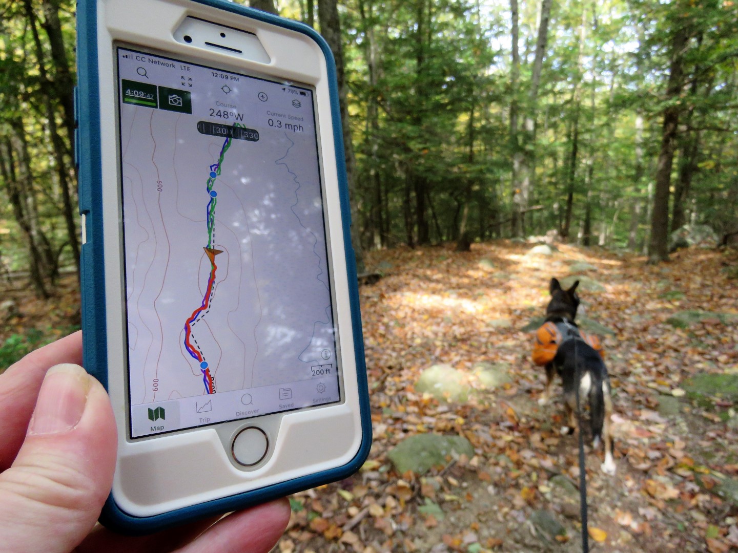
HIKE DISTANCE: 9 miles (with a couple of side trips)
THE HIKE:
 |
| Walking back out of the train station parking lot to ... |
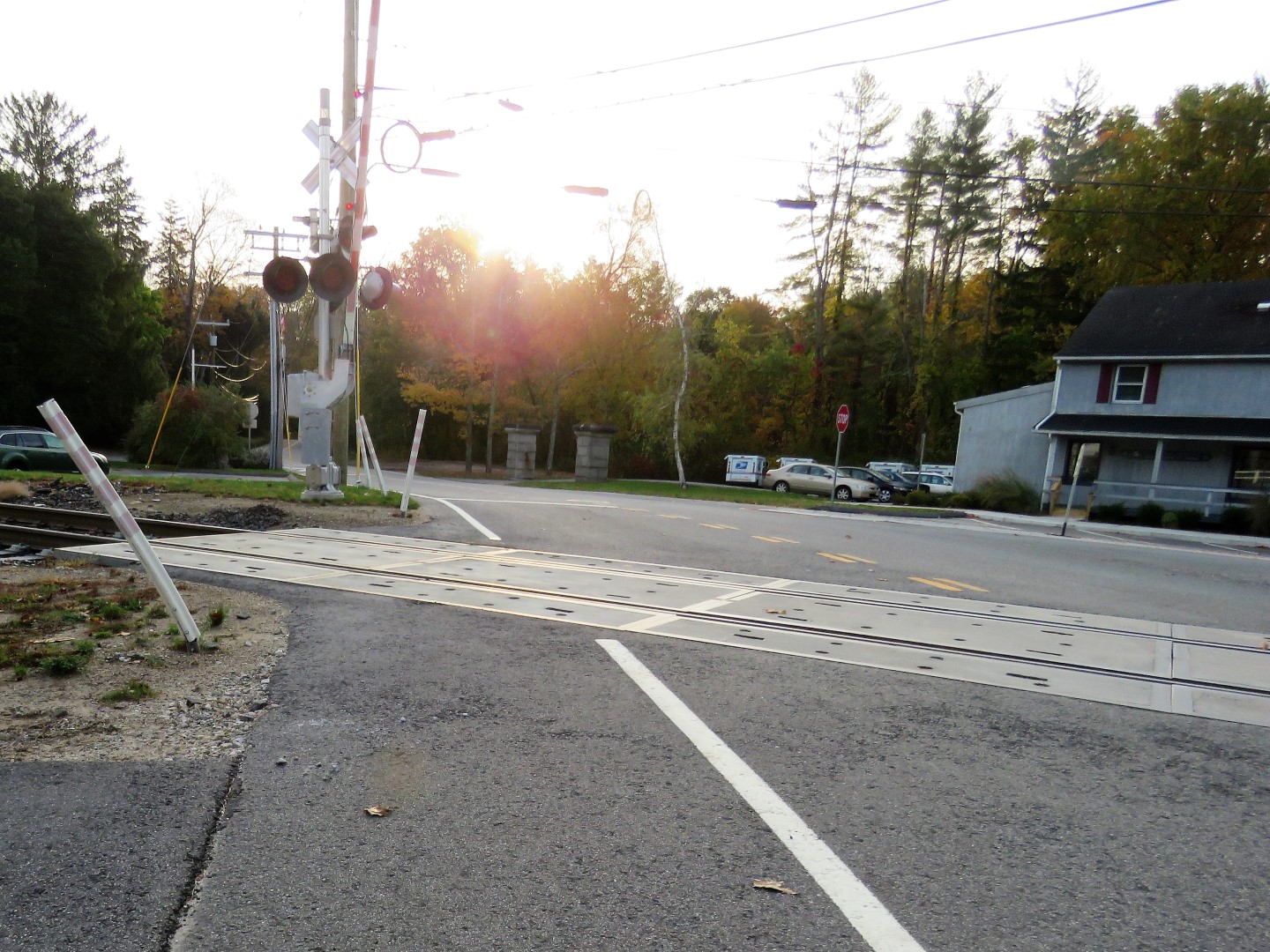 |
| ... a right on Long Ridge Road then crossing the railroad tracks and staying left on Side Cut Road. |
 |
| Keeping with Side Cut Road veering left. |
 |
| Watch for an old stone fence on the left; the entrance to the trail is left just before the stone fence. |

 |
| The Ives Trail and the white-blazed Sidecut Trail of the Bogus Brook Preserve run together. |


 |
| A pond formed by Bogus Mountain Brook on the other side of the railroad tracks. |
 |
| Uh oh. What to do? The sign says crossing the tracks is not permitted and you can't see it from here but the trail does continue on the other side, just not over the tracks. |
 |
| Let's just say we somehow ended up on the other side looking back at where we had been. |
 |
| Once on the other side of the tracks, the white trail forms a loop, the side along the pond not part of the Ives Trail. So I did a short out and back at either end of the loop to see the pond. |


 |
| The Chuck Wagon Trail is a connector trail that goes into a residential neighborhood. |
 |
| It also leads to the far end of the pond where I stood in one place and got ... |
 |
| Eastern Phoebe |
 |
| Song Sparrow |
 |
| Palm Warbler |
 |
| Back on the Ives Trail. |
 |
| The Ives Trail now joins the blue-blazed Top Rock Trail. |
 |
| Balloon #50 of the year. |


 |
| Balloon #51 of the year. |


 |
| The map shows a trail heading north to a lookout. I tried to find it but was not successful. Sometimes there was a distinct trail to follow but that fizzled out. |
 |
| While looking for the lookout, balloon #52 of the year. |
 |
| Back on the Ives Trail. |
 |
| This black-capped chickadee made me work for this picture. |

 |
| A trail register. |


 |
| Now in the Wiedel Preserve, the acquisition of which eliminated a road walk portion of the trail. I had read that Monique Wiedel just passed away in August 2020 at age 102. |


 |
| Female Purple Finch |


 |
| Vacant until next spring. |
 |
| A bench for a break over there. Nice! |

 |
| The trail then comes out on Long Ridge Road where it turns left ... |
 |
| ... and follows Long Ridge Road for about 200 yards. |
 |
| Turning right into what looks like a parking spot ... |
 |
| ... but it is not. At this point, continuing down Long Ridge Road it would be a 1-mile road walk back to the train station for a loop hike of 5 miles. But I still had a 2-mile stretch to do to meet up with where I left off last time so we continued on the Ives Trail for an out-and-back portion. |


 |
| Crossing over West Redding Brook. |
 |
| I don't know which wildlife preserve we were in but initially the trail runs through it. |
 |
| Shortly after leaving the wildlife preserve there is fencing blocking off private property. |

 |
| And here we are, at the point where we left off earlier this year. |
 |
| That rock on the right is where we took a break last time and I was going to do the same except a woman with two off leash dogs that she did not have adequate control over was coming our way so I had to keep going and deal with that instead. Grrrrr. |

 |
| There had been recent trail maintenance everywhere (thanks!) except for this one blow down. But had I not had to bushwhack around it ... |
 |
| ... I would have not seen balloon #54 of the year. I had missed it on the way out. |

 |
| West Redding Brook |
 |
| Coming back out on Long Ridge Road and turning right. |
 |
| Just a few steps along on the left, an old cemetery. I wanted to go and explore but Brodie got all nervous and refused to go in. What was up with that? Haunted? |


 |
| Continuing on down Long Ridge Road (and it's all downhill the rest of the way). |

 |
| It's not a bad road walk with fairly light traffic. |
 |
| Turning right to the train station parking lot. |
