ABOUT THE PARKS:
White Clay Creek Preserve - Pennsylvania DCNR (no parking fee)
White Clay Creek State Park - Delaware State Parks ($4 in state, $8 out of state parking fee)
Some of the trails on the DE side are closed during hunting season except Sundays as there is no hunting in Delaware State Parks on Sundays. (Currently no hunting on Sundays in Pennsylvania either)
DIRECTIONS:
GPS Coordinates 39.766612, -75.766927
 |
| Parking Lot #1 on the Pennsylvania side. |
TRAIL MAPS:
White Clay Creek Preserve Trail Map - Pennsylvania DCNR
White Clay Creek Watershed Trails - Delaware State Parks (The current online map shows the Possom Hill area as under construction. Construction is complete and the paper map at the park office is more current showing this area as completed.)
HIKE DISTANCE: 14.75 miles (about 10 miles without the southern loop)
THE HIKE:
 |
| From the parking lot, we started on the fancy Penndel Trail entrance. |
 |
| Coming out of that entrance, the blue Mason-Dixon Trail goes either way; we turned right on the Penndel/Mason Dixon Trail. |
 |
| This area was loaded with birds with this tufted titmouse being one of the few to sit still long enough. And that wasn't very long at all. |
 |
| It truly was as cold as this picture looks. Driving through Philly at 7 AM it was 30 degrees. At the trailhead it was 17 degrees at 8 AM. I had to throw on a fourth just-in-case layer that I keep in the car. |
 |
| This white-throated sparrow looks cold. |
 |
| Blue-blazed Mason-Dixon Trail. |
 |
| A duck taking off from a pond on the right. |
 |
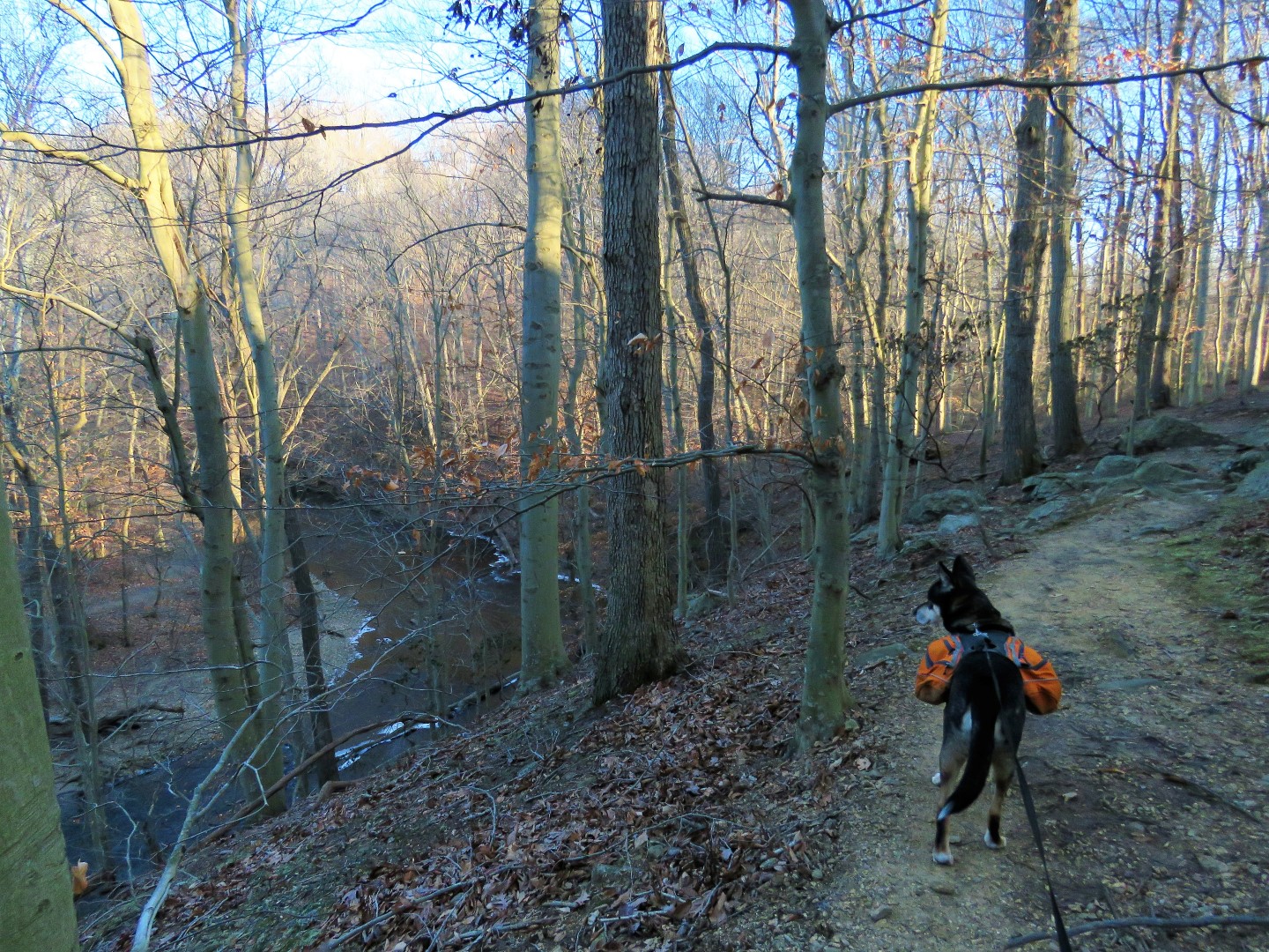
| The trail starts to run along East Branch White Clay Creek. |
 |
| We followed the Mason-Dixon Trail left and would be returning via the Charles Bailey Trail straight ahead. |
 |
| The Mason-Dixon Trail loops around and meets up with the Charles Bailey Trail which is to the right of the bridge. We veered left crossing the bridge... |
 |
| ... over East Branch White Clay Creek ... |
 |
| ... then immediately turned left on the Wendel Cassel Trail. |
 |
| The Wendell Cassell Trail climbs uphill overlooking East Branch White Clay Creek. |
 |
| Eastern Towhee |
 |
| Crossing Yeatman Station Road. |
 |
The sign was hard to read covered with frost. A brief description I found online at waymarking.com : "
Hodgkins’ extension of the West Line eastward created a line segment known as the “Top of the Wedge Line”, and his newly-surveyed circle created a thin strip of disputed territory (known as the “Horn”) immediately northwest of the line. Delaware and Pennsylvania agreed that the Wedge belonged to Delaware and the Horn belonged to Pennsylvania. The US Congress ratified the result in 1921." |
 |
| There are lots of bridges ... |
 |
| ... and benches. |
 |
| Entering Delaware |
 |
| Crossing Thompson Station Road. |
 |
| Now left following the David English Trail. |
 |
| At this point continuing on the David English Trail would make for a 10-mile loop. |
 |
| Left across the bridge adds a 4.75 mile loop, returning to this spot. |
 |
| Crossing Pleasant Hill Road VERY carefully. For as much warning as there is for motorists that there is a pedestrian crossing, they come flying around the limited sight bends at high rates of speed. You basically have to listen for traffic then run. |
 |
| After crossing, left on the Whitely Farms Loop. |
 |
| At this intersection we turned left ... |
 |
| ... on what looks to be a newer, more manicured trail. |
 |
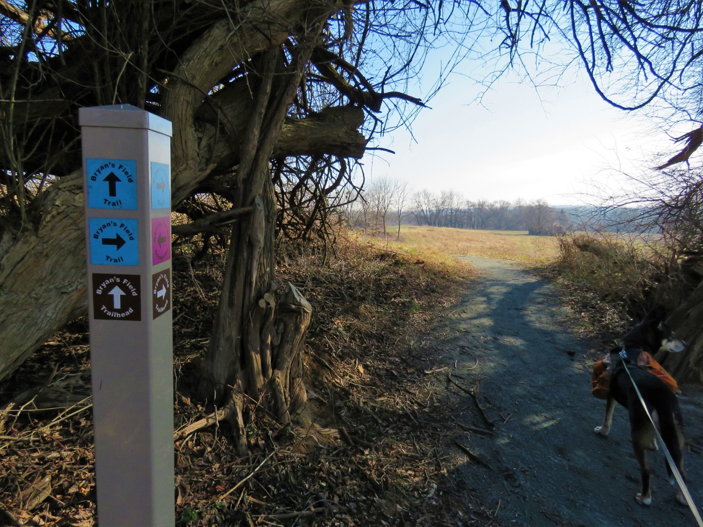
| Left on the Bryan's Farm Trail. |
 |
| Passing by the Possum Hill Parking area ... |
 |
| ... and a small pond. |
 |
| Making use of one of those benches for a break. |
 |
| Just before Nine-Foot Road parking area, an abandoned farm ... |
 |
| ... with a pond. |
 |
| A short distance on the concrete Smith Mill Road ... |
 |
| ... to a left on Whitely Farms Loop. |
 |
| This comes back out at that dangerous road crossing ... |
 |
| ... over the bridge where we started the second loop ... |
 |
| ... then left on David English Trail. |
 |
| Coming up behind the park office ... |
 |
| ... where we detoured briefly to grab a large printed map from the holder next to the office door. |
 |
| Continuing on from the park office. |
 |
| Now it's the Charles Bailey Trail most of the way back. |
 |
| Prime real estate for birds. |
 |
| The Charles Bailey Trail mostly follows along White Clay Creek. |
 |
| Balloon #66 of the year. |
 |
| It was after these old bridge abutments that I noticed ... |
 |
| ... we were back in Pennsylvania based on the DCNR sign. |
 |
| Here was where we crossed over East Branch White Clay Creek at the beginning of the hike and went up the hill to the right. Now crossing back over that bridge and keeping straight on the Charles Bailey Trail. |
 |
| The Mason-Dixon Trail joins in where the Charles Bailey Trail ends and the Penndel Trail begins. |
 |
| The temperature was now 48 degrees so the frost from early in the morning had melted. |
 |
| Back at the covered bridge ... |
 |
| ... to the now much busier parking lot. |


Love that bird house! What a cool park :) Thanks for sharing.
ReplyDeleteYeah right? That is one fancy birdhouse.
DeleteOw, how nice...one can _never_ go wrong at White Clay Creek State Park/Preserve!! So many trails to explore...and I've only done a small portion of them -- although, I've been on pretty much all the ones you covered in this hike...with the exception of the Wendell Cassel Trail, which appears to be newer. (I've been on the David English Trail more than once, but never remember the WC trail junction.) Also, when I hiked some of the Charles Bailey Trail, I don't remember seeing a sign that I was crossing into PA...perhaps the small marker was added in the past 5 or 6 years? (But I later found out that the spot where the old bridge was...was the "key" point!)
ReplyDeleteIt's been quite some time since I've been to White Clay Creek SP (in DE), and I think 2020 is going to _have_ to be the year that I return! (I've been on a small portion of the Whiteley Farms Trail, and need to do the whole thing at some point! Also, have to do the Tri-Valley Trail...where I believe the Tri-State [PA-DE-MD] Marker is located along the way.)
Excellent adventure, as always -- and congrats for obtaining balloon #66...yet another new record?? And I'm guessing you still have at least one more hike in 2019, so we'll see what the final total comes to. Happy Hiking!!
-- Jim
The last time I was there was 2011 with Shawnee and we hit the arc monument but not the tri-state marker. So much to explore there. And yes, last year's balloon total was 56 so that record was broken this year. We'll see what the last hike of the year brings.
Delete