

ABOUT THE PARK:
High Point State Park - New Jersey Department of Environmental Protection
DIRECTIONS:
GPS Coordinates 41.30282, -74.66755
 |
| Appalachian Trail Parking at High Point State Park |
TRAIL MAP:
Kittatinny Trails Map 123 - New York New Jersey Trail Conference
High Point State Park Free Map - New York New Jersey Trail Conference
High Point State Park - New Jersey DEP
Powered by Wikiloc
HIKE DISTANCE: 9.9 miles
THE HIKE:
It was a perfect hiking day - 55 degrees at 7:30 AM when we started and 72 degrees at the end of the hike at 2:00 PM with low humidity. So nice after a week of oppressive heat and humidity.
 |
| From the kiosk at the corner of the parking lot ... |
 |
| ... the blue connector trail ... |
 |
| ... with the red dot Iris Trail merging in ... |

 |
| ... to left on the Appalachian trail where blue ends and the yellow Mashipacong Trail starts. |


 |
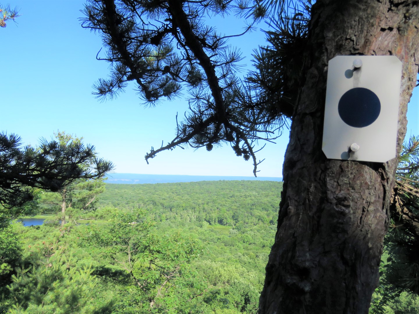
| Passing by the Blue Dot trail to hit a viewpoint on the AT a short distance ahead first before returning to this trail. |
 |
| This viewpoint is on top of boulders to the right when the AT turns left downhill. The views from the Blue Dot Trail turned out to be much better so it's really not worth going to this overlook. |
 |
| We retraced and turned left on Blue Dot. |
 |
| Sawmill Lake to the left. |
 |
| Delaware River barely visible. |
 |
| Campers at Sawmill Lake |


 |
| Sawmill Lake |
 |
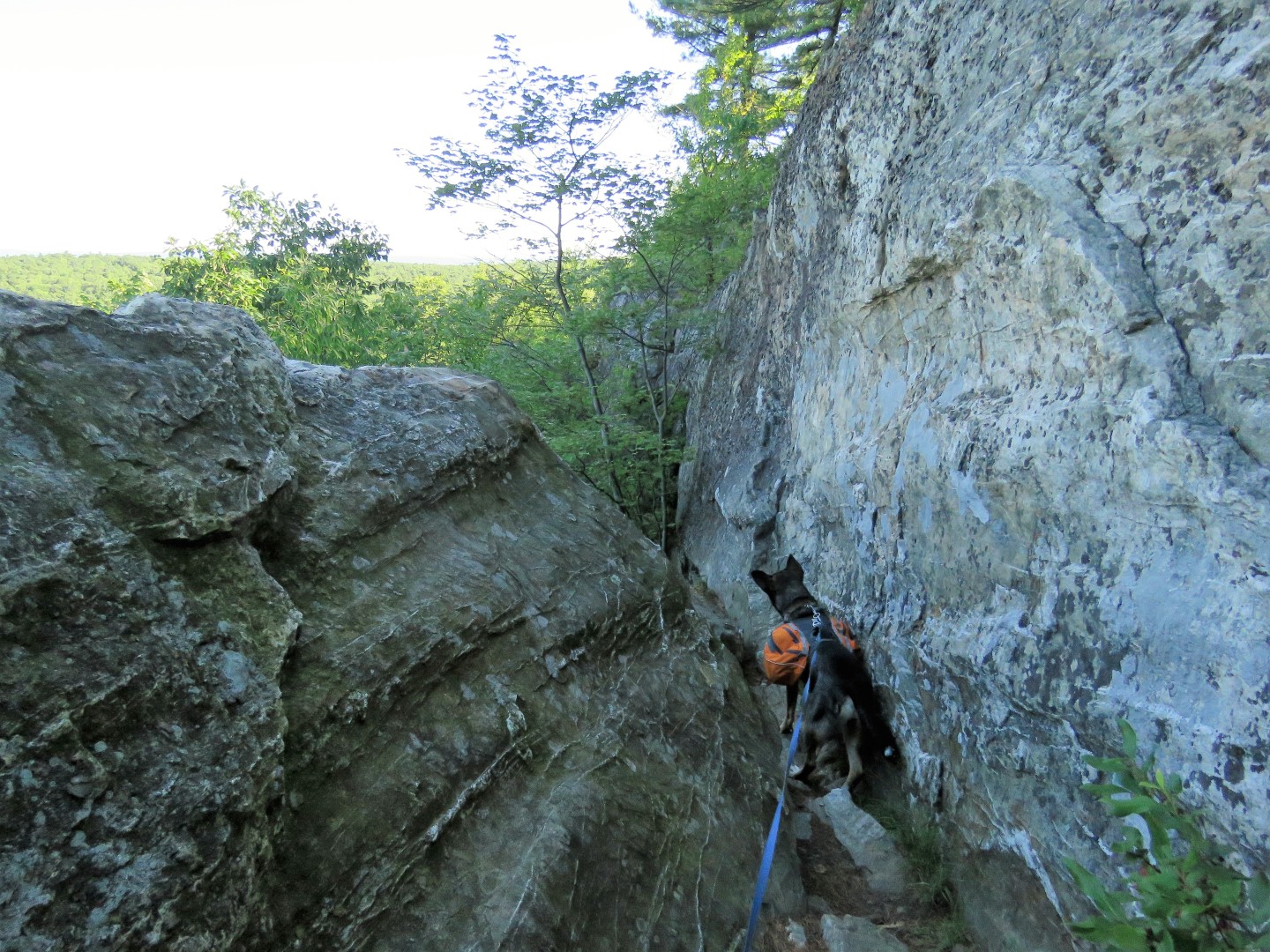
| Going down steeply. |
 | |
| Oh no, Brodie's worst nightmare - a vertical drop. I had to throw my stuff off then climb down then ... |
 |
| ... grab an uncooperative Brodie who was pancaked on the ledge and hoist him down by the handle of his backpack after I pried his claws loose from the rock. Can he ever hold on for dear life! |
 |
| Safely down and he lives to see another day. |

 |
| Blue ends at the campground at Sawmill Lake. We turned right and followed the campground road. |
 |
| Walking along the campground road.. |
 |
| Although we were right next to Sawmill Lake which would be on the left, it is not visible. |
 |
| When the campground road curves left, right on an unmarked woods road. |
 |
| It starts out grassy then becomes old asphalt. |
 |
| Gray Catbird |

 |
| Turning left on the yellow Mashipacong Trail. The post rates the trail as very difficult but it's not. |

 |
| In this part it alternates between a little more open unkempt trail n the woods ... |
 |
| ... and very overgrown trail in open areas. This trail apparently does not get much use and we never saw another person. |


 |
| After the yellow trail turns left on Sawmill Road a short distance ... |
 |
| ... then right back into the woods at the bend in the road ... |
 |
| ... the path becomes more open woods road. |

 |
| There are even two very sturdy bridges along the way. |
 |
| When yellow ends at Park Ridge Road ... |
 |
| ... a gated road is directly across the way. |
 |
| It was my intention to follow this road to woods roads up ahead but when I saw a house behind the stone wall and heard chickens, I felt I might be on private property and was a little worried those woods roads might be overgrown and not used much like the yellow trail was so we backtracked .... |
 |
| ... and road walked a very pleasant 1.2 miles on Park Ridge Road instead. No cars ever passed us. |
 |
| Had I looked at my Cairn app sooner, I would have seen that the way I intended to go had tracks in place - the green lines - so it should have been doable. But this road walk was very nice so no regrets. |

 |
| Turning right on the brown Life Trail, another trail that seems to be very lightly used but was in better shape than yellow. |

 |
| The blue/red Fuller Trail joins in. |

 |
| The trails end at the winter parking lot where we turned left ... |
 |
| ... then right on Park Ridge Road. |
 |
| Left on Sawmill Road at the intersection for a short distance. |
 |
| ...then straight across Route 23 to the Old Trail. |
 |
| This old carriage road ascends very gradually. |


 |
| Old Trail ends at Lake Marcia. |
 |
| High Point Monument comes into view. |

 |
| I had no idea there was a path around Lake Marcia but there is and we took it. Much better than road walking around because that road is fairly busy with traffic from the monument. |

 |
| Looking back at Lake Marcia from the far end. |
 |
| Taking the Monument Trail. |


 |
| It was crowded up at the monument so we just walked around the base. Having come from hiking the more remote areas of High Point State Park, crowds just weren't doing it for me so just a quick loop around and we were out of there. |


 |
| Heading back down the blue/Monument Trail. |
 |
| When blue ends, straight on the AT. |

 |
| I wanted to find the spot where I had taken Shawnee's picture 9 years earlier - this was probably not it but close enough. |

 |
| At the observation deck I was looking for a place to tie Brodie to the base (force of habit) having forgotten he does steps just fine. It was Shawnee who was terrified of steps. So up we went. |

 |
| Lake Marcia |
 |
| Going back down. |

 |
| The AT comes out on a field and continues across Route 23 ... |
 |
| ... to the High Point State Park office. |
 |
| To the left of the office at the kiosk ... |
 |
| ... continuing on the Appalachian Trail. |

 |
| Turning left on ... |
 |
| ...blue/red Iris Trail. |
 |
| Staying on blue when the red Iris Trail goes right. |
 |
| Back at the parking lot. |
 |
| He had a great time even though I tried to kill him on that vertical drop. |
What a beautiful day for a hike! I couldn't help giggling at poor Brodie plastered to that ledge.
ReplyDeleteIt was so gorgeous I could have hiked twice as far but unfortunately I had to get back home. You weren't the only one giggling at poor Brodie!
Delete