ABOUT THE PARK:
Harriman State Park - New York State Office of Parks, Recreation and Historic Preservation
DIRECTIONS:
GPS Coordinates 41.11839, -74.15711
 |
| D Lot Commuter Parking. Although no parking is indicated on the trail map for the southern end of the S-B Trail, the D Lot is steps away and according to the Village of Suffern parking web site (www.suffernparking.com click on "Parking Policy" in top menu): "No permits are required after 4:00 p.m. for all Village of Suffern Parking Lots as well as all day on weekends and Federal Holidays." |
TRAIL MAP:
Southern Harriman Bear Mountain Trails Map 118 - New York New Jersey Trail Conference
HIKE DISTANCE: 7.5 miles (3.75 miles each way)
THE HIKE:
 |
| From the D Lot cross Orange Avenue and turn left. |
 |
| A short distance ahead ... |
 |
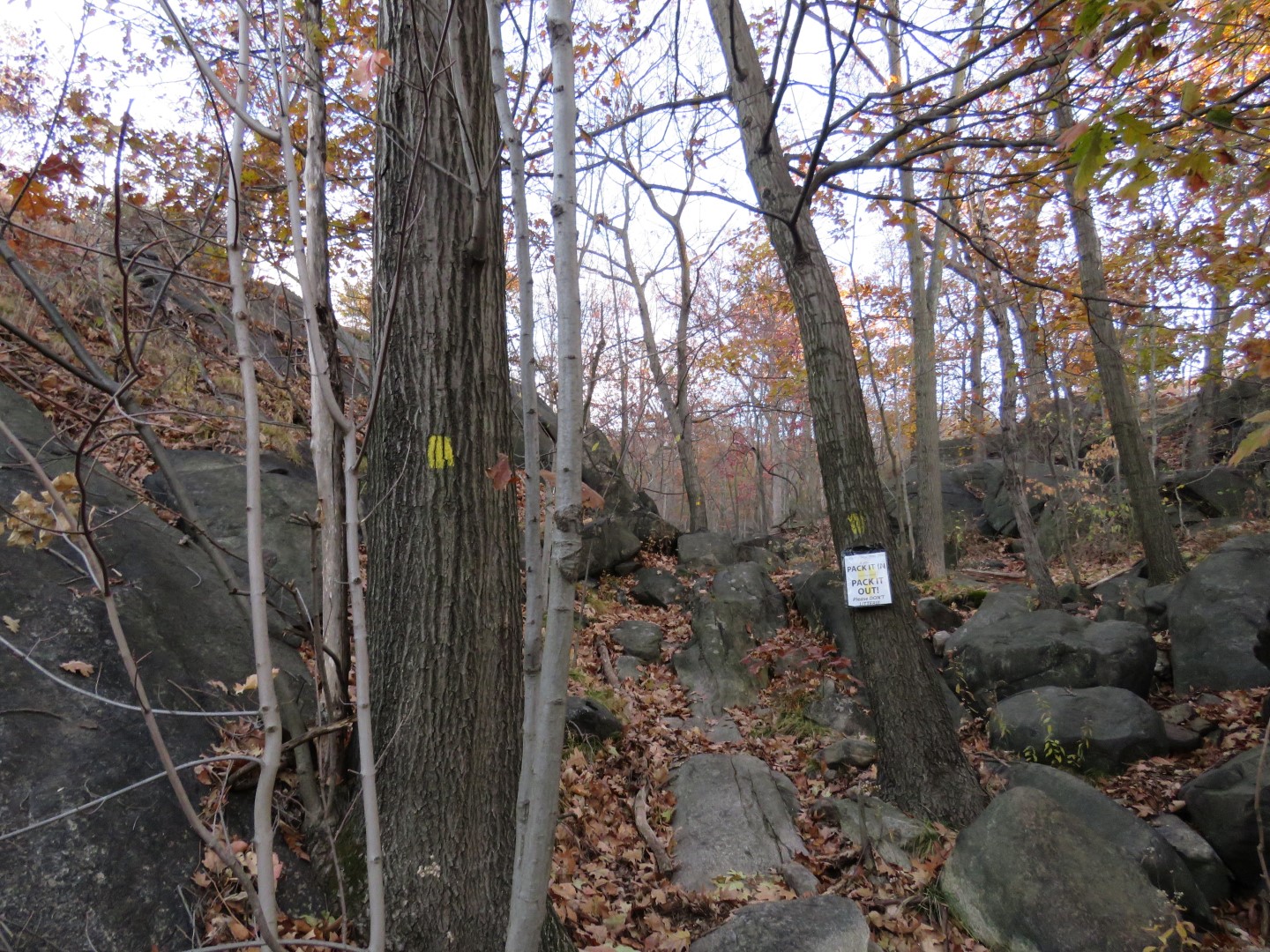
| ... the trail sign and ... |
 |
| ... the trail head. You can see the parking lot off to the right, that is how close it is. |
 |
| The trail starts off steep and continues that way for about half a mile. It's downright treacherous with thick leaf drop, like stepping on ice. Going up wasn't as bad as going back down at the end of the hike. |
 |
| Up, up, up ... |
 |
| Nearing the top, the beginning of views... |
 |
| ... that open up the higher you climb. |
 |
| After the views the trail levels out. |
 |
| Harriman State Park is a popular place where it is hard to find solitude but this would definitely be the trail for that - it's too far from the other trails and nobody seems to know about being able to park in the commuter lot on weekends. The only other hiker I came across had come from the train station. |
 |
| Gas Pipeline |
 |
| Crossing a power cut. |
 |
| Kitchen Stairs |
 |
| This was well off the trail and I would have never seen it with leaves on the trees. Zoomed in to get a look. |
 |
| Although the trail is pretty level, it does go up and down over rises with a scramble here and there but nothing like the beginning of the hike. |
 |
| Another gas pipeline. |
 |
| And another power cut. |
 |
| Going into ... |
 |
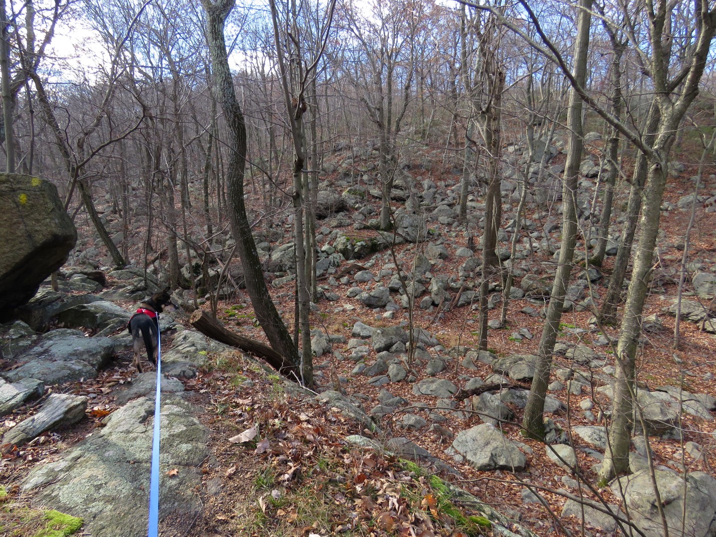
| Valley of Dry Bones |
 |
| Climbing up out of the Valley of Dry Bones. |
 |
| We continued to the top of the next rise to the boulder up ahead where the trail turns right, took a break and headed back. |
 |
| Heading back through the Valley of Dry Bones. |
 |
| Back through the power cut. |
 |
| Power cut view. |
 |
| There were a couple of spots where I had to sit and slide down on the leaves. |
 |
| Coming back up on the views. |
 |
| The trail goes up and over the boulder - it didn't look that way on the way up! |
 |
| Going down - no pictures here, it was too hard to keep from sliding and falling. |
 |
| All the way down and heading back to the car. |


I can say w/certainty this is one hike I'm content to enjoy just through your pictures. :( If I were to do it now, I'd probably slide all the way - intentionally & unintentionally, Glad to see you safely back home. Brodie is really adapting to these technical hikes. Bet he was exhausted all the way home.
ReplyDeleteLinda
I fell three times, LOL. Fortunately, not on the steepest part. At least I had the good sense to sit down and slide. Today I found a nice rock imprint on my thigh. I felt that sucker under that pile of leaves when I landed on it. OUCH. And Brodie, well, he was doing great on the uphill scrambles. I'd just drop the leash and he'd go up and wait for me until I got there. Was hoping him might do the same going down but I had doubts that I should have heeded. He tends to feel he knows where he is going when he can follow our scent back. At one point I looked up from scrambling down and Brodie was nowhere in sight. I yelled for him but the traffic noise was so loud there was no way he could have heard me. It wasn't but a few minutes later that my phone rang. He had made it all the way to the trail head and a passerby yelled STOP (which he did), grabbed the leash and held him for me until I got there. What a nice woman. I couldn't thank her enough. We'll be avoiding hikes that technical for a while.
DeleteWow that looks like a steep hike. I've been to Bear Mountain and that was very steep. I also have been to Harriman State Park the Pine Meadow Lake hike. That starts out very steep also. Harriman is a beautiful park. It's one of my favorites but I haven't been there in quite a few years. I admire you're tenacity in doing these hikes. Looks like Brodie is a trooper too. Thanks for sharing. Joanne from NJ
ReplyDeleteMostly just the beginning, then back down at the end. It's the thick layer of leaves that made it so much more difficult.
DeleteDaniela
Hi Daniela -- wow...you're definitely *not* letting up on the challenging hikes! Glad you're O.K. from taking a few spills. I imagine the leaves (even if not totally wet) can be almost as bad as ice, or wet rocks, and you couple that with a steep incline... I've hiked parts of the Conestoga Trail & Mason Dixon Trail (in PA), and I can agree that in some ways, going up steep inclines is actually better than coming back down! Totally understand that you don't have any pix while coming down the last section...your other shots (especially the "views from above") more than make up for it! By the way -- what was the major highway way down below...was it Interstate 87 by any chance?
ReplyDeleteAnyway -- Brodie continues to rock the hikes (even if he may be getting a little "cocky" when he gets too far ahead of you! :) ) There was one pic "missing", however...there was no shot of your break (and feeding Brodie a little jerky!!) Hee Hee!
Keep up the excellent work!
(Oops...forgot to sign off on the above message...from Jim! :)
DeleteI knew that was you, Jim! That is I-87 and I-287. Unlike his predecessor (who would have NEVER finished a hike on her own), Brodie refuses to eat anything on hikes and his new thing is refusing to drink water. All the less for me to have to haul around. He just wants to obsessively eat grass which he will then puke up in the car on the way home.
DeleteDaniela