

ABOUT THE PARK:
Pequannock Watershed - Newark Watershed Conservation and Development Corporation
DIRECTIONS:
GPS Coordinates to parking P1: 41.075339,-74.445161
View Larger Map
 |
| There are several roadside pullouts near the trail head. The P1 sign is at the intersection of Clinton Road and Van Orden Road. |
IMPORTANT:
A permit is required to hike in the Pequannock Watershed. Permits must be purchased in person at the Newark Watershed office. Click here for information on obtaining permits.TRAIL MAPS:
North Jersey Trails Map #116 - NY/NJ Trail Conference
HIKE DISTANCE: 9.9 miles with 5.9 and 6.9 mile options
THE HIKE:
 |
| Trail head for the white trail at the corner of Clinton Road and Van Orden Road. |
 |
| For a closer look at the sign. |
 |
| The white-blazed trail starts out as a woods road... |
 |
| ... with a few glimpses of Hank's Pond on the left. |
 |
| These little red efts were all over the place so I had to watch my step! They weren't as vibrant orange as they usually are so it was more difficult to see them. |
 |
| The white trail eventually leaves the woods road and scrambles up to a rock ridge. |
 |
| Along the ridge with steep drops down either side. |
 |
| Watch for cairns that show the way - at this cairn with the painted blaze it does not look like the trail goes left but it does - it is more obvious on the other side of the vegetation. |
 |
| When the teal diamond-blazed Highlands Trail joins in from the right, there are seasonal views to the right. |
 |
| At a small power cut, the Bearfort Fire Tower is visible to the left. |
 |
| The white trail and Pequannock Watershed property end at Stephens Road. For the 6.9 mile hike, turn left and continue on Stephens Road to the yellow tail on the left; for the 9.9-mile hike, turn left on Stephens Road briefly then right on the blue-blazed trail into Wawayanda State Park. |
 |
| Blue-blazed trail in Wawayanda State Park. |

 |
| A tiny little frog on the trail. |
 |
| There were all kinds of birds along the blue trail but they were very elusive. I did manage to get a shot of this Northern Flicker. |
 |
| The blue trail skirts around a swamp through a rocky area... |
 |
| ... then meets up with the red-blazed trail. |
 |
| Looking back at the red-blazed trail from where it ends at Stephens Road. |
 |
| The beginning of the yellow-blazed trail off of Stephens Road. |
 |
| The yellow-blazed trail is a gravel/woods road until it reaches the fire tower. |
 |
| Bearfort Fire Tower |
 |
| A quick shot from the first level of the fire tower... |
 |
| ... because it was a long, scary, steep climb to that level and well, it was scary and I needed to get back down ASAP! |
 |
| Limited views along the yellow/teal trail... |
 |
| ... of Cedar Pond. |
 |
| On the combined yellow/teal trail |
 |
| Looking back at the blowdown blocking the yellow/teal trail right at the turn for the blue trail - easy to miss if you don't turn around and look back at the blowdown if it is still there. |
 |
| On the blue/red and white trail. |
 |
| When the blue/red and white trails split, turn left and go steeply down loose rocks to follow the blue trail when the red and white trail (where my dog, who follows the path of least resistance, is) goes uphill to the right. |
 |
| At the bottom of the loose rocks, the blue trail becomes a little overgrown and hard to follow, but only briefly... |
 |
| ... before descending to a pretty forest floor. |

 |
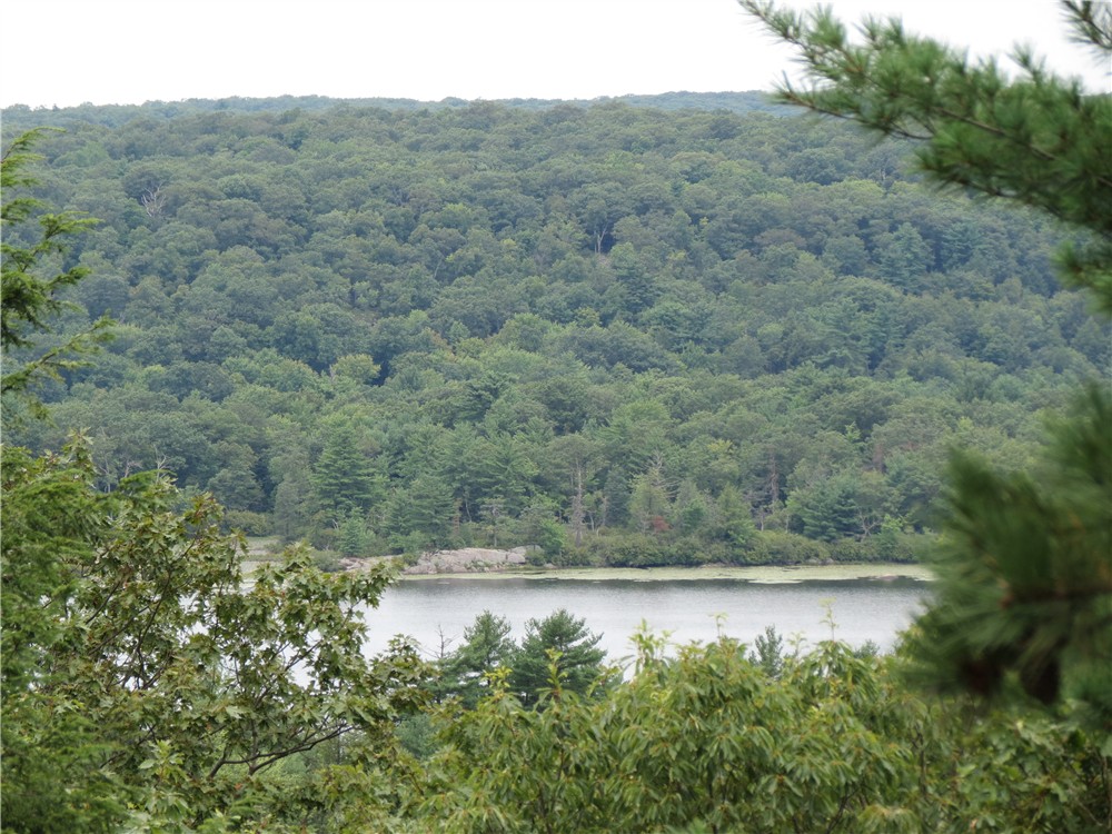
| Hank's Pond |
 |
| An old fireplace ruin along the blue and white trail at Hank's Pond. |
 |
| Hank's Pond from the other end. |

HIKE SUMMARY:
[ 0.00] Take the white-blazed trail from the P1 parking area
[ 0.15] Keep right on the white trail when the woods road continues straight and blue starts to the left
[ 1.45] Keep straight on white when blue goes left
[ 2.35] Teal diamond-blazed Highlands Trail comes in from the right; seasonal view to the right
[ 2.40] Teal diamond-blazed Highlands Trail leaves to the left (for 5.9 mile hike turn left following the teal diamond Highlands Trail to the fire tower then pick up at [7.05])
[ 2.70] Bearfort Fire Tower visible to the left in power cut
[ 3.15] Turn left on gravel Stephens Road when the white trail ends
[ 3.20] Turn right on blue-blazed trail into Wawayanda Park (for 6.9 mile hike, continue on Stephens Road to yellow trail on left - pick up at [6.45])
[ 4.00] Side trail on right not on map - goes out and back .15 mile total to seasonal view
[ 4.70] Blue trail makes sharp left at red arrow on tree ahead and trail not on map that leaves to the right with white blazes
[ 5.05] Skirt around swamp to the left, at T-intersection turn left, turn left on red when blue ends
[ 6.35] Red ends at Stephens Road, keep left on gravel Stephens Road
[ 6.45] Turn right on yellow trail at yellow metal gate
[ 7.00] Turn left on teal-blazed Highlands Trail - did not see blazes at intersection
[ 7.05] Bearfort Fire Tower; retrace on teal Highland Trail to yellow trail, turn left and follow combined teal/yellow
[ 7.10] Keep right on teal/yellow when red and white trail goes left
[ 7.30] Limited views of Cedar Pond to the right
[ 7.75] Bushwhack around large blowdown then immediately on the other side of the blowdown, take the blue side trail that leaves teal/yellow to the left
[ 7.90] Continue on blue/red and white when red and white comes in from the left
[ 8.10] Left on blue when red and white leaves to the right
[ 8.20] Turn right on blue and white when blue goes left
[ 8.85] Blue and white trail runs next to Hank's Pond
[ 9.40] Left on umarked woods road at end of Hank's Pond when blue and white goes right
[ 9.75] Keep straight on white when white comes in from the left and blue starts to the right
[ 9.90] Back at P1 parking
I'm so happy to have stumbled upon your blog. I've really ramped up my hiking this year and find your pics, directions, and comments very helpful and inspiring. THANKS!
ReplyDeleteThank YOU! So glad you find it useful.
DeleteDaniela
Excellent Photography.. U are true wild life photographer, The clearness for your post is just spectacular and that i can think you are an expert in this subject.
ReplyDeleteThank you so much! But really, it's the camera. I got a Canon PowerShot SX40 HS on a friend's recommendation (http://www.danbalogh.com/) and it is the best camera ever!
DeleteDaniela