

ABOUT THE PARKS:
Kenneth Lockwood Gorge - New Jersey Department of Environmental Protection
Taylor Steelworkers Historical Greenway - Traillink.com
Columbia Trail - Traillink.com
Columbia Trail - Hunterdon County Department of Parks
Voorhees State Park - New Jersey Department of Environmental Protection
DIRECTIONS:
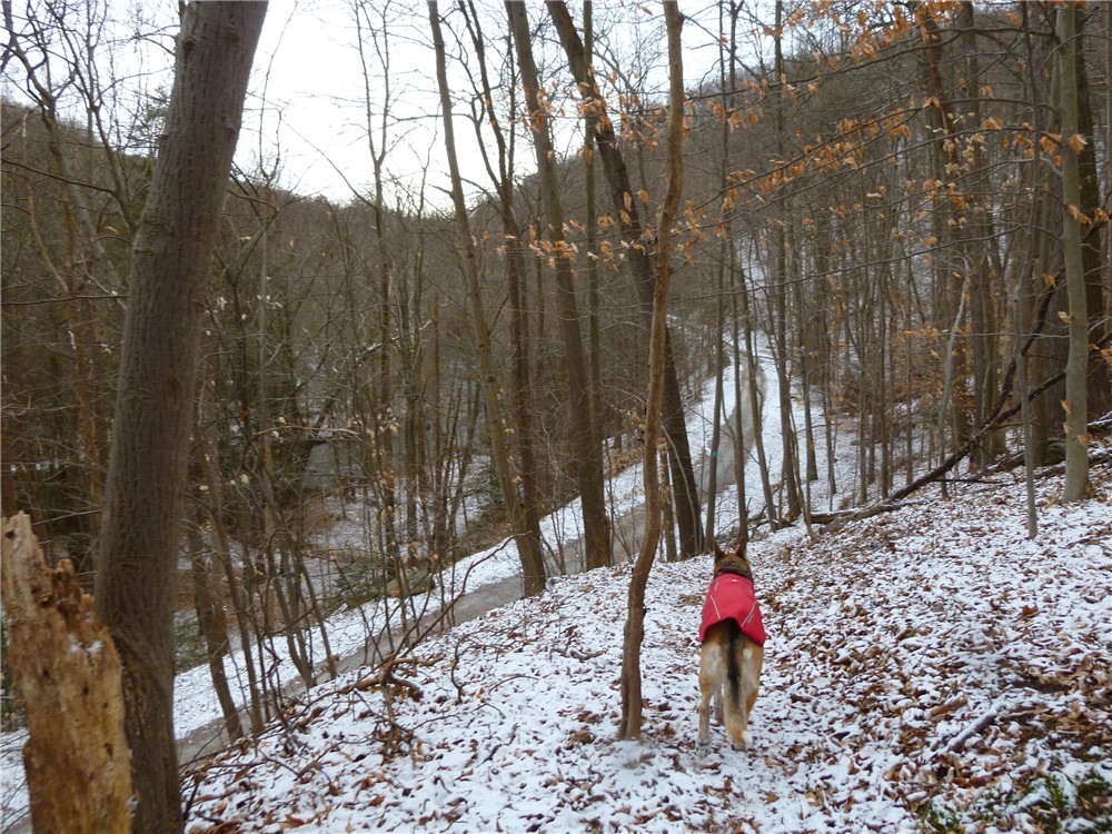
View Larger Map
 |
| Turn left from Main Street into parking lot at "The Commons" sign. |
 |
| Parking lot with direct access to the Columbia Trail. |
TRAIL MAPS:
Voorhees State Park - Googledocs (download map to rotate and print)
Columbia Trail - Hunterdon County Department of Parks
Ken Lockwood Gorge at EveryTrail
EveryTrail - Find the best Hiking in New Jersey
HIKE DISTANCE:
Ken Lockwood Gorge and Voorhees State Park - 16.6 miles
Click here for NY/NJ Trail Conference writeup for Ken Lockwood Gorge only - 7.5 miles
Click here for NY/NJ Trail Conference writeup for Voorhees State Park only - 4.1 miles
THE HIKE:
 |
| Walk out of the parking lot the way you drove in, cross straight over Main Street and follow the paved portion of the Columbia Trail through the town crossing several streets. |
 |
| The entrance to Lake Solitude and the Taylor Steelworkers Historic Greenway with 6.5 miles of trails and on the right .4 mile into the hike. |
 |
| At a fork just beyond the Greenway entrance sign the yellow-blazed trail descends to the historic TISCO building. |
 |
| Coming around from behind the TISCO building. |
 |
| 100 year old refurbished truss bridge |
 |
| Union Forge Ruins |
 |
| Solitude House Museum |
This map of the greenway is not accurate as there is no trail circling Lake Solitude and the blue-blazed trail at Solitude House that leads towards Solitude Dam disappears in an area of flood debris and construction. At this time the dam is undergoing reconstruction and there is no lake or waterfalls. You can walk to the other side of Solitude House up to River Road and turn left to access Ken Lockwood Gorge that way but I don't recommend it - it involves a road walk up River Road along about a 1 mile section with traffic and private property sign pollution along the lake and river side. Better to retrace from Solitude House back to the Columbia Trail.
 |
| From the fork at the Taylor Steelworkers Greenway entrance, the red-blazed trail to the left leads to an overlook of Lake Solitude and Solitude Dam. The dam is currently undergoing restoration. |
 |
| What Solitude Falls looked like before construction started - photo courtesy of Dan Balogh http://danbalogh.com/lockwood.html |
 |
| Continuing on the Columbia Trail, veer left on a side trail down to Cokesbury Road. Turn right on Cokesbury Road, proceed over the bridge, then turn left on River Road. |
 |
| There is hardly any traffic on River Road from Cokesbury Road on, only local residents and those driving to the Ken Lockwood Gorge parking area half a mile ahead. The road turns to gravel and is gated after the parking area. |
 |
| Beyond the gate, River Road continues as a gravel road closely following the South Branch of the Raritan River with the Columbia Trail visible higher up on the other side of the river. |

 |
| River Road continues under the Ken Lockwood Gorge Bridge. The Columbia Trail crosses over on the bridge. |
 |
| Access the Columbia Trail from Hoffmans Crossing Road. |
 |
| The teal diamond blazed Highlands Trail uses this portion of the Columbia Trail. |
 |
| The Columbia Trail crosses the South Branch of the Raritan River on the Ken Lockwood Gorge Bridge. |
 |
| At the 4 1/2 mile post, the teal-blazed Highlands Trail leaves the Columbia Trail sharply to the right and switchback up the side of the gorge. |
 |
| Looking back into the gorge from the Highlands Trail. |
 |
| After about a half mile road walk on the shoulder of Route 513, the Highlands Trail enters Voorhees State Park on the park road then leaves the park road to the left over a bridge. |
 |
| The Highlands Trail crosses many small creeks as it follows along with the white-blazed Cross Park Trail. |
 |
| The vistas along the pink-blazed Vista Trail are obstructed and seasonal. |
 |
| Interesting seating along the Vista Trail. |
 |
| Access the Solar System Trail to the left beyond the gate, just before the fence at the observatory. |
 |
| The Solar System Trail ends at a parking lot for a scenic view of Round Valley Reservoir. |
 |
| Round Valley Reservoir |
 |
| The blue-blazed Hill Acres Trail leads back to the teal-blazed Highlands Trail near the bridge to the park road. |
 |
| The Highlands Trail follows Route 513 turning into the woods after about half a mile. |
 |
| The Highlands Trail switchbacks down into the gorge to the Columbia Trail. |
HIKE SUMMARY:
0.00 Walk out of Commons parking lot entrance, cross straight over Main Street and continue on paved trail
0.25 .25 mile marker (mile marker posts all along the Columbia Trail every quarter of a mile)
0.40 Turn right at Taylor Steelworkers Historical Greenway sigh; right on yellow at fork, trail descends
0.60 Historic TISCO building on right, continue left on yellow
0.70 Cross bridge; trail loops around to left between chain link fenced areas
0.85 Turn left on blue at start of blue trail when yellow turns sharply right
0.90 Solitude House museum on right, blue trail turns left and abruptly ends at dam construction; retrace back to yellow trail and up to greenway entrance
1.50 At greenway entrance, take red-blazed fork to overlook
1.55 Solitude Dam overlook at end of red trail; retrace
1.60 Right on Columbia Trail
2.40 Left at fork leaving Columbia Trail before it crosses over bridge; descend to Cokesbury Road and turn right; walk on Cokesbury Road towards bridge over river
2.50 Left on paved River Road after crossing river on bridge
2.80 River Road crosses power cut
2.95 River Road turns to gravel after last house on right
3.05 Parking lots and accessible deck for Ken Lockwood Gorge on left
3.15 Continue beyond gate blocking River Road to traffic
3.90 Continue beyond gate blocking River Road to traffic after crossing old stone bridge; parking lot and accessible deck beyond gate
4.00 Continue on River Road under Ken Lockwood Gorge Bridge/Columbia Trail
4.60 River Road becomes paved and passes through residential area
5.00 Turn right on paved Hoffmans Crossing Road
5.05 Turn right on Columbia Trail/teal-blazed Highlands Trail at bike crossing sign
6.00 Cross over river on Ken Lockwood Gorge Bridge
6.15 4.5 mile marker; turn right on teal diamond Highlands Trail, ascend switchback out of gorge
6.75 Highlands Trail turn right on woods road
6.90 Cross wire barrier where another woods road merges in from left
7.05 Turn left on Route 513
7.60 Turn right into Voorhees State Park directly opposite school
7.65 Parking on right; paracourse starts on left
8.05 At Hoppock Grove picnic area follow teal Highlands Trail to the left over a footbridge
8.15 Turn right on teal/orange/white trail; stay on teal/white when orange leaves to the right
8.45 Cross footbridge
8.60 Rock hop over creek
8.70 Rock hop over creek
8.75 Rock hop over creek
9.10 Rock hop over creek
9.25 Teal/white turns right along power cut briefly before turning left back into woods
9.55 Turn left on paved park road
9.60 Turn right on teal/pink trail at Vista Trail sign (pink blazes will be sporadic - mostly teal blazes along this part)
9.65 Cross creek on footbridge
9.75 Cross footbridge
9.90 At fork with a cairn when teal Highlands Trail goes right keep left on pink (no pink markers at intersection and markers are very sporadic for a while)
10.10 At top of incline with stone wall ahead, keep right when trail not on map comes in from left
10.25 Trail passes between 2 stone chairs; pink markers become more frequent
10.45 Turn right on paved park road; keep straight through intersection with another paved road
10.90 Turn right towards observatory then left on Solar System Trail before fence at observatory building
11.25 Solar System Trail comes out in parking lot with scenic overlook of Round Valley Reservoir to right; continue to blue-blazed Hill Acres Trail through field on left (large sign)
11.35 Cross through power cut
11.55 When trail comes out at woods road, keep right (unmarked)
11.60 At well marked intersection, turn right; blue-blazed Hill Acres Trail becomes gravel road
12.00 At intersection turn left following Hill Acres Trail sign
12.10 At intersection with teal-blazed Highlands Trail, turn right following teal blazes back
12.15 Cross footbridge to park road; turn right on park road
12.60 Turn left on Route 513
13.20 Turn right on woods road just after mailbox with number 304
13.35 Keep left at fork then right at next fork beyond wire barrier
13.50 Highlands Trail leaves woods road to left as footpath
14.10 Right on Columbia Trail at 4.5 mile post
14.75 Ken Lockwood Gorge parking lots come into view below
15.00 power cut
15.35 Cross bridge over Cokesbury Road; side trail to Cokesbury Road on right
15.95 Cross residential road
16.15 Taylor Steelworkers Historic Greenway entrance on left
16.40 Trail becomes paved through town crossing several roads back to parking lot
16.60 Back at parking lot
Great post and great pics! Thanks!
ReplyDelete