

ABOUT THE PARK:
Pequannock Received Grants for Mountainside Park Improvements - NorthJersey.com
 |
| Although the park sign says no dogs are allowed, the township web site says dogs are allowed. The Director of Parks and Recreation did confirm via email that leashed dogs are allowed in the park. |
DIRECTIONS:
GPS Coordinates 40.971152, -74.325497
View Larger Map
 |
| Parking for about 7 cars. |
TRAIL MAP:
Mountainside Park Free Trail Map - NY/NJ Trail Conference
Jersey Highlands Central North Region Trail Map 125 - NY/NJ Trail Conference
HIKE DISTANCE: 3.7 miles
THE HIKE:
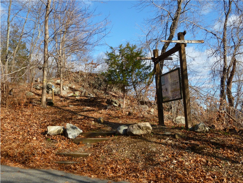 |
| The blue-blazed trail starts up the steps next to the kiosk at the far end of the parking lot. |
 |
| I-287 below provides traffic noise which eventually decreases in volume. |
 |
| The blue trail leads to the mountaintop in the distance. |
 |
| Bridge crossing at boy scout shelter. |
 |
| A bench off to the side along the way overlooking I-287. |
 |
| At the top of the mountain where white, yellow and blue trails come together, 360 degree views. |

 |
| Looking back at the mountaintop overlook after descending. |
 |
| Just before the parking lot the red trail follows along a creek as a woods road. |
 |
| The end of the red trail at the parking lot and I-287. |
HIKE SUMMARY:
[ 0.00] Take the blue trail up the wooden steps next to the kiosk at the far end of parking lot
[ 0.20] Keep right on blue/red when red joins in from the left
[ 0.25] Keep left on blue when red leaves to the right
[ 0.65] Left on orange when blue goes right (random blue blazes along this trail also)
[ 0.80] Cross bridge towards shelter on orange/blue when blue joins in from the right; keep left on blue when orange continues straight
[ 0.95] Straight on blue as orange crosses over at gravel road
[ 1.20] Keep left on blue where bench sits off to the right
[ 1.40] Kiosk and benches at 360 degree overlook; continue on yellow trail at opposite side of kiosk
[ 1.80] Keep straight on yellow as orange crosses over as woods road
[ 1.90] Keep left on yellow/orange as orange comes in from the right
[ 2.00] Stay on yellow/orange across bridge over creek
[ 2.25] Turn right on orange when yellow leaves to the left; red joins in from left
[ 2.30] Continue on orange/red crossing pipline
[ 2.45] At bench turn left on red when orange goes straight towards boardwalk
[ 3.05] At bench turn left on orange when red/orange goes right
[ 3.35] Bench on left
[ 3.55] At woods road turn left on red along creek
[ 3.70] Cross metal gate back to parking lot
There are inconsistencies with this hike description; strongly recommend the NY-NJ Trail Conference map on the website be downloaded and carefully reviewed. It is also suggested that one hike the Blue Trail entirely to the top of the Nob and return entirely on the Yellow Trail, or the Orange Trail. There are confusing crossovers that are not clearly defined in this description.
ReplyDeletePlease clarify where you found inconsistencies so I can make corrections if I wrote something in error. I reported the way I hiked it and certainly there are many different combinations possible with the trails available.
ReplyDeleteDaniela
Is it advisable to stick to the two trails.which is better to go up/down? Jeffstoveken@yahoo.com. Thanks
ReplyDeleteDoesn't really matter which trail you hike up. If I were to do it again I would take the yellow trail up and the yellow trail back down. The blue trail hugs 287 on your right on the way up and I didn't find the noise of the trucks and cars pleasant.
ReplyDeleteI ran this loop on Saturday and had a terrific time. Followed the written directions and they worked very well for me. highly recommend.
ReplyDeleteAdd another dimension to your exploration of this park. Visit theredtrail.webs.com and find a guide to a Letterboxing and GeoCache set up on the Red Trail at Mountainside Park.
ReplyDelete