

ABOUT THE PARK:
Hubbard Park - City of Meriden
Hubbard Park and Castle Craig - Connecticut Weekender
Hanging Hills - Wikipedia
The Black Dog of Hanging Hills - Connecticut Weekender
Metacomet Trail - Wikipedia
 |
| The Hanging Hills as seen from I-691: From left to right West Peak, East Peak, Castle Craig |
DIRECTIONS:
GPS Coordinates 41.562803, -72.809665
View Larger Map
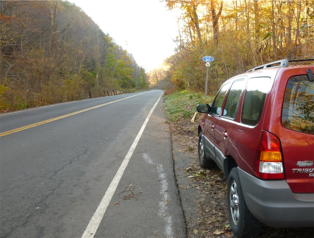 |
| Parking space for ONE car at the trailhead on the west side of Rt. 71. Additional pullouts available farther south on the same side. If you need to park there, road walk back to the trailhead. Careful - Rt. 71 is VERY busy! |
TRAIL MAPS:
Hubbard Park Trail Map - Meriden Land Trust (shows most of the hike)
Metacomet Hiking Trail South - Connecticut Explorer Guide (shows all of the hike)
Note that the map above refers to a reroute that is easy to miss - no longer the case as this turn is now very well-blazed.
Connecticut Walk Book - CT Forest & Park Assn - 3-ring-binder book with removable maps for all of the Connecticut Blue-Blazed Hiking Trail System
HIKE DISTANCE: 7 miles
PEAK BAGGING:
East Peak - Peakery.com
West Peak - Peakery.com
THE HIKE:
 |
| Head west uphill into the woods at the Metacomet Trail sign on Rt. 71 |
 |
| For most of this hike follow the blue blazes of the Metacomet Trail. |
 |
| 1/4 of a mile into the hike, the Elmere Reservoir on the left and a large water tank on the right. |
 |
| In another half mile, cross the dam at Merimere Reservoir. |
 |
| At the end of the dam watch for the trail to turn left into the woods - step over the cable guardrail, descend to the creek, rock hop over, then ascend, somewhat steeply at times. |
 |
| At the 1.5 mile point breathtaking views in all directions with Mine Island in Merimere Reservoir directly below. |
 |
| Continue on to Castle Craig, almost 2 miles into the hike. Castle Craig can be climbed for views from the top. |
 |
| From the top of Castle Craig, Sleeping Giant State Park to the right of the Long Island Sound. |
 |
| Flag at Castle Craig |
 |
| From the castle at East Peak the trail continues on to West Peak. Take this warning seriously - there are VERY steep drops from the cliffs in this area and many have lost their lives here. |
 |
| I believe this might be a Peregrine Falcon seen on the way to West Peak. |
 |
| Trail descends steeply down into the ravine. |
 |
| Trail ascends steeply up West Peak. Although this is the area haunted by the Black Dog of Hanging Hills, this is not the ghost dog, this is my friend's dog, Haley :) |
 |
| A little garter snake along the trail. |
 |
| Views from West Peak |
 |
| Tired dogs taking a nap on West Peak with East Peak in the distance. |
 |
| Leaving West Peak the blue-blazed Metacomet Trail follows the ridge with more views to the west. |
 |
| Trail along the ridge. |
 |
| At 5.1 miles turn right on Edgewood Road as the blue trail turns left. The next mile is walking on paved roads to Merimere Reservoir along residential streets with very little traffic (only had 1 car pass us). |
 |
| At the gates at Merimere Reservoir turn left to pick up the blue-blazed trail from the first part of the hike which will lead back to Rt. 71. |
 |
| Trail descends back to parking on Rt. 71 |
HIKE SUMMARY:
[ 0.00] Head uphill into the woods at the Metacomet Trail sign on Rt. 71
[ 0.20] Pass between a blue water tower on the right and Elmere Reservoir on left
[ 0.55] Keep straight at a cairn when a trail goes right
[ 0.60] Keep straight when a trail comes in from the right
[ 0.65] A residence comes into view to the right through the woods
[ 0.80] Trail comes out on road, turn left then right at Merimere Reservoir and cross dam
[ 0.90] Turn left over rope guardrail into woods, rock hop over creek and ascend veering left
[ 0.95] At top of steep ascent, keep left on blue when blue with red dot goes right
[ 1.00] Rock hop over creek
[ 1.10] Trail runs along ledge above Merimere Reservoir before veering away to the right
[ 1.50] Scenic overlook of Mine Island in Merimere Reservoir and Sleeping Giant State Park to the south
[ 1.75] Side trail to left to view
[ 1.90] Keep straight on blue trail when white comes in from the left; turn left on paved road towards castle
when leaving castle, with back towards castle turn left and walk along the edge of the parking lot towards the electrical box to find a boulder with a blue blaze
[ 2.20] Blue trail turns sharply left downhill just before paved road (turn left and follow paved road as alternate route to West Peak to avoid steep descent into ravine and climb back up)
[ 2.40] At bottom of ravine, turn right on blue/red when red comes in from the left briefly, then follow blue to the right as red continues straight; begin steep ascent
[ 2.60] Cross small boulder field then swampy area after which trail switchbacks up to the left
[ 2.70] When the blue trail goes right at the gravel road, turn left towards views at West Peak
[ 2.75] West Peak; retrace
[ 2.80] When blue comes in from right, keep straight on blue
[ 2.90] Turn left at left turn blazes on pole towards radio towers and buildings; blazes old and faded in this area; trail turns right and heads away from towers into woods
[ 3.20] Trail veers left downhill just before woods road (easy to miss turn and get on woods road if not paying attention)
[ 4.15] Cross power cut
[ 4.35] Rock hop over creek
[ 4.40] Trail turns left when unmarked comes in from right
[ 4.50] Trail becomes wider woods road
[ 4.55] Keep left at fork
[ 4.65] Rock hop over creek
[ 4.75] Trail turns right on woods road that comes in from the left
[ 5.00] Keep straight through large open space when another woods road comes in from the right
[ 5.10] At orange barrier when the blue-blazed trail goes left, turn right and walk along paved Edgewood Road
[ 5.40] Hallmere Reservoir on right
[ 5.80] At intersection turn right on paved Percival Park Road
[ 6.05] Continue beyond the "Road Closed" signs
[ 6.10] At brown gates just before Merimere Reservoir, turn left into woods to pick up blue trail
[ 6.30] At fork keep right
[ 6.70] Pass between blue water tank on left and Elmere Reservoir on right
[ 7.00] Arrive at parking on Rt. 71
Hi!
ReplyDeleteAttempted to hike up to Castle Craig today, but never made it! We pared on 71, hiked, crossed the damn, hiked, and got as far as the gates at the Merimere Reservoir before we completely lost the trail! No more blue blazes. Any idea what happened? Which way are we supposed to go when we come out at the reservoir?
Thanks
Amber
Look at the 8th picture, the one beneath Merimere Reservoir. You have to watch the pavement because the turn is painted on the pavement. Right after the reservoir you turn left at the arrow painted on the road and jump the wire guardrail.
DeleteDaniela
Thanks for the detailed explanation... we had a great hike and the views were one of the best in the hikes I have been so far...
ReplyDeleteExcellent! Glad you liked it!
DeleteDaniela
Thank you so much for these detailed and accurate instructions. We had a great hike!
ReplyDeleteWonderful! Thanks for letting me know!
DeleteDaniela
I'm new to CT AND WANT TO TRY IT SO BADLY but all the confusion scares me! I wish there was a better map! How do you get to this "parking area" on 71? It just appears? Lol
ReplyDeleteGreat descriptions. My wife and I just took a first year wedding anniversary hike on this trail and were very grateful for your directions. Thanks!
ReplyDeleteWow - I grew up just a few hundred yards north of the beginning of this trail on Rt. 71 (Chamberlain Hwy.) Spent much of my childhood exploring these woods back in the 50's and 60's. My parents and grandparents spent lots of time and took lots of pictures at Hubbard Park when it was still pretty rustic. It's been wonderful looking at the topographic maps of the woods that I knew so well. Live in upstate New York now. Thanks for the memories!
ReplyDeleteI am enjoying poking around this site. Thanks. To be clear, the Metacomet Trail begins at the corner of Rt 15 (Berlin Turnpike) and Orchard Road in the Town of Berlin. It follows Orchard Road for over a mile and then enters the woods, eventually coming out on Rt 71 (Chamberlin Highway) at a place known locally (and colorfully) as Cathole Pass, where you began.
ReplyDelete