

ABOUT THE PARK:
Mt. Everett State Reservation - Massachusetts Department of Conservation and Recreation
DIRECTIONS:
GPS Coordinates 42.089478, -73.411248
View Larger Map
 |
| Off-road parking for about 5-6 cars. |
South Taconic Trails Map (check for new edition Spring 2015) - NY/NJ Trail Conference
Mt. Washington State Forest Map - Massachusetts DCR
South Taconic Range Map - Berkshire Natural Resources Council, Inc.
HIKE DISTANCE: 13.75 miles out and back
HIKE DESCRIPTION:
Pick up the blue triangle-blazed Race Brook Falls Trail from the information board at about the mid point of the parking area.


The first fork gives the option of seeing the lower falls via a .35 mile side trail to the right.
 |
| Race Brook Falls - Lower Falls |
The trail ascends and crosses the creek at the bottom of the upper falls.
 |
| Race Brook Falls - Upper Falls |
 |
| Race Brook Falls Trail terminates at the Appalachian Trail |
 |
| Appalachian Trail |
 |
| Mt. Everett to the north as seen from Mt. Race |
 |
| View of Massachusetts countryside to the east from Mt. Race |
 |
| Twin Lakes in Connecticut from Mt. Race |
 |
| Bear Rock Stream |
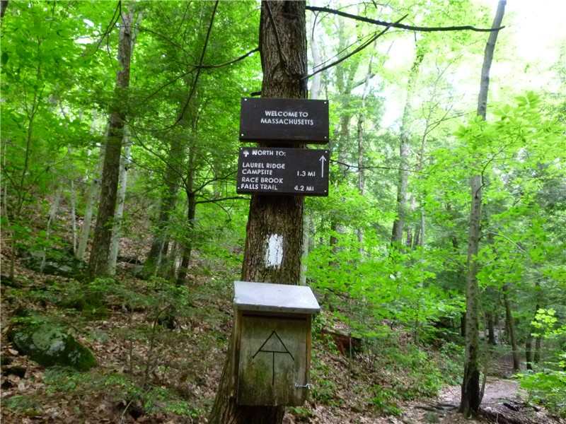 |
| Before crossing Sages Ravine Brook there is a "Welcome to MA" sign but you will still be in MA all along Sages Ravine. |
 |
| Sages Ravine Brook |
 |
| Sages Ravine |
Where the Appalachian Trail starts to ascend to the left away from Sages Ravine Brook is a good turn around point. The picture of the Sages Ravine sign is from up at the top of that hill but there is nothing else worth climbing up for unless you are doing a shuttle hike to parking areas in that direction.
 |
| Returning via Mt. Race |
HIKE SUMMARY:
[ 0.00] From parking area take trail starting at kiosk (sign trail register)
[ 0.30] Right at fork towards lower falls
[ 0.65] Lower falls; retrace
[ 1.00] Back at intersection take left fork towards upper falls; trail parallels creek; watch for unmarked left turn to rock hop over creek short distance ahead
[ 1.15] Ascend two sets of log steps
[ 1.35] Keep left towards Race Brook Campsite (right trail to lower falls does not provide as good of a view as the first trail to the lower falls)
[ 1.60] Rock hop over creek at top of lower falls; trail turns left away from creek and ascends more steeply
[ 1.75] Trail levels out with views to the east through the trees
[ 1.85] Trail reaches creek, turns right and follows along right side of creek
[ 1.95] Cross creek to left over log bridge
[ 2.10] Rock hop over feeder stream
[ 2.25] Continue through Race Brook Campsite
[ 2.50] Trail switchbacks up short flight of stone steps
[ 2.60] Turn left on white-blazed Appalachian Trail at intersection
[ 3.45] 360 degree views at top of rock scramble
[ 4.10] Trail leaves ridge into woods and descends
[ 4.25] Cross small stream
[ 5.15] Cross Bear Rock Stream
[ 5.35] Keep straight when trail to right goes to Laurel Ridge Campsite
[ 6.05] Keep straight when trail merges in from left (easy to miss veering left on the return route so be sure to turn around and make note of this area as a fork going in the opposite direction)
[ 6.15] Keep left when unmarked woods road goes right
[ 6.25] Rock hop across Sages Ravine Brook
[ 6.35] Ascend rock steps where trail parallels ravine from higher up
[ 6.45] Cross feeder stream on log bridge
[ 6.75] Keep left on white-blazed trail when log bridge crosses over on blue-blazed trail to Sages Ravine Campsite
[ 7.00] Turn around to head back when trail ascends uphill to the left
[ 7.25] Keep right on white-blazed trail when log bridge crosses over on blue-blazed trail to Sages Ravine Campsite
[ 7.50] Cross feeder stream on log bridge
[ 7.70] Rock hop across Sages Ravine Brook
[ 7.85] Keep straight on white-blazed trail when woods road comes in from left
[ 7.95] Left at unmarked fork when woods road goes right
[ 8.70] Straight on white-blazed trail when trail to Laurel Ridge Campsite goes left
[ 8.85] Cross Bear Rock Stream
[10.00] Exit woods on to ridge with views
[10.40] Summit of Mt. Race
[10.60] 360 degree views with Mt. Everett straight ahead before descending from Mt. Race
[ 11.55] At intersection, right on blue triangle-blazed Race Brook Falls Trail
[ 11.80] Follow trail through Race Brook Falls Campsite
[12.25] Cross over log bridge
[12.35] Watch for left turn over creek where trail appears to go straight
[12.70] Cross creek at bottom of upper falls
[13.00] Keep straight when side trail to lower falls goes left
[13.25] Descend two sets of wooden steps
[13.35] Trail turns left and rock hops over creek
[13.50] Keep right at intersection where left goes to lower falls
[13.65] Trail exits woods and skirts small field
[13.75] Arrive at parking area
I have a quick question for you: Do you know if there's overnight parking allowed at the Race Brook Trailhead? I'm thinking of going and spending the night there but I'd be leaving my car there overnight.
ReplyDeletePlease let me know: elliottcfox@gmail.com
Hi. how long will it take to do the trail?
ReplyDeleteThat depends on how fast you hike and how often and how long you stop. Doing this entire hike would take just about all day.
DeleteDaniela
Same question as anonymous above, Do you know if they allow overnight parking? I'm looking to do a short 2-day hike that includes bear mountain as well and was hoping I could use this trailhead as my end point
ReplyDeleteSorry, I have no idea since I don't overnight. You would need to contact the park.
DeleteMount Everett State Reservation
East St., Mount Washington
c/o RD 3 East St.
Mt. Washington, MA 01258
(413) 528-0330