ABOUT THE PARK:
Bear Mountain State Park - NY State Office of Parks, Recreation and Historic Preservation
DIRECTIONS:
GPS coordinates 41.324232, -74.007425
View Larger Map
There is room for 2-3, maybe 4 cars depending on how people park. Turn into the parking area at the mailbox with number 284.
TRAIL MAP:
Northern Harriman Bear Mountain Trails Map #119 - NY/NJ Trail Conference
HIKE DISTANCE: 9.65 miles
Some shorter versions:
5 miles - Popolopen Torne and Popolopen Gorge Loop - NY/NJ Trail Conference
4.3 miles - Camp Smith Trail to Anthony's Nose - NY/NJ Trail Conference
HIKE DESCRIPTION:
PLEASE NOTE: TRAILS USED FOR PART OF THIS HIKE WILL BE CLOSED FROM FALL 2011 THROUGH SPRING 2012 AND THE BRIDGE OVER POPOLOPEN CREEK WAS DESTROYED BY HURRICANE IRENE - CLICK HERE FOR MORE INFORMATION
UPDATE: As of 12/6/2012 a new bridge is in place. CLICK HERE FOR DETAILS.
The hike starts by crossing Mine Road and ascending Popolopen Torne on the blue-blazed trail.
 |
| Bear Mountain Bridge and Anthony's Nose from Popolopen Torne |
 |
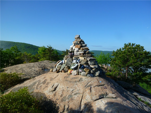
| Tribute to American Soldiers on Popolopen Torne |
Raging water after 5 days of rain completely drowns out nearby traffic noise.
 |
| Red on White Popolopen Gorge Trail Along Popolopen Creek |
 |
| Appalachian Trail Sign at Bear Mountain Bridge Tollbooths |
 |
| Crossing Bear Mountain Bridge on the Appalachian Trail |
 |
| Hudson View from Bear Mountain Bridge |
 |
| Appalachian Trail Leaves Rt. 9D and Ascends Anthony's Nose |
 |
| View From First Side Trail on Anthony's Nose |
 |
| View From Anthony's Nose |
 |
| View South From Anthony's Nose |

 |
| View From Suspension Footbridge |
A scenic loop around Brooks Lake brings you back to the 1777/1779/blue trail to finish up above along the Popolopen Gorge.
HIKE SUMMARY:
[ 0.00] Cross Mine Road, turn left and walk along Mine Road 50 feet, turn right on blue-blazed trail up stone steps
[ 0.60] American Soldiers Tribute on top of Popolopen Torne
[ 0.80] Cross straight over paved Mine Road and continue under guardrail on blue-blazed trail
[ 0.90] Cross straight over dirt road; after short distance right on 1777/1779/blue-blazed trail parallel to Popolopen Creek
[ 1.00] Trail turns left down rock steps to bridge over Popolopen Creek
[ 1.05] Turn left on red on white-blazed Popolopen Gorge Trail
[ 1.80] Trail turns left before small creek and switchbacks down towards Popolopen Creek
[ 2.30] Clearing to left with view of falls
[ 2.45] Come out at small clearing and veer left towards Route 9W; right on Route 9W, at end of guardrail turn left and carefully cross side street then VERY CAREFULLY cross 9W - traffic zooms FAST here; continue on sidewalk towards traffic circle following around to the left to Bear Mountain Bridge
[ 2.70] Tollbooths on Bear Mountain Bridge; continue across Bridge following white Appalachian Trail blazes
[ 3.20] Veer left on 9D after crossing bridge; stay on left side
[ 3.30] Cross over to right at pedestrian crossing sign
[ 3.40] Turn right into woods where white-blazed A.T. leaves Route 9W at the A.T. sign and kiosk
[ 3.75] Turn right on woods road blue-blazed trail when white goes left; trail register on left after turn
[ 4.25] Side trail to right to views beyond old footings; retrace and continue right on blue trail
[ 4.50] Right to rock outcrop views; retrace and turn left on blue to proceed back to bridge
[ 5.10] Blue trail ends at register, left on white-blazed A.T.
[ 5.55] Left on Route 9W at kiosk, stay on left side of road; cross to other side when shoulder becomes wider where cars are parked
[ 6.20] Other side of bridge opposite toll booths at end of railing, make sharp right down steps on red on white trail
[ 6.30] Left on blue on white trail at NO TRESPASSING sign
[ 6.40] Cross small bridge over creek
[ 6.50] Cross suspension footbridge
[ 6.70] Fort Montgomery; keep to the left through the parking lot, veer left up stone steps on to 1777/1779/blue-blazed trail
[ 6.80] Trail goes under Route 9W
[ 6.95] Turn left on Mine Road briefly then keep straight on trail into woods as Mine Road turns right
[ 7.15] Turn left on Mine Road short distance then turn right as trail leaves Mine Road
[ 7.25] Keep straight on red square on white trail when 1777/1779/blue trails go left over boards; loop around Brooks Lake
[ 8.20] Right on 1777/1779/blue trail when left goes over boards
[ 8.40] Right on Mine Road
[ 8.50] Left on trail just past intersection with Wildwood Ridge Road
[ 9.25] A trail goes sharply to the right but blazes blacked out***; a little farther along, blue trail leaves to the right up stone steps - have to watch carefully for turn (this is the trail from beginning of the hike}
[ 9.45] Cross gravel road
[ 9.55] Go under guardrail, turn right on Mine Road and follow back to parking area on right
[ 9.65] Arrive back at parking area
*** This might be the other side of the blue trail that comes out in the parking lot. I did not take it since the blazes were blacked out at the intersection.


Fun hike! Did variations of this twice in the past week, just haven't made it up Anthony's nose yet. Really great blog too, it's been so helpful and i'm really happy i stumbled on it.
ReplyDeleteTHANK YOU!
Excellent! Thanks for the feedback.
ReplyDeleteDaniela
Is the trail open this time of year ? 2/28/16 . 64 degrees out
ReplyDeleteJesse
Is the trail open this time of year ? 2/28/16 . 64 degrees out
ReplyDeleteJesse
It's always open. To the best of my knowledge it was only closed when the bridge was out and being replaced but that was done a long time ago. If you want to confirm you can call the park.
Delete