

ABOUT THE PARK:
I can't quite remember how I came across this hike but information was very sketchy and I almost took it off of my list of hikes to do when I stumbled upon this article by "The Late Sam Slemp". His words compelled me to do the hike. Maybe it was the "Think you're tough?" part he started his article off with. I was up for the challenge. And he left sufficient information that I felt comfortable proceeding with the hike.
TRAIL MAP:
I could find no trail map and as far as I am concerned, no map, no hike, but I was able to piece together what I thought the trail was on the topo map and it was good enough for me to feel comfortable doing the hike. I did find that the trail no longer uses part of the Appalachian Trail like it once apparently did so it must have been rerouted to cross over the A.T. Keep in mind that my map is not completely accurate but is a pretty good representation of the trail.

DIRECTIONS:
From Hungry Mother State Park 26.5 miles (35 minutes)
I-81 North to exit 60 (Rural Retreat); north on Blacklick Road for 2.5 miles, left on Crawfish Road for 4 miles, left on Strawberry Road for 2 miles to circular parking lot at dead end.

HIKE DISTANCE:
Some places I read 10 miles, another place 11.7 miles, my pedometer said 13.5 miles.
HIKE DIRECTIONS:
I did this hike on a Sunday. My car was the only one in the parking lot when I arrived at 7 am and it was the only car in the lot when I finished in the early afternoon. A group of horseback riders passed me in the valley towards the end of the hike - those were the only other people I saw on the entire trail. This is a very remote wilderness hike. The hike starts on the Crawfish Valley Trail which is beyond the gate that blocks the end of Strawberry Road. There are no trail blazes for the first mile - simply head straight out the old valley road.


To the left behind the trees you will catch a glimpse of the ridge you will be climbing:

At 1 mile, turn left where the trail markers start and you will be on Channel Rock Hollow.

From this point on you will be following orange diamonds:

As soon as you turn left you will need to cross Reed Creek. The morning we were there the concrete bridge was a good 6 inches under water.

I certainly did not want to get my shoes and socks wet 1 mile into the hike so I had no choice but to take them off and walk across barefooted. Thank goodness I always keep a People Towel in my backpack - that tiny, almost weightless towel did a great job drying off my feet so I could put my shoes and socks back on.
After crossing Reed Creek you will feel like you are walking through the woods in the dark. The leaf cover is so thick it blocks out most of the light. As you near the top of the ridge, the sunlight will start coming through.


Coming up on the ridge the trail markers will take you to the right along the ridge which goes up and down like a roller coaster - it is quite the workout! The views are minimal because of foliage but I can imagine they are spectacular if hiked when the leaves are down.


At about 8 miles you will reach the Appalachian Trail:

From this point the trail continues across the A.T. to Bear Creek. If I were to do this hike again, I would hang a right on the A.T. and meet back up with the orange trail when it crosses back over, turning right on the orange trail to head back to the parking lot.
If you opt to stay on the orange trail which is called the Bear Creek Trail on the other side of the A.T., you will soon descend into the valley where things become very overgrown, muddy, buggy and swampy. A good portion of the trail looked like this and I almost stepped on this poor frog:

By the time we got through the Bear Creek Trail, my hiking shoes were caked with mud:

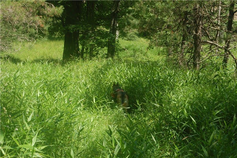
Trails were sometimes so overgrown I was wading through waist high weeds in hopes I was not stepping on snakes because I certainly could not see anything.
At about 10 miles you cross back over the A.T. So like I said before, if you skip the Bear Creek Trail and take the A.T. instead and it will be much more pleasant. Now back on this side of the A.T. the orange trail eventually turns back into the road through the valley. There will not be much shade through this part.


For as remote of a hike as this was, we obviously were not the only ones to have ever used the trail based on the litter we packed out. There was the intentional litter on the left, and the unintentional litter on the right - a water bottle, a horseshoe and a bungee cord that I first mistook for a snake!

Have hunted this area many years ago. Found your right up through Google search.
ReplyDelete